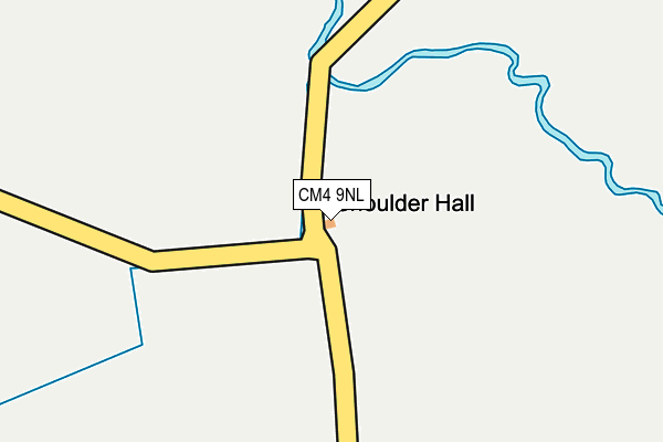
CM4 9NL lies on Buttsbury in Ingatestone. CM4 9NL is located in the Ingatestone, Fryerning and Mountnessing electoral ward, within the local authority district of Brentwood and the English Parliamentary constituency of Brentwood and Ongar. The Sub Integrated Care Board (ICB) Location is NHS Mid and South Essex ICB - 99E and the police force is Essex. This postcode has been in use since January 1980.


GetTheData
Source: OS OpenMap – Local (Ordnance Survey)
Source: OS VectorMap District (Ordnance Survey)
Licence: Open Government Licence (requires attribution)
| Easting | 565911 |
| Northing | 197565 |
| Latitude | 51.652398 |
| Longitude | 0.396936 |
GetTheData
Source: Open Postcode Geo
Licence: Open Government Licence
| Street | Buttsbury |
| Town/City | Ingatestone |
| Country | England |
| Postcode District | CM4 |
➜ See where CM4 is on a map | |
GetTheData
Source: Land Registry Price Paid Data
Licence: Open Government Licence
Elevation or altitude of CM4 9NL as distance above sea level:
| Metres | Feet | |
|---|---|---|
| Elevation | 50m | 164ft |
Elevation is measured from the approximate centre of the postcode, to the nearest point on an OS contour line from OS Terrain 50, which has contour spacing of ten vertical metres.
➜ How high above sea level am I? Find the elevation of your current position using your device's GPS.
GetTheData
Source: Open Postcode Elevation
Licence: Open Government Licence
| Ward | Ingatestone, Fryerning And Mountnessing |
| Constituency | Brentwood And Ongar |
GetTheData
Source: ONS Postcode Database
Licence: Open Government Licence
| Regent Drive (Rosebay Avenue) | Billericay | 1,509m |
| Regent Drive (Rosebay Avenue) | Billericay | 1,537m |
| Goldington Crescent (Rosebay Avenue) | Billericay | 1,555m |
| Arlington Way | Billericay | 1,611m |
| Horseshoe Close (Rosebay Avenue) | Billericay | 1,846m |
| Ingatestone Station | 1.9km |
| Billericay Station | 3km |
| Shenfield Station | 5.2km |
GetTheData
Source: NaPTAN
Licence: Open Government Licence
| Percentage of properties with Next Generation Access | 100.0% |
| Percentage of properties with Superfast Broadband | 0.0% |
| Percentage of properties with Ultrafast Broadband | 0.0% |
| Percentage of properties with Full Fibre Broadband | 0.0% |
Superfast Broadband is between 30Mbps and 300Mbps
Ultrafast Broadband is > 300Mbps
| Percentage of properties unable to receive 2Mbps | 0.0% |
| Percentage of properties unable to receive 5Mbps | 0.0% |
| Percentage of properties unable to receive 10Mbps | 100.0% |
| Percentage of properties unable to receive 30Mbps | 100.0% |
GetTheData
Source: Ofcom
Licence: Ofcom Terms of Use (requires attribution)
GetTheData
Source: ONS Postcode Database
Licence: Open Government Licence


➜ Get more ratings from the Food Standards Agency
GetTheData
Source: Food Standards Agency
Licence: FSA terms & conditions
| Last Collection | |||
|---|---|---|---|
| Location | Mon-Fri | Sat | Distance |
| Railway Station | 17:00 | 12:00 | 1,850m |
| Ingatestone Post Office | 17:45 | 12:30 | 2,119m |
| Heybridge | 16:45 | 09:30 | 2,130m |
GetTheData
Source: Dracos
Licence: Creative Commons Attribution-ShareAlike
The below table lists the International Territorial Level (ITL) codes (formerly Nomenclature of Territorial Units for Statistics (NUTS) codes) and Local Administrative Units (LAU) codes for CM4 9NL:
| ITL 1 Code | Name |
|---|---|
| TLH | East |
| ITL 2 Code | Name |
| TLH3 | Essex |
| ITL 3 Code | Name |
| TLH36 | Heart of Essex |
| LAU 1 Code | Name |
| E07000068 | Brentwood |
GetTheData
Source: ONS Postcode Directory
Licence: Open Government Licence
The below table lists the Census Output Area (OA), Lower Layer Super Output Area (LSOA), and Middle Layer Super Output Area (MSOA) for CM4 9NL:
| Code | Name | |
|---|---|---|
| OA | E00109030 | |
| LSOA | E01021460 | Brentwood 002D |
| MSOA | E02004465 | Brentwood 002 |
GetTheData
Source: ONS Postcode Directory
Licence: Open Government Licence
| CM4 9NZ | Buttsbury | 546m |
| CM12 0TN | Buckwyns Chase | 608m |
| CM4 9NY | Padhams Green Road | 1047m |
| CM12 0TS | Mountnessing Road | 1151m |
| CM4 9PA | Stock Lane | 1214m |
| CM12 0TL | Buckwyns Chase | 1300m |
| CM12 0SN | Betony Crescent | 1422m |
| CM12 0SW | Colville Mews | 1473m |
| CM12 0SZ | Granville Close | 1488m |
| CM12 0ST | Mallow Gardens | 1512m |
GetTheData
Source: Open Postcode Geo; Land Registry Price Paid Data
Licence: Open Government Licence