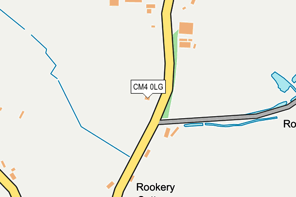
CM4 0LG lies on Rookery Road in Blackmore, Ingatestone. CM4 0LG is located in the High Ongar, Willingale and The Rodings electoral ward, within the local authority district of Epping Forest and the English Parliamentary constituency of Brentwood and Ongar. The Sub Integrated Care Board (ICB) Location is NHS Hertfordshire and West Essex ICB - 07H and the police force is Essex. This postcode has been in use since January 1980.


GetTheData
Source: OS OpenMap – Local (Ordnance Survey)
Source: OS VectorMap District (Ordnance Survey)
Licence: Open Government Licence (requires attribution)
| Easting | 559591 |
| Northing | 203317 |
| Latitude | 51.705898 |
| Longitude | 0.308259 |
GetTheData
Source: Open Postcode Geo
Licence: Open Government Licence
| Street | Rookery Road |
| Locality | Blackmore |
| Town/City | Ingatestone |
| Country | England |
| Postcode District | CM4 |
➜ See where CM4 is on a map | |
GetTheData
Source: Land Registry Price Paid Data
Licence: Open Government Licence
Elevation or altitude of CM4 0LG as distance above sea level:
| Metres | Feet | |
|---|---|---|
| Elevation | 90m | 295ft |
Elevation is measured from the approximate centre of the postcode, to the nearest point on an OS contour line from OS Terrain 50, which has contour spacing of ten vertical metres.
➜ How high above sea level am I? Find the elevation of your current position using your device's GPS.
GetTheData
Source: Open Postcode Elevation
Licence: Open Government Licence
| Ward | High Ongar, Willingale And The Rodings |
| Constituency | Brentwood And Ongar |
GetTheData
Source: ONS Postcode Database
Licence: Open Government Licence
| The Wheatsheaf (King Street) | High Ongar | 343m |
| The Wheatsheaf (King Street) | High Ongar | 349m |
| King Street | High Ongar | 491m |
| King Street | High Ongar | 495m |
| Nine Ashes Farm (Rookery Road) | Blackmore | 578m |
GetTheData
Source: NaPTAN
Licence: Open Government Licence
| Percentage of properties with Next Generation Access | 100.0% |
| Percentage of properties with Superfast Broadband | 86.7% |
| Percentage of properties with Ultrafast Broadband | 0.0% |
| Percentage of properties with Full Fibre Broadband | 0.0% |
Superfast Broadband is between 30Mbps and 300Mbps
Ultrafast Broadband is > 300Mbps
| Median download speed | 48.8Mbps |
| Average download speed | 47.7Mbps |
| Maximum download speed | 80.00Mbps |
| Median upload speed | 10.7Mbps |
| Average upload speed | 11.0Mbps |
| Maximum upload speed | 20.00Mbps |
| Percentage of properties unable to receive 2Mbps | 0.0% |
| Percentage of properties unable to receive 5Mbps | 0.0% |
| Percentage of properties unable to receive 10Mbps | 0.0% |
| Percentage of properties unable to receive 30Mbps | 13.3% |
GetTheData
Source: Ofcom
Licence: Ofcom Terms of Use (requires attribution)
Estimated total energy consumption in CM4 0LG by fuel type, 2015.
| Consumption (kWh) | 40,497 |
|---|---|
| Meter count | 6 |
| Mean (kWh/meter) | 6,750 |
| Median (kWh/meter) | 6,676 |
GetTheData
Source: Postcode level gas estimates: 2015 (experimental)
Source: Postcode level electricity estimates: 2015 (experimental)
Licence: Open Government Licence
GetTheData
Source: ONS Postcode Database
Licence: Open Government Licence


➜ Get more ratings from the Food Standards Agency
GetTheData
Source: Food Standards Agency
Licence: FSA terms & conditions
| Last Collection | |||
|---|---|---|---|
| Location | Mon-Fri | Sat | Distance |
| Great Oxney Green | 16:55 | 09:00 | 1,323m |
| Blackmore P.o. | 16:15 | 11:00 | 1,617m |
| Cock Lane | 16:30 | 09:05 | 1,663m |
GetTheData
Source: Dracos
Licence: Creative Commons Attribution-ShareAlike
The below table lists the International Territorial Level (ITL) codes (formerly Nomenclature of Territorial Units for Statistics (NUTS) codes) and Local Administrative Units (LAU) codes for CM4 0LG:
| ITL 1 Code | Name |
|---|---|
| TLH | East |
| ITL 2 Code | Name |
| TLH3 | Essex |
| ITL 3 Code | Name |
| TLH35 | West Essex |
| LAU 1 Code | Name |
| E07000072 | Epping Forest |
GetTheData
Source: ONS Postcode Directory
Licence: Open Government Licence
The below table lists the Census Output Area (OA), Lower Layer Super Output Area (LSOA), and Middle Layer Super Output Area (MSOA) for CM4 0LG:
| Code | Name | |
|---|---|---|
| OA | E00110583 | |
| LSOA | E01021769 | Epping Forest 003A |
| MSOA | E02004529 | Epping Forest 003 |
GetTheData
Source: ONS Postcode Directory
Licence: Open Government Licence
| CM5 9NS | King Street | 405m |
| CM4 0LD | Rookery Road | 501m |
| CM4 0FL | Rookery Road | 561m |
| CM4 0LB | Nine Ashes Road | 623m |
| CM4 0LQ | 624m | |
| CM5 9NX | Chelmsford Road | 738m |
| CM4 0LA | Nine Ashes Road | 787m |
| CM5 9NR | King Street | 854m |
| CM4 0JP | Fingrith Hall Lane | 884m |
| CM4 0JZ | Nine Ashes Road | 1040m |
GetTheData
Source: Open Postcode Geo; Land Registry Price Paid Data
Licence: Open Government Licence