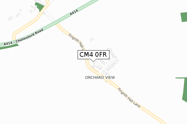
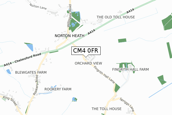
CM4 0FR is located in the High Ongar, Willingale and The Rodings electoral ward, within the local authority district of Epping Forest and the English Parliamentary constituency of Brentwood and Ongar. The Sub Integrated Care Board (ICB) Location is NHS Hertfordshire and West Essex ICB - 07H and the police force is Essex. This postcode has been in use since February 2019.


GetTheData
Source: OS Open Zoomstack (Ordnance Survey)
Licence: Open Government Licence (requires attribution)
Attribution: Contains OS data © Crown copyright and database right 2024
Source: Open Postcode Geo
Licence: Open Government Licence (requires attribution)
Attribution: Contains OS data © Crown copyright and database right 2024; Contains Royal Mail data © Royal Mail copyright and database right 2024; Source: Office for National Statistics licensed under the Open Government Licence v.3.0
| Easting | 560350 |
| Northing | 203788 |
| Latitude | 51.709918 |
| Longitude | 0.319477 |
GetTheData
Source: Open Postcode Geo
Licence: Open Government Licence
| Country | England |
| Postcode District | CM4 |
| ➜ CM4 open data dashboard ➜ See where CM4 is on a map | |
GetTheData
Source: Land Registry Price Paid Data
Licence: Open Government Licence
| Ward | High Ongar, Willingale And The Rodings |
| Constituency | Brentwood And Ongar |
GetTheData
Source: ONS Postcode Database
Licence: Open Government Licence
| April 2022 | Violence and sexual offences | On or near Parking Area | 432m |
| March 2022 | Vehicle crime | On or near Parking Area | 432m |
| February 2022 | Violence and sexual offences | On or near Parking Area | 432m |
| ➜ Get more crime data in our Crime section | |||
GetTheData
Source: data.police.uk
Licence: Open Government Licence
| Norton Heath Cafe (Willingate Road) | High Ongar | 381m |
| The Wheatsheaf (King Street) | High Ongar | 1,230m |
| The Wheatsheaf (King Street) | High Ongar | 1,237m |
| King Street | High Ongar | 1,363m |
| King Street | High Ongar | 1,368m |
| Ingatestone Station | 6.5km |
GetTheData
Source: NaPTAN
Licence: Open Government Licence
| Percentage of properties with Next Generation Access | 100.0% |
| Percentage of properties with Superfast Broadband | 0.0% |
| Percentage of properties with Ultrafast Broadband | 0.0% |
| Percentage of properties with Full Fibre Broadband | 0.0% |
Superfast Broadband is between 30Mbps and 300Mbps
Ultrafast Broadband is > 300Mbps
| Percentage of properties unable to receive 2Mbps | 0.0% |
| Percentage of properties unable to receive 5Mbps | 0.0% |
| Percentage of properties unable to receive 10Mbps | 0.0% |
| Percentage of properties unable to receive 30Mbps | 100.0% |
GetTheData
Source: Ofcom
Licence: Ofcom Terms of Use (requires attribution)
GetTheData
Source: ONS Postcode Database
Licence: Open Government Licence


➜ Get more ratings from the Food Standards Agency
GetTheData
Source: Food Standards Agency
Licence: FSA terms & conditions
| Last Collection | |||
|---|---|---|---|
| Location | Mon-Fri | Sat | Distance |
| Great Oxney Green | 16:55 | 09:00 | 1,493m |
| Cock Lane | 16:30 | 09:05 | 1,899m |
| Blackmore P.o. | 16:15 | 11:00 | 1,910m |
GetTheData
Source: Dracos
Licence: Creative Commons Attribution-ShareAlike
| Facility | Distance |
|---|---|
| Blackmore Sports And Social Club Nine Ashes Road, Blackmore, Ingatestone Grass Pitches, Squash Courts, Artificial Grass Pitch, Outdoor Tennis Courts | 1.7km |
| Willingale Cricket Club The Glebe, The Street, Willingdale, Ongar Grass Pitches | 3.7km |
| The Stondon Massey Playing Field Nine Ashes Road, Stondon Massey, Brentwood Grass Pitches | 3.7km |
GetTheData
Source: Active Places
Licence: Open Government Licence
| School | Phase of Education | Distance |
|---|---|---|
| Blackmore Primary School Nine Ashes Road, Blackmore, Ingatestone, CM4 0QR | Primary | 1.8km |
| Highwood Primary School Loves Green, Highwood, Chelmsford, CM1 3QH | Primary | 3.8km |
| High Ongar Primary School The Street, High Ongar, Ongar, CM5 9NB | Primary | 3.9km |
GetTheData
Source: Edubase
Licence: Open Government Licence
The below table lists the International Territorial Level (ITL) codes (formerly Nomenclature of Territorial Units for Statistics (NUTS) codes) and Local Administrative Units (LAU) codes for CM4 0FR:
| ITL 1 Code | Name |
|---|---|
| TLH | East |
| ITL 2 Code | Name |
| TLH3 | Essex |
| ITL 3 Code | Name |
| TLH35 | West Essex |
| LAU 1 Code | Name |
| E07000072 | Epping Forest |
GetTheData
Source: ONS Postcode Directory
Licence: Open Government Licence
The below table lists the Census Output Area (OA), Lower Layer Super Output Area (LSOA), and Middle Layer Super Output Area (MSOA) for CM4 0FR:
| Code | Name | |
|---|---|---|
| OA | E00110583 | |
| LSOA | E01021769 | Epping Forest 003A |
| MSOA | E02004529 | Epping Forest 003 |
GetTheData
Source: ONS Postcode Directory
Licence: Open Government Licence
| CM4 0JP | Fingrith Hall Lane | 21m |
| CM4 0LP | 559m | |
| CM4 0LQ | 565m | |
| CM4 0LL | Garwood Cottages | 779m |
| CM4 0JN | Fingrith Hall Lane | 800m |
| CM4 0LN | 875m | |
| CM4 0LG | Rookery Road | 893m |
| CM4 0JW | Spriggs Lane | 1093m |
| CM5 9NS | King Street | 1283m |
| CM4 0LD | Rookery Road | 1308m |
GetTheData
Source: Open Postcode Geo; Land Registry Price Paid Data
Licence: Open Government Licence