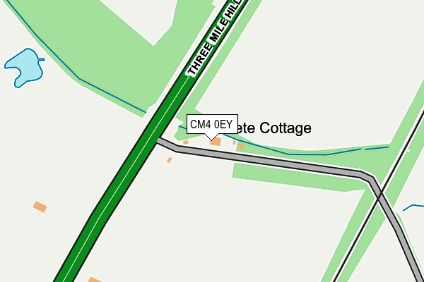
CM4 0EY lies on Killigrews in Margaretting, Ingatestone. CM4 0EY is located in the South Hanningfield, Stock and Margaretting electoral ward, within the local authority district of Chelmsford and the English Parliamentary constituency of Maldon. The Sub Integrated Care Board (ICB) Location is NHS Mid and South Essex ICB - 06Q and the police force is Essex. This postcode has been in use since January 1980.


GetTheData
Source: OS OpenMap – Local (Ordnance Survey)
Source: OS VectorMap District (Ordnance Survey)
Licence: Open Government Licence (requires attribution)
| Easting | 568436 |
| Northing | 203134 |
| Latitude | 51.701676 |
| Longitude | 0.436083 |
GetTheData
Source: Open Postcode Geo
Licence: Open Government Licence
| Street | Killigrews |
| Locality | Margaretting |
| Town/City | Ingatestone |
| Country | England |
| Postcode District | CM4 |
➜ See where CM4 is on a map | |
GetTheData
Source: Land Registry Price Paid Data
Licence: Open Government Licence
Elevation or altitude of CM4 0EY as distance above sea level:
| Metres | Feet | |
|---|---|---|
| Elevation | 40m | 131ft |
Elevation is measured from the approximate centre of the postcode, to the nearest point on an OS contour line from OS Terrain 50, which has contour spacing of ten vertical metres.
➜ How high above sea level am I? Find the elevation of your current position using your device's GPS.
GetTheData
Source: Open Postcode Elevation
Licence: Open Government Licence
| Ward | South Hanningfield, Stock And Margaretting |
| Constituency | Maldon |
GetTheData
Source: ONS Postcode Database
Licence: Open Government Licence
| Woodview (Three Mile Hill) | Margaretting | 222m |
| Woodview (Three Mile Hill) | Margaretting | 289m |
| Hylands Park (Three Mile Hill) | Chelmsford | 631m |
| Hylands Park (Three Mile Hill) | Chelmsford | 691m |
| Whites Place (Main Road) | Margaretting | 1,282m |
| Chelmsford Station | 4.5km |
| Ingatestone Station | 5.3km |
GetTheData
Source: NaPTAN
Licence: Open Government Licence
| Percentage of properties with Next Generation Access | 100.0% |
| Percentage of properties with Superfast Broadband | 0.0% |
| Percentage of properties with Ultrafast Broadband | 0.0% |
| Percentage of properties with Full Fibre Broadband | 0.0% |
Superfast Broadband is between 30Mbps and 300Mbps
Ultrafast Broadband is > 300Mbps
| Percentage of properties unable to receive 2Mbps | 0.0% |
| Percentage of properties unable to receive 5Mbps | 100.0% |
| Percentage of properties unable to receive 10Mbps | 100.0% |
| Percentage of properties unable to receive 30Mbps | 100.0% |
GetTheData
Source: Ofcom
Licence: Ofcom Terms of Use (requires attribution)
GetTheData
Source: ONS Postcode Database
Licence: Open Government Licence


➜ Get more ratings from the Food Standards Agency
GetTheData
Source: Food Standards Agency
Licence: FSA terms & conditions
| Last Collection | |||
|---|---|---|---|
| Location | Mon-Fri | Sat | Distance |
| Tesco Princes Road | 17:50 | 12:40 | 2,827m |
| Lodge Road | 16:45 | 09:00 | 2,868m |
| Shakestones | 17:30 | 12:00 | 2,958m |
GetTheData
Source: Dracos
Licence: Creative Commons Attribution-ShareAlike
The below table lists the International Territorial Level (ITL) codes (formerly Nomenclature of Territorial Units for Statistics (NUTS) codes) and Local Administrative Units (LAU) codes for CM4 0EY:
| ITL 1 Code | Name |
|---|---|
| TLH | East |
| ITL 2 Code | Name |
| TLH3 | Essex |
| ITL 3 Code | Name |
| TLH36 | Heart of Essex |
| LAU 1 Code | Name |
| E07000070 | Chelmsford |
GetTheData
Source: ONS Postcode Directory
Licence: Open Government Licence
The below table lists the Census Output Area (OA), Lower Layer Super Output Area (LSOA), and Middle Layer Super Output Area (MSOA) for CM4 0EY:
| Code | Name | |
|---|---|---|
| OA | E00109738 | |
| LSOA | E01021602 | Chelmsford 018B |
| MSOA | E02004502 | Chelmsford 018 |
GetTheData
Source: ONS Postcode Directory
Licence: Open Government Licence
| CM4 0EX | Main Road | 294m |
| CM4 0EZ | Killigrews | 561m |
| CM2 8TH | Private Road | 876m |
| CM2 8TJ | Butts Way | 938m |
| CM2 8TG | London Road | 952m |
| CM4 9JT | Maldon Road | 1069m |
| CM2 8PH | Goat Hall Lane | 1131m |
| CM4 9JS | Maldon Road | 1174m |
| CM2 8PQ | Goat Hall Lane | 1492m |
| CM2 8TL | Bekeswell Lane | 1521m |
GetTheData
Source: Open Postcode Geo; Land Registry Price Paid Data
Licence: Open Government Licence