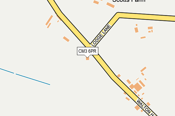
CM3 6PR lies on Birchwood Road in Purleigh, Chelmsford. CM3 6PR is located in the Purleigh electoral ward, within the local authority district of Maldon and the English Parliamentary constituency of Maldon. The Sub Integrated Care Board (ICB) Location is NHS Mid and South Essex ICB - 06Q and the police force is Essex. This postcode has been in use since January 1980.


GetTheData
Source: OS OpenMap – Local (Ordnance Survey)
Source: OS VectorMap District (Ordnance Survey)
Licence: Open Government Licence (requires attribution)
| Easting | 582655 |
| Northing | 202394 |
| Latitude | 51.690587 |
| Longitude | 0.641236 |
GetTheData
Source: Open Postcode Geo
Licence: Open Government Licence
| Street | Birchwood Road |
| Locality | Purleigh |
| Town/City | Chelmsford |
| Country | England |
| Postcode District | CM3 |
➜ See where CM3 is on a map | |
GetTheData
Source: Land Registry Price Paid Data
Licence: Open Government Licence
Elevation or altitude of CM3 6PR as distance above sea level:
| Metres | Feet | |
|---|---|---|
| Elevation | 50m | 164ft |
Elevation is measured from the approximate centre of the postcode, to the nearest point on an OS contour line from OS Terrain 50, which has contour spacing of ten vertical metres.
➜ How high above sea level am I? Find the elevation of your current position using your device's GPS.
GetTheData
Source: Open Postcode Elevation
Licence: Open Government Licence
| Ward | Purleigh |
| Constituency | Maldon |
GetTheData
Source: ONS Postcode Database
Licence: Open Government Licence
| Spar Lane (Chelmsford Road) | Purleigh | 902m |
| Spar Lane (Chelmsford Road) | Purleigh | 910m |
| Purleigh Village Hall (Howe Green Road) | Purleigh | 1,050m |
| Purleigh Village Hall (Howe Green Road) | Purleigh | 1,057m |
| Dart Purleigh (Callowood Croft) | Purleigh | 1,136m |
| South Woodham Ferrers Station | 5.2km |
| North Fambridge Station | 5.4km |
GetTheData
Source: NaPTAN
Licence: Open Government Licence
| Percentage of properties with Next Generation Access | 100.0% |
| Percentage of properties with Superfast Broadband | 100.0% |
| Percentage of properties with Ultrafast Broadband | 0.0% |
| Percentage of properties with Full Fibre Broadband | 0.0% |
Superfast Broadband is between 30Mbps and 300Mbps
Ultrafast Broadband is > 300Mbps
| Percentage of properties unable to receive 2Mbps | 0.0% |
| Percentage of properties unable to receive 5Mbps | 0.0% |
| Percentage of properties unable to receive 10Mbps | 0.0% |
| Percentage of properties unable to receive 30Mbps | 0.0% |
GetTheData
Source: Ofcom
Licence: Ofcom Terms of Use (requires attribution)
GetTheData
Source: ONS Postcode Database
Licence: Open Government Licence


➜ Get more ratings from the Food Standards Agency
GetTheData
Source: Food Standards Agency
Licence: FSA terms & conditions
| Last Collection | |||
|---|---|---|---|
| Location | Mon-Fri | Sat | Distance |
| Old Purleigh Road | 16:05 | 07:30 | 1,026m |
| Purleigh P.o. | 17:15 | 10:30 | 1,280m |
| The Bell | 17:15 | 07:15 | 1,567m |
GetTheData
Source: Dracos
Licence: Creative Commons Attribution-ShareAlike
The below table lists the International Territorial Level (ITL) codes (formerly Nomenclature of Territorial Units for Statistics (NUTS) codes) and Local Administrative Units (LAU) codes for CM3 6PR:
| ITL 1 Code | Name |
|---|---|
| TLH | East |
| ITL 2 Code | Name |
| TLH3 | Essex |
| ITL 3 Code | Name |
| TLH36 | Heart of Essex |
| LAU 1 Code | Name |
| E07000074 | Maldon |
GetTheData
Source: ONS Postcode Directory
Licence: Open Government Licence
The below table lists the Census Output Area (OA), Lower Layer Super Output Area (LSOA), and Middle Layer Super Output Area (MSOA) for CM3 6PR:
| Code | Name | |
|---|---|---|
| OA | E00111256 | |
| LSOA | E01021903 | Maldon 007G |
| MSOA | E02004561 | Maldon 007 |
GetTheData
Source: ONS Postcode Directory
Licence: Open Government Licence
| CM3 6TR | Walton Hall Lane | 163m |
| CM3 6RG | Birchwood Road | 411m |
| CM3 6PW | Lodge Lane | 748m |
| CM3 6PT | Mill Hill | 786m |
| CM3 6PU | Mill Lane | 807m |
| CM3 6QP | Chelmsford Road | 816m |
| CM3 6QN | Chelmsford Road | 897m |
| CM3 6QW | Spar Lane | 944m |
| CM3 6PL | Chelmsford Road | 980m |
| CM3 6PN | Chelmsford Road | 999m |
GetTheData
Source: Open Postcode Geo; Land Registry Price Paid Data
Licence: Open Government Licence