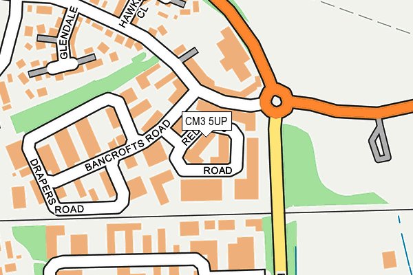
CM3 5UP is located in the South Woodham-Elmwood and Woodville electoral ward, within the local authority district of Chelmsford and the English Parliamentary constituency of Maldon. The Sub Integrated Care Board (ICB) Location is NHS Mid and South Essex ICB - 06Q and the police force is Essex. This postcode has been in use since June 1981.


GetTheData
Source: OS OpenMap – Local (Ordnance Survey)
Source: OS VectorMap District (Ordnance Survey)
Licence: Open Government Licence (requires attribution)
| Easting | 581480 |
| Northing | 197941 |
| Latitude | 51.650966 |
| Longitude | 0.621917 |
GetTheData
Source: Open Postcode Geo
Licence: Open Government Licence
| Country | England |
| Postcode District | CM3 |
➜ See where CM3 is on a map ➜ Where is South Woodham Ferrers? | |
GetTheData
Source: Land Registry Price Paid Data
Licence: Open Government Licence
Elevation or altitude of CM3 5UP as distance above sea level:
| Metres | Feet | |
|---|---|---|
| Elevation | 10m | 33ft |
Elevation is measured from the approximate centre of the postcode, to the nearest point on an OS contour line from OS Terrain 50, which has contour spacing of ten vertical metres.
➜ How high above sea level am I? Find the elevation of your current position using your device's GPS.
GetTheData
Source: Open Postcode Elevation
Licence: Open Government Licence
| Ward | South Woodham-elmwood And Woodville |
| Constituency | Maldon |
GetTheData
Source: ONS Postcode Database
Licence: Open Government Licence
| Hamberts Road (Ferrers Road) | South Woodham Ferrers | 92m |
| Hamberts Road (Ferrers Road) | South Woodham Ferrers | 100m |
| Mitchell Way (King Edward's Road) | South Woodham Ferrers | 595m |
| School (Brickfields Road) | South Woodham Ferrers | 599m |
| Leighlands Road (Inchbonnie Road) | South Woodham Ferrers | 761m |
| South Woodham Ferrers Station | 1.1km |
| North Fambridge Station | 4.1km |
| Battlesbridge Station | 4.9km |
GetTheData
Source: NaPTAN
Licence: Open Government Licence
GetTheData
Source: ONS Postcode Database
Licence: Open Government Licence


➜ Get more ratings from the Food Standards Agency
GetTheData
Source: Food Standards Agency
Licence: FSA terms & conditions
| Last Collection | |||
|---|---|---|---|
| Location | Mon-Fri | Sat | Distance |
| Mr Gees P.o. | 17:30 | 12:20 | 685m |
| Clement Green Lane | 17:00 | 10:15 | 883m |
| Hullbridge Road Post Office | 16:45 | 11:10 | 1,049m |
GetTheData
Source: Dracos
Licence: Creative Commons Attribution-ShareAlike
The below table lists the International Territorial Level (ITL) codes (formerly Nomenclature of Territorial Units for Statistics (NUTS) codes) and Local Administrative Units (LAU) codes for CM3 5UP:
| ITL 1 Code | Name |
|---|---|
| TLH | East |
| ITL 2 Code | Name |
| TLH3 | Essex |
| ITL 3 Code | Name |
| TLH36 | Heart of Essex |
| LAU 1 Code | Name |
| E07000070 | Chelmsford |
GetTheData
Source: ONS Postcode Directory
Licence: Open Government Licence
The below table lists the Census Output Area (OA), Lower Layer Super Output Area (LSOA), and Middle Layer Super Output Area (MSOA) for CM3 5UP:
| Code | Name | |
|---|---|---|
| OA | E00170994 | |
| LSOA | E01021613 | Chelmsford 019C |
| MSOA | E02004503 | Chelmsford 019 |
GetTheData
Source: ONS Postcode Directory
Licence: Open Government Licence
| CM3 5WA | Cutlers Road | 169m |
| CM3 5UG | Bancrofts Road | 200m |
| CM3 5TR | Hawkwood Close | 221m |
| CM3 5TP | Hamberts Road | 243m |
| CM3 5TS | Glendale | 249m |
| CM3 5UH | Drapers Road | 255m |
| CM3 5TL | King Edwards Road | 303m |
| CM3 5TT | Bankside Close | 311m |
| CM3 5SB | East Bridge Road | 355m |
| CM3 5PG | Chadwick Road | 360m |
GetTheData
Source: Open Postcode Geo; Land Registry Price Paid Data
Licence: Open Government Licence