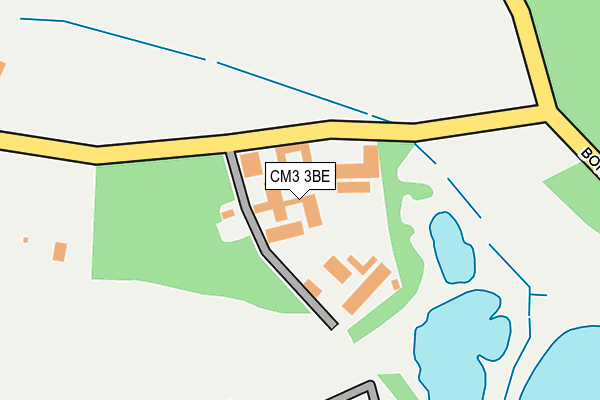
CM3 3BE lies on Drakes Lane in Boreham, Chelmsford. CM3 3BE is located in the Broomfield and The Walthams electoral ward, within the local authority district of Chelmsford and the English Parliamentary constituency of Saffron Walden. The Sub Integrated Care Board (ICB) Location is NHS Mid and South Essex ICB - 06Q and the police force is Essex. This postcode has been in use since January 1980.


GetTheData
Source: OS OpenMap – Local (Ordnance Survey)
Source: OS VectorMap District (Ordnance Survey)
Licence: Open Government Licence (requires attribution)
| Easting | 573962 |
| Northing | 213144 |
| Latitude | 51.789901 |
| Longitude | 0.520945 |
GetTheData
Source: Open Postcode Geo
Licence: Open Government Licence
| Street | Drakes Lane |
| Locality | Boreham |
| Town/City | Chelmsford |
| Country | England |
| Postcode District | CM3 |
➜ See where CM3 is on a map | |
GetTheData
Source: Land Registry Price Paid Data
Licence: Open Government Licence
Elevation or altitude of CM3 3BE as distance above sea level:
| Metres | Feet | |
|---|---|---|
| Elevation | 50m | 164ft |
Elevation is measured from the approximate centre of the postcode, to the nearest point on an OS contour line from OS Terrain 50, which has contour spacing of ten vertical metres.
➜ How high above sea level am I? Find the elevation of your current position using your device's GPS.
GetTheData
Source: Open Postcode Elevation
Licence: Open Government Licence
| Ward | Broomfield And The Walthams |
| Constituency | Saffron Walden |
GetTheData
Source: ONS Postcode Database
Licence: Open Government Licence
| Hatfield Peverel Station | 5km |
GetTheData
Source: NaPTAN
Licence: Open Government Licence
| Median download speed | 2.9Mbps |
| Average download speed | 2.9Mbps |
| Maximum download speed | 3.90Mbps |
| Median upload speed | 0.8Mbps |
| Average upload speed | 0.8Mbps |
| Maximum upload speed | 1.14Mbps |
GetTheData
Source: Ofcom
Licence: Ofcom Terms of Use (requires attribution)
GetTheData
Source: ONS Postcode Database
Licence: Open Government Licence

➜ Get more ratings from the Food Standards Agency
GetTheData
Source: Food Standards Agency
Licence: FSA terms & conditions
| Last Collection | |||
|---|---|---|---|
| Location | Mon-Fri | Sat | Distance |
| Fuller Street | 16:45 | 07:30 | 2,974m |
| Mill Lane | 17:10 | 13:00 | 4,066m |
| Church Avenue | 17:00 | 13:00 | 4,105m |
GetTheData
Source: Dracos
Licence: Creative Commons Attribution-ShareAlike
The below table lists the International Territorial Level (ITL) codes (formerly Nomenclature of Territorial Units for Statistics (NUTS) codes) and Local Administrative Units (LAU) codes for CM3 3BE:
| ITL 1 Code | Name |
|---|---|
| TLH | East |
| ITL 2 Code | Name |
| TLH3 | Essex |
| ITL 3 Code | Name |
| TLH36 | Heart of Essex |
| LAU 1 Code | Name |
| E07000070 | Chelmsford |
GetTheData
Source: ONS Postcode Directory
Licence: Open Government Licence
The below table lists the Census Output Area (OA), Lower Layer Super Output Area (LSOA), and Middle Layer Super Output Area (MSOA) for CM3 3BE:
| Code | Name | |
|---|---|---|
| OA | E00109443 | |
| LSOA | E01021540 | Chelmsford 001C |
| MSOA | E02004485 | Chelmsford 001 |
GetTheData
Source: ONS Postcode Directory
Licence: Open Government Licence
| CM3 3ND | Drakes Lane | 403m |
| CM3 3BB | Russell Green Cottages | 658m |
| CM3 3NE | Birds Farm Lane | 718m |
| CM3 3NF | Boreham Road | 940m |
| CM3 3NB | Cranham Road | 1212m |
| CM3 3NH | Leighs Road | 1275m |
| CM3 3NA | Leighs Road | 1372m |
| CM3 3BA | Waltham Road | 1583m |
| CM3 3NQ | Daisleys Lane | 1676m |
| CM3 3PS | Domsey Lane | 1767m |
GetTheData
Source: Open Postcode Geo; Land Registry Price Paid Data
Licence: Open Government Licence