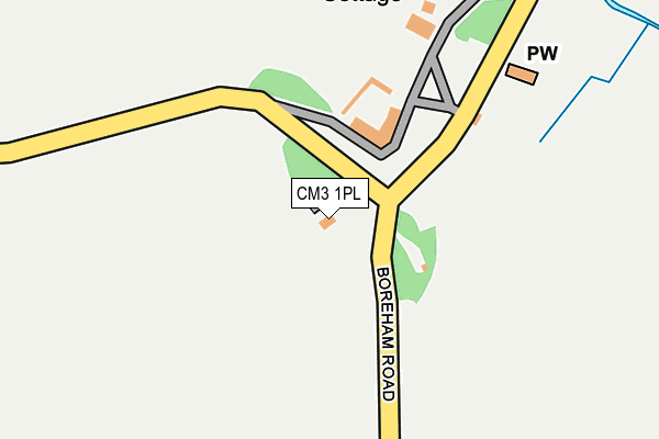
CM3 1PL is located in the Boreham and The Leighs electoral ward, within the local authority district of Chelmsford and the English Parliamentary constituency of Saffron Walden. The Sub Integrated Care Board (ICB) Location is NHS Mid and South Essex ICB - 06Q and the police force is Essex. This postcode has been in use since January 1980.


GetTheData
Source: OS OpenMap – Local (Ordnance Survey)
Source: OS VectorMap District (Ordnance Survey)
Licence: Open Government Licence (requires attribution)
| Easting | 573672 |
| Northing | 215451 |
| Latitude | 51.810713 |
| Longitude | 0.517899 |
GetTheData
Source: Open Postcode Geo
Licence: Open Government Licence
| Country | England |
| Postcode District | CM3 |
➜ See where CM3 is on a map | |
GetTheData
Source: Land Registry Price Paid Data
Licence: Open Government Licence
Elevation or altitude of CM3 1PL as distance above sea level:
| Metres | Feet | |
|---|---|---|
| Elevation | 50m | 164ft |
Elevation is measured from the approximate centre of the postcode, to the nearest point on an OS contour line from OS Terrain 50, which has contour spacing of ten vertical metres.
➜ How high above sea level am I? Find the elevation of your current position using your device's GPS.
GetTheData
Source: Open Postcode Elevation
Licence: Open Government Licence
| Ward | Boreham And The Leighs |
| Constituency | Saffron Walden |
GetTheData
Source: ONS Postcode Database
Licence: Open Government Licence
| The Square And Compasses (Braintree Road) | Fuller Street | 1,182m |
| The Square And Compasses (Braintree Road) | Fuller Street | 1,188m |
| The Crescent (Strawbrook Hill) | Little Leighs | 1,516m |
| The Crescent (Strawbrook Hill) | Little Leighs | 1,535m |
| Deres Bridge (Main Road) | Great Leighs | 1,546m |
| Cressing Station | 6.2km |
GetTheData
Source: NaPTAN
Licence: Open Government Licence
| Percentage of properties with Next Generation Access | 100.0% |
| Percentage of properties with Superfast Broadband | 0.0% |
| Percentage of properties with Ultrafast Broadband | 0.0% |
| Percentage of properties with Full Fibre Broadband | 0.0% |
Superfast Broadband is between 30Mbps and 300Mbps
Ultrafast Broadband is > 300Mbps
| Percentage of properties unable to receive 2Mbps | 60.0% |
| Percentage of properties unable to receive 5Mbps | 60.0% |
| Percentage of properties unable to receive 10Mbps | 60.0% |
| Percentage of properties unable to receive 30Mbps | 100.0% |
GetTheData
Source: Ofcom
Licence: Ofcom Terms of Use (requires attribution)
GetTheData
Source: ONS Postcode Database
Licence: Open Government Licence


➜ Get more ratings from the Food Standards Agency
GetTheData
Source: Food Standards Agency
Licence: FSA terms & conditions
| Last Collection | |||
|---|---|---|---|
| Location | Mon-Fri | Sat | Distance |
| Fuller Street | 16:45 | 07:30 | 1,197m |
| Ranks Green | 16:30 | 07:45 | 2,792m |
| Fairstead | 16:45 | 08:00 | 3,596m |
GetTheData
Source: Dracos
Licence: Creative Commons Attribution-ShareAlike
The below table lists the International Territorial Level (ITL) codes (formerly Nomenclature of Territorial Units for Statistics (NUTS) codes) and Local Administrative Units (LAU) codes for CM3 1PL:
| ITL 1 Code | Name |
|---|---|
| TLH | East |
| ITL 2 Code | Name |
| TLH3 | Essex |
| ITL 3 Code | Name |
| TLH36 | Heart of Essex |
| LAU 1 Code | Name |
| E07000070 | Chelmsford |
GetTheData
Source: ONS Postcode Directory
Licence: Open Government Licence
The below table lists the Census Output Area (OA), Lower Layer Super Output Area (LSOA), and Middle Layer Super Output Area (MSOA) for CM3 1PL:
| Code | Name | |
|---|---|---|
| OA | E00109419 | |
| LSOA | E01021538 | Chelmsford 001A |
| MSOA | E02004485 | Chelmsford 001 |
GetTheData
Source: ONS Postcode Directory
Licence: Open Government Licence
| CM3 1PW | Cole Hill | 703m |
| CM3 3NQ | Daisleys Lane | 749m |
| CM3 1PN | Cole Hill | 911m |
| CM3 2BA | Brookside Cottages | 1159m |
| CM3 2AZ | Fuller Street | 1175m |
| CM3 1PP | Boreham Road | 1227m |
| CM3 2BB | Fuller Street | 1281m |
| CM3 3NH | Leighs Road | 1338m |
| CM3 3NF | Boreham Road | 1392m |
| CM3 2AY | Fuller Street | 1425m |
GetTheData
Source: Open Postcode Geo; Land Registry Price Paid Data
Licence: Open Government Licence