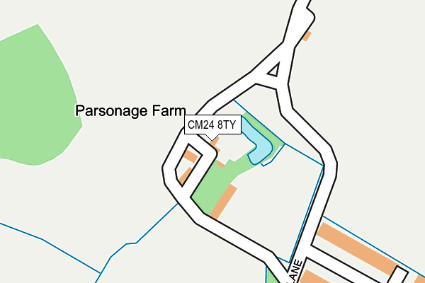
CM24 8TY is located in the Stansted South & Birchanger electoral ward, within the local authority district of Uttlesford and the English Parliamentary constituency of Saffron Walden. The Sub Integrated Care Board (ICB) Location is NHS Hertfordshire and West Essex ICB - 07H and the police force is Essex. This postcode has been in use since January 1980.


GetTheData
Source: OS OpenMap – Local (Ordnance Survey)
Source: OS VectorMap District (Ordnance Survey)
Licence: Open Government Licence (requires attribution)
| Easting | 551525 |
| Northing | 223419 |
| Latitude | 51.888745 |
| Longitude | 0.200423 |
GetTheData
Source: Open Postcode Geo
Licence: Open Government Licence
| Country | England |
| Postcode District | CM24 |
➜ See where CM24 is on a map | |
GetTheData
Source: Land Registry Price Paid Data
Licence: Open Government Licence
Elevation or altitude of CM24 8TY as distance above sea level:
| Metres | Feet | |
|---|---|---|
| Elevation | 100m | 328ft |
Elevation is measured from the approximate centre of the postcode, to the nearest point on an OS contour line from OS Terrain 50, which has contour spacing of ten vertical metres.
➜ How high above sea level am I? Find the elevation of your current position using your device's GPS.
GetTheData
Source: Open Postcode Elevation
Licence: Open Government Licence
| Ward | Stansted South & Birchanger |
| Constituency | Saffron Walden |
GetTheData
Source: ONS Postcode Database
Licence: Open Government Licence
| Bentley Drive (Foresthall Road) | Birchanger | 636m |
| Reeve Road (Foresthall Road) | Stansted Mountfitchet | 687m |
| Reeve Road (Foresthall Road) | Stansted Mountfitchet | 689m |
| Bentley Drive (Foresthall Road) | Birchanger | 691m |
| Palmer Close (Foresthall Road) | Stansted Mountfitchet | 760m |
| Stansted Mountfitchet Station | 1.4km |
| Bishops Stortford Station | 3.5km |
| Elsenham Station | 4km |
GetTheData
Source: NaPTAN
Licence: Open Government Licence
| Percentage of properties with Next Generation Access | 100.0% |
| Percentage of properties with Superfast Broadband | 33.3% |
| Percentage of properties with Ultrafast Broadband | 0.0% |
| Percentage of properties with Full Fibre Broadband | 0.0% |
Superfast Broadband is between 30Mbps and 300Mbps
Ultrafast Broadband is > 300Mbps
| Percentage of properties unable to receive 2Mbps | 0.0% |
| Percentage of properties unable to receive 5Mbps | 0.0% |
| Percentage of properties unable to receive 10Mbps | 0.0% |
| Percentage of properties unable to receive 30Mbps | 66.7% |
GetTheData
Source: Ofcom
Licence: Ofcom Terms of Use (requires attribution)
GetTheData
Source: ONS Postcode Database
Licence: Open Government Licence


➜ Get more ratings from the Food Standards Agency
GetTheData
Source: Food Standards Agency
Licence: FSA terms & conditions
| Last Collection | |||
|---|---|---|---|
| Location | Mon-Fri | Sat | Distance |
| Birchanger Lane | 17:00 | 09:00 | 920m |
| Birchanger | 17:00 | 12:15 | 998m |
| 7 Chapel Hill | 17:30 | 11:30 | 1,490m |
GetTheData
Source: Dracos
Licence: Creative Commons Attribution-ShareAlike
The below table lists the International Territorial Level (ITL) codes (formerly Nomenclature of Territorial Units for Statistics (NUTS) codes) and Local Administrative Units (LAU) codes for CM24 8TY:
| ITL 1 Code | Name |
|---|---|
| TLH | East |
| ITL 2 Code | Name |
| TLH3 | Essex |
| ITL 3 Code | Name |
| TLH35 | West Essex |
| LAU 1 Code | Name |
| E07000077 | Uttlesford |
GetTheData
Source: ONS Postcode Directory
Licence: Open Government Licence
The below table lists the Census Output Area (OA), Lower Layer Super Output Area (LSOA), and Middle Layer Super Output Area (MSOA) for CM24 8TY:
| Code | Name | |
|---|---|---|
| OA | E00112222 | |
| LSOA | E01022086 | Uttlesford 006A |
| MSOA | E02004596 | Uttlesford 006 |
GetTheData
Source: ONS Postcode Directory
Licence: Open Government Licence
| CM24 8GF | Parsonage Lane | 289m |
| CM24 8TU | Forest Hall Road | 550m |
| CM24 8TX | Forest Hall Road | 576m |
| CM24 8UX | Felstead Crescent | 619m |
| CM24 8EZ | Peachey Walk | 625m |
| CM24 8SN | Livings Way | 645m |
| CM24 8UA | Churchill Corner | 652m |
| CM24 8EU | Walson Way | 659m |
| CM24 8FB | Palmer Close | 659m |
| CM24 8GD | Walson Way | 661m |
GetTheData
Source: Open Postcode Geo; Land Registry Price Paid Data
Licence: Open Government Licence