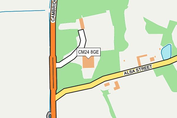
CM24 8GE is located in the Stansted North electoral ward, within the local authority district of Uttlesford and the English Parliamentary constituency of Saffron Walden. The Sub Integrated Care Board (ICB) Location is NHS Hertfordshire and West Essex ICB - 07H and the police force is Essex. This postcode has been in use since February 2008.


GetTheData
Source: OS OpenMap – Local (Ordnance Survey)
Source: OS VectorMap District (Ordnance Survey)
Licence: Open Government Licence (requires attribution)
| Easting | 551504 |
| Northing | 226507 |
| Latitude | 51.916494 |
| Longitude | 0.201474 |
GetTheData
Source: Open Postcode Geo
Licence: Open Government Licence
| Country | England |
| Postcode District | CM24 |
➜ See where CM24 is on a map ➜ Where is Stansted Mountfitchet? | |
GetTheData
Source: Land Registry Price Paid Data
Licence: Open Government Licence
Elevation or altitude of CM24 8GE as distance above sea level:
| Metres | Feet | |
|---|---|---|
| Elevation | 80m | 262ft |
Elevation is measured from the approximate centre of the postcode, to the nearest point on an OS contour line from OS Terrain 50, which has contour spacing of ten vertical metres.
➜ How high above sea level am I? Find the elevation of your current position using your device's GPS.
GetTheData
Source: Open Postcode Elevation
Licence: Open Government Licence
| Ward | Stansted North |
| Constituency | Saffron Walden |
GetTheData
Source: ONS Postcode Database
Licence: Open Government Licence
| Alsa Street (Cambridge Road) | Stansted Mountfitchet | 288m |
| Alsa Street (Cambridge Road) | Stansted Mountfitchet | 290m |
| Orford House (Hillend Road) | Ugley | 679m |
| Orford House (Hillend Road) | Ugley | 689m |
| Village Hall (Cambridge Road) | Ugley | 809m |
| Stansted Mountfitchet Station | 1.7km |
| Elsenham Station | 1.9km |
| Stansted Airport Station | 5.1km |
GetTheData
Source: NaPTAN
Licence: Open Government Licence
GetTheData
Source: ONS Postcode Database
Licence: Open Government Licence


➜ Get more ratings from the Food Standards Agency
GetTheData
Source: Food Standards Agency
Licence: FSA terms & conditions
| Last Collection | |||
|---|---|---|---|
| Location | Mon-Fri | Sat | Distance |
| Wood End Green | 16:30 | 09:00 | 963m |
| Stansted Old Post Office | 17:30 | 11:00 | 1,567m |
| 7 Chapel Hill | 17:30 | 11:30 | 1,615m |
GetTheData
Source: Dracos
Licence: Creative Commons Attribution-ShareAlike
The below table lists the International Territorial Level (ITL) codes (formerly Nomenclature of Territorial Units for Statistics (NUTS) codes) and Local Administrative Units (LAU) codes for CM24 8GE:
| ITL 1 Code | Name |
|---|---|
| TLH | East |
| ITL 2 Code | Name |
| TLH3 | Essex |
| ITL 3 Code | Name |
| TLH35 | West Essex |
| LAU 1 Code | Name |
| E07000077 | Uttlesford |
GetTheData
Source: ONS Postcode Directory
Licence: Open Government Licence
The below table lists the Census Output Area (OA), Lower Layer Super Output Area (LSOA), and Middle Layer Super Output Area (MSOA) for CM24 8GE:
| Code | Name | |
|---|---|---|
| OA | E00112218 | |
| LSOA | E01022083 | Uttlesford 005C |
| MSOA | E02004595 | Uttlesford 005 |
GetTheData
Source: ONS Postcode Directory
Licence: Open Government Licence
| CM24 8SQ | Alsa Business Park | 221m |
| CM24 8SX | Alsa Street | 266m |
| CM24 8EW | The Rookery | 660m |
| CM22 6HP | Pound Lane | 689m |
| CM24 8EN | White Bear | 704m |
| CM24 8EH | Alderbury Road | 706m |
| CM24 8ED | Poulteney Road | 712m |
| CM22 6HW | Snakes Lane | 752m |
| CM24 8DG | Five Acres | 770m |
| CM24 8EB | Mary Mcarthur Place | 807m |
GetTheData
Source: Open Postcode Geo; Land Registry Price Paid Data
Licence: Open Government Licence