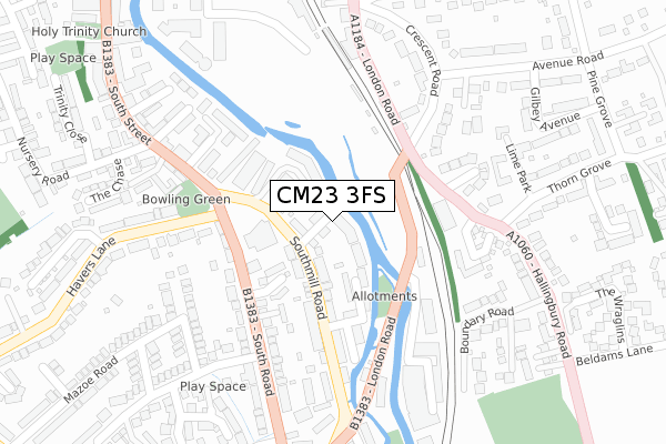
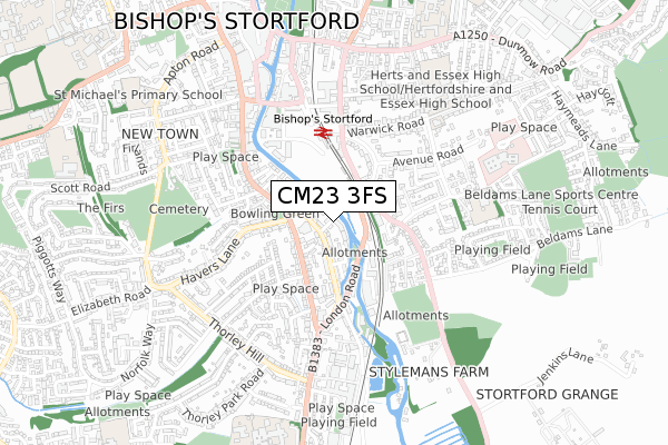
CM23 3FS is located in the Bishop's Stortford Central electoral ward, within the local authority district of East Hertfordshire and the English Parliamentary constituency of Hertford and Stortford. The Sub Integrated Care Board (ICB) Location is NHS Hertfordshire and West Essex ICB - 06K and the police force is Hertfordshire. This postcode has been in use since April 2018.


GetTheData
Source: OS Open Zoomstack (Ordnance Survey)
Licence: Open Government Licence (requires attribution)
Attribution: Contains OS data © Crown copyright and database right 2024
Source: Open Postcode Geo
Licence: Open Government Licence (requires attribution)
Attribution: Contains OS data © Crown copyright and database right 2024; Contains Royal Mail data © Royal Mail copyright and database right 2024; Source: Office for National Statistics licensed under the Open Government Licence v.3.0
| Easting | 549211 |
| Northing | 220566 |
| Latitude | 51.863735 |
| Longitude | 0.165592 |
GetTheData
Source: Open Postcode Geo
Licence: Open Government Licence
| Country | England |
| Postcode District | CM23 |
| ➜ CM23 open data dashboard ➜ See where CM23 is on a map ➜ Where is Bishop's Stortford? | |
GetTheData
Source: Land Registry Price Paid Data
Licence: Open Government Licence
| Ward | Bishop's Stortford Central |
| Constituency | Hertford And Stortford |
GetTheData
Source: ONS Postcode Database
Licence: Open Government Licence
| September 2022 | Drugs | On or near Great Eastern Close | 206m |
| August 2022 | Drugs | On or near Great Eastern Close | 206m |
| June 2022 | Criminal damage and arson | On or near The Moorings | 123m |
| ➜ Get more crime data in our Crime section | |||
GetTheData
Source: data.police.uk
Licence: Open Government Licence
| Rhodes Arts Complex (Southmill Road) | Bishop's Stortford | 85m |
| Rhodes Arts Complex (South Road) | Bishop's Stortford | 150m |
| Rhodes Arts Complex (South Road) | Bishop's Stortford | 166m |
| Pryors Close (Hallingbury Road) | Bishop's Stortford | 169m |
| Pryors Close (Hallingbury Road) | Bishop's Stortford | 196m |
| Bishops Stortford Station | 0.3km |
| Stansted Mountfitchet Station | 4.8km |
GetTheData
Source: NaPTAN
Licence: Open Government Licence
➜ Broadband speed and availability dashboard for CM23 3FS
| Percentage of properties with Next Generation Access | 100.0% |
| Percentage of properties with Superfast Broadband | 100.0% |
| Percentage of properties with Ultrafast Broadband | 100.0% |
| Percentage of properties with Full Fibre Broadband | 0.0% |
Superfast Broadband is between 30Mbps and 300Mbps
Ultrafast Broadband is > 300Mbps
| Median download speed | 9.8Mbps |
| Average download speed | 30.4Mbps |
| Maximum download speed | 80.00Mbps |
| Median upload speed | 1.0Mbps |
| Average upload speed | 6.6Mbps |
| Maximum upload speed | 20.00Mbps |
| Percentage of properties unable to receive 2Mbps | 0.0% |
| Percentage of properties unable to receive 5Mbps | 0.0% |
| Percentage of properties unable to receive 10Mbps | 0.0% |
| Percentage of properties unable to receive 30Mbps | 0.0% |
➜ Broadband speed and availability dashboard for CM23 3FS
GetTheData
Source: Ofcom
Licence: Ofcom Terms of Use (requires attribution)
GetTheData
Source: ONS Postcode Database
Licence: Open Government Licence


➜ Get more ratings from the Food Standards Agency
GetTheData
Source: Food Standards Agency
Licence: FSA terms & conditions
| Last Collection | |||
|---|---|---|---|
| Location | Mon-Fri | Sat | Distance |
| South Road | 17:30 | 12:00 | 190m |
| Railway Station | 17:30 | 12:00 | 312m |
| Telephone Exchange | 17:30 | 12:00 | 458m |
GetTheData
Source: Dracos
Licence: Creative Commons Attribution-ShareAlike
| Facility | Distance |
|---|---|
| Vision Fitness (Bishop’s Stortford) Southmill Road, Bishops Stortford Health and Fitness Gym | 166m |
| Nuffield Health (Bishop's Stortford) Anchor Street, Bishop's Stortford Swimming Pool, Health and Fitness Gym, Studio | 480m |
| Thorn Grove Primary School Thorn Grove, Bishop's Stortford Grass Pitches | 559m |
GetTheData
Source: Active Places
Licence: Open Government Licence
| School | Phase of Education | Distance |
|---|---|---|
| Thorn Grove Primary School Thorn Grove, Bishop's Stortford, CM23 5LD | Primary | 559m |
| The Hertfordshire & Essex High School and Science College Warwick Road, Bishop's Stortford, CM23 5NJ | Secondary | 588m |
| White Trees Independent School 13a London Road, Bishops Stortford, Hertfordshire, CM23 5NA | Not applicable | 811m |
GetTheData
Source: Edubase
Licence: Open Government Licence
| Risk of CM23 3FS flooding from rivers and sea | Very Low |
| ➜ CM23 3FS flood map | |
GetTheData
Source: Open Flood Risk by Postcode
Licence: Open Government Licence
The below table lists the International Territorial Level (ITL) codes (formerly Nomenclature of Territorial Units for Statistics (NUTS) codes) and Local Administrative Units (LAU) codes for CM23 3FS:
| ITL 1 Code | Name |
|---|---|
| TLH | East |
| ITL 2 Code | Name |
| TLH2 | Bedfordshire and Hertfordshire |
| ITL 3 Code | Name |
| TLH23 | Hertfordshire CC |
| LAU 1 Code | Name |
| E07000242 | East Hertfordshire |
GetTheData
Source: ONS Postcode Directory
Licence: Open Government Licence
The below table lists the Census Output Area (OA), Lower Layer Super Output Area (LSOA), and Middle Layer Super Output Area (MSOA) for CM23 3FS:
| Code | Name | |
|---|---|---|
| OA | E00119086 | |
| LSOA | E01023444 | East Hertfordshire 007B |
| MSOA | E02004884 | East Hertfordshire 007 |
GetTheData
Source: ONS Postcode Directory
Licence: Open Government Licence
| CM23 3DH | Southmill Road | 56m |
| CM23 3DA | Southmill Road | 65m |
| CM23 3DW | Kimberley Villas | 81m |
| CM23 3DY | Southmill Trading Centre | 87m |
| CM23 3DQ | The Moorings | 99m |
| CM23 3JE | Kimberley Close | 121m |
| CM23 3DR | Mill Street | 160m |
| CM23 3JG | South Road | 171m |
| CM23 3DP | Southmill Road | 174m |
| CM23 3JH | South Road | 198m |
GetTheData
Source: Open Postcode Geo; Land Registry Price Paid Data
Licence: Open Government Licence