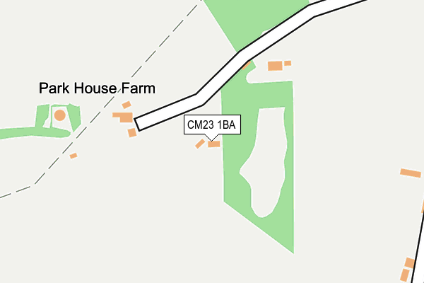
CM23 1BA lies on Park Green in Berden, Bishop's Stortford. CM23 1BA is located in the Stort Valley electoral ward, within the local authority district of Uttlesford and the English Parliamentary constituency of Saffron Walden. The Sub Integrated Care Board (ICB) Location is NHS Hertfordshire and West Essex ICB - 07H and the police force is Essex. This postcode has been in use since January 1980.


GetTheData
Source: OS OpenMap – Local (Ordnance Survey)
Source: OS VectorMap District (Ordnance Survey)
Licence: Open Government Licence (requires attribution)
| Easting | 546589 |
| Northing | 228637 |
| Latitude | 51.936946 |
| Longitude | 0.130972 |
GetTheData
Source: Open Postcode Geo
Licence: Open Government Licence
| Street | Park Green |
| Locality | Berden |
| Town/City | Bishop's Stortford |
| Country | England |
| Postcode District | CM23 |
➜ See where CM23 is on a map | |
GetTheData
Source: Land Registry Price Paid Data
Licence: Open Government Licence
Elevation or altitude of CM23 1BA as distance above sea level:
| Metres | Feet | |
|---|---|---|
| Elevation | 120m | 394ft |
Elevation is measured from the approximate centre of the postcode, to the nearest point on an OS contour line from OS Terrain 50, which has contour spacing of ten vertical metres.
➜ How high above sea level am I? Find the elevation of your current position using your device's GPS.
GetTheData
Source: Open Postcode Elevation
Licence: Open Government Licence
| Ward | Stort Valley |
| Constituency | Saffron Walden |
GetTheData
Source: ONS Postcode Database
Licence: Open Government Licence
| Benskins Close (Pelham Road) | Berden | 1,115m |
| St Nicholas Field (The Street) | Berden | 1,180m |
| St Nicholas Field (The Street) | Berden | 1,181m |
| Bonneting Lane (Pelham Road) | Berden | 1,199m |
| Bonneting Lane (Pelham Road) | Berden | 1,205m |
| Stansted Mountfitchet Station | 6.2km |
GetTheData
Source: NaPTAN
Licence: Open Government Licence
| Percentage of properties with Next Generation Access | 100.0% |
| Percentage of properties with Superfast Broadband | 0.0% |
| Percentage of properties with Ultrafast Broadband | 0.0% |
| Percentage of properties with Full Fibre Broadband | 0.0% |
Superfast Broadband is between 30Mbps and 300Mbps
Ultrafast Broadband is > 300Mbps
| Percentage of properties unable to receive 2Mbps | 0.0% |
| Percentage of properties unable to receive 5Mbps | 0.0% |
| Percentage of properties unable to receive 10Mbps | 0.0% |
| Percentage of properties unable to receive 30Mbps | 100.0% |
GetTheData
Source: Ofcom
Licence: Ofcom Terms of Use (requires attribution)
GetTheData
Source: ONS Postcode Database
Licence: Open Government Licence


➜ Get more ratings from the Food Standards Agency
GetTheData
Source: Food Standards Agency
Licence: FSA terms & conditions
| Last Collection | |||
|---|---|---|---|
| Location | Mon-Fri | Sat | Distance |
| Stocking Pelham | 17:00 | 10:45 | 1,404m |
| East End | 16:45 | 10:15 | 2,162m |
| Starling Green | 16:00 | 09:30 | 2,473m |
GetTheData
Source: Dracos
Licence: Creative Commons Attribution-ShareAlike
The below table lists the International Territorial Level (ITL) codes (formerly Nomenclature of Territorial Units for Statistics (NUTS) codes) and Local Administrative Units (LAU) codes for CM23 1BA:
| ITL 1 Code | Name |
|---|---|
| TLH | East |
| ITL 2 Code | Name |
| TLH3 | Essex |
| ITL 3 Code | Name |
| TLH35 | West Essex |
| LAU 1 Code | Name |
| E07000077 | Uttlesford |
GetTheData
Source: ONS Postcode Directory
Licence: Open Government Licence
The below table lists the Census Output Area (OA), Lower Layer Super Output Area (LSOA), and Middle Layer Super Output Area (MSOA) for CM23 1BA:
| Code | Name | |
|---|---|---|
| OA | E00112235 | |
| LSOA | E01022089 | Uttlesford 005G |
| MSOA | E02004595 | Uttlesford 005 |
GetTheData
Source: ONS Postcode Directory
Licence: Open Government Licence
| CM23 1AZ | Brickhouse End | 308m |
| CM23 1AY | The Street | 893m |
| CM23 1AU | Church View Cottages | 1025m |
| CM23 1AT | The Street | 1102m |
| CM23 1AX | St Nicholas Field | 1109m |
| SG9 0JB | Crabs Lane | 1118m |
| CM23 1AJ | Vicarage Lane | 1123m |
| CM23 1AL | Gawlers | 1135m |
| CM23 1AS | The Street | 1169m |
| CM23 1BX | Benskins Close | 1182m |
GetTheData
Source: Open Postcode Geo; Land Registry Price Paid Data
Licence: Open Government Licence