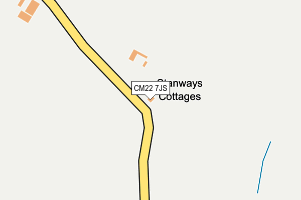
CM22 7JS is in Hatfield Broad Oak, Bishop's Stortford. CM22 7JS is located in the Broad Oak & the Hallingburys electoral ward, within the local authority district of Uttlesford and the English Parliamentary constituency of Saffron Walden. The Sub Integrated Care Board (ICB) Location is NHS Hertfordshire and West Essex ICB - 07H and the police force is Essex. This postcode has been in use since January 1980.


GetTheData
Source: OS OpenMap – Local (Ordnance Survey)
Source: OS VectorMap District (Ordnance Survey)
Licence: Open Government Licence (requires attribution)
| Easting | 555776 |
| Northing | 216192 |
| Latitude | 51.822639 |
| Longitude | 0.258861 |
GetTheData
Source: Open Postcode Geo
Licence: Open Government Licence
| Locality | Hatfield Broad Oak |
| Town/City | Bishop's Stortford |
| Country | England |
| Postcode District | CM22 |
➜ See where CM22 is on a map | |
GetTheData
Source: Land Registry Price Paid Data
Licence: Open Government Licence
Elevation or altitude of CM22 7JS as distance above sea level:
| Metres | Feet | |
|---|---|---|
| Elevation | 80m | 262ft |
Elevation is measured from the approximate centre of the postcode, to the nearest point on an OS contour line from OS Terrain 50, which has contour spacing of ten vertical metres.
➜ How high above sea level am I? Find the elevation of your current position using your device's GPS.
GetTheData
Source: Open Postcode Elevation
Licence: Open Government Licence
| Ward | Broad Oak & The Hallingburys |
| Constituency | Saffron Walden |
GetTheData
Source: ONS Postcode Database
Licence: Open Government Licence
| Barnfield | Hatfield Broad Oak | 635m |
| Barnfield | Hatfield Broad Oak | 640m |
| The Dukes Head (Broad Street) | Hatfield Broad Oak | 940m |
| The Dukes Head (Broad Street) | Hatfield Broad Oak | 944m |
| Post Office (High Street) | Hatfield Broad Oak | 1,250m |
GetTheData
Source: NaPTAN
Licence: Open Government Licence
| Percentage of properties with Next Generation Access | 100.0% |
| Percentage of properties with Superfast Broadband | 57.1% |
| Percentage of properties with Ultrafast Broadband | 0.0% |
| Percentage of properties with Full Fibre Broadband | 0.0% |
Superfast Broadband is between 30Mbps and 300Mbps
Ultrafast Broadband is > 300Mbps
| Median download speed | 19.8Mbps |
| Average download speed | 19.2Mbps |
| Maximum download speed | 35.38Mbps |
| Median upload speed | 1.2Mbps |
| Average upload speed | 2.6Mbps |
| Maximum upload speed | 5.20Mbps |
| Percentage of properties unable to receive 2Mbps | 0.0% |
| Percentage of properties unable to receive 5Mbps | 0.0% |
| Percentage of properties unable to receive 10Mbps | 0.0% |
| Percentage of properties unable to receive 30Mbps | 42.9% |
GetTheData
Source: Ofcom
Licence: Ofcom Terms of Use (requires attribution)
GetTheData
Source: ONS Postcode Database
Licence: Open Government Licence


➜ Get more ratings from the Food Standards Agency
GetTheData
Source: Food Standards Agency
Licence: FSA terms & conditions
| Last Collection | |||
|---|---|---|---|
| Location | Mon-Fri | Sat | Distance |
| Windmill | 16:45 | 10:00 | 3,585m |
| Aythorpe Roding | 16:45 | 10:00 | 3,940m |
| Godfrey Way | 17:15 | 11:45 | 3,993m |
GetTheData
Source: Dracos
Licence: Creative Commons Attribution-ShareAlike
The below table lists the International Territorial Level (ITL) codes (formerly Nomenclature of Territorial Units for Statistics (NUTS) codes) and Local Administrative Units (LAU) codes for CM22 7JS:
| ITL 1 Code | Name |
|---|---|
| TLH | East |
| ITL 2 Code | Name |
| TLH3 | Essex |
| ITL 3 Code | Name |
| TLH35 | West Essex |
| LAU 1 Code | Name |
| E07000077 | Uttlesford |
GetTheData
Source: ONS Postcode Directory
Licence: Open Government Licence
The below table lists the Census Output Area (OA), Lower Layer Super Output Area (LSOA), and Middle Layer Super Output Area (MSOA) for CM22 7JS:
| Code | Name | |
|---|---|---|
| OA | E00112083 | |
| LSOA | E01022059 | Uttlesford 009A |
| MSOA | E02004599 | Uttlesford 009 |
GetTheData
Source: ONS Postcode Directory
Licence: Open Government Licence
| CM22 7JR | Barnfield | 611m |
| CM22 7JW | Waters Villas | 654m |
| CM22 7JP | Hammond Road | 746m |
| CM22 7JN | Hammond Road | 755m |
| CM22 7HY | Cannons Lane | 763m |
| CM22 7JA | Broad Street Green | 822m |
| CM22 7JB | Medlars Mead | 918m |
| CM22 7JD | Broad Street | 921m |
| CM22 7HX | Cannons Lane | 935m |
| CM22 7JE | Broad Street | 938m |
GetTheData
Source: Open Postcode Geo; Land Registry Price Paid Data
Licence: Open Government Licence