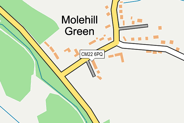
CM22 6PQ lies on Mole Hill Green in Takeley, Bishop's Stortford. CM22 6PQ is located in the Takeley electoral ward, within the local authority district of Uttlesford and the English Parliamentary constituency of Saffron Walden. The Sub Integrated Care Board (ICB) Location is NHS Hertfordshire and West Essex ICB - 07H and the police force is Essex. This postcode has been in use since January 1980.


GetTheData
Source: OS OpenMap – Local (Ordnance Survey)
Source: OS VectorMap District (Ordnance Survey)
Licence: Open Government Licence (requires attribution)
| Easting | 556362 |
| Northing | 224703 |
| Latitude | 51.898945 |
| Longitude | 0.271233 |
GetTheData
Source: Open Postcode Geo
Licence: Open Government Licence
| Street | Mole Hill Green |
| Locality | Takeley |
| Town/City | Bishop's Stortford |
| Country | England |
| Postcode District | CM22 |
➜ See where CM22 is on a map ➜ Where is Molehill Green? | |
GetTheData
Source: Land Registry Price Paid Data
Licence: Open Government Licence
Elevation or altitude of CM22 6PQ as distance above sea level:
| Metres | Feet | |
|---|---|---|
| Elevation | 110m | 361ft |
Elevation is measured from the approximate centre of the postcode, to the nearest point on an OS contour line from OS Terrain 50, which has contour spacing of ten vertical metres.
➜ How high above sea level am I? Find the elevation of your current position using your device's GPS.
GetTheData
Source: Open Postcode Elevation
Licence: Open Government Licence
| Ward | Takeley |
| Constituency | Saffron Walden |
GetTheData
Source: ONS Postcode Database
Licence: Open Government Licence
| The Three Horseshoes (Molehill Green Road) | Molehill Green | 37m |
| The Three Horseshoes (Molehill Green Road) | Molehill Green | 40m |
| Molehill Green Road (Elsenham Road) | Molehill Green | 115m |
| School Lane (Molehill Green Road) | Molehill Green | 115m |
| School Lane (Molehill Green Road) | Molehill Green | 120m |
| Stansted Airport Station | 1.4km |
| Elsenham Station | 3.8km |
| Stansted Mountfitchet Station | 4.9km |
GetTheData
Source: NaPTAN
Licence: Open Government Licence
| Percentage of properties with Next Generation Access | 0.0% |
| Percentage of properties with Superfast Broadband | 0.0% |
| Percentage of properties with Ultrafast Broadband | 0.0% |
| Percentage of properties with Full Fibre Broadband | 0.0% |
Superfast Broadband is between 30Mbps and 300Mbps
Ultrafast Broadband is > 300Mbps
| Median download speed | 2.5Mbps |
| Average download speed | 2.9Mbps |
| Maximum download speed | 4.00Mbps |
| Median upload speed | 0.8Mbps |
| Average upload speed | 0.7Mbps |
| Maximum upload speed | 0.98Mbps |
| Percentage of properties unable to receive 2Mbps | 0.0% |
| Percentage of properties unable to receive 5Mbps | 100.0% |
| Percentage of properties unable to receive 10Mbps | 100.0% |
| Percentage of properties unable to receive 30Mbps | 100.0% |
GetTheData
Source: Ofcom
Licence: Ofcom Terms of Use (requires attribution)
GetTheData
Source: ONS Postcode Database
Licence: Open Government Licence


➜ Get more ratings from the Food Standards Agency
GetTheData
Source: Food Standards Agency
Licence: FSA terms & conditions
| Last Collection | |||
|---|---|---|---|
| Location | Mon-Fri | Sat | Distance |
| Standstead Airport - Arrivals | 17:30 | 10:30 | 1,136m |
| Stanstead Airport - Concourse | 17:00 | 10:30 | 1,335m |
| Brick End | 16:45 | 08:30 | 1,568m |
GetTheData
Source: Dracos
Licence: Creative Commons Attribution-ShareAlike
The below table lists the International Territorial Level (ITL) codes (formerly Nomenclature of Territorial Units for Statistics (NUTS) codes) and Local Administrative Units (LAU) codes for CM22 6PQ:
| ITL 1 Code | Name |
|---|---|
| TLH | East |
| ITL 2 Code | Name |
| TLH3 | Essex |
| ITL 3 Code | Name |
| TLH35 | West Essex |
| LAU 1 Code | Name |
| E07000077 | Uttlesford |
GetTheData
Source: ONS Postcode Directory
Licence: Open Government Licence
The below table lists the Census Output Area (OA), Lower Layer Super Output Area (LSOA), and Middle Layer Super Output Area (MSOA) for CM22 6PQ:
| Code | Name | |
|---|---|---|
| OA | E00112243 | |
| LSOA | E01022090 | Uttlesford 006B |
| MSOA | E02004596 | Uttlesford 006 |
GetTheData
Source: ONS Postcode Directory
Licence: Open Government Licence
| CM22 6PG | Mole Hill Green Cottages | 130m |
| CM22 6PH | Mole Hill Green | 163m |
| CM22 6PJ | School Lane | 280m |
| CM6 2BW | Chapel End | 381m |
| CM22 6PF | Bambers Green | 811m |
| CM6 2BN | Woodgates End | 828m |
| CM22 6PL | Mill End | 1284m |
| CM6 2BG | Browns End Road | 1391m |
| CM22 6DR | Gaunts End | 1403m |
| CM6 2BE | Browns End Road | 1410m |
GetTheData
Source: Open Postcode Geo; Land Registry Price Paid Data
Licence: Open Government Licence