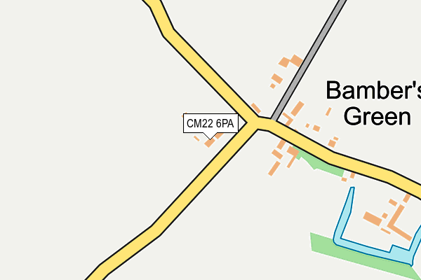
CM22 6PA lies on Easton View in Takeley, Bishop's Stortford. CM22 6PA is located in the Takeley electoral ward, within the local authority district of Uttlesford and the English Parliamentary constituency of Saffron Walden. The Sub Integrated Care Board (ICB) Location is NHS Hertfordshire and West Essex ICB - 07H and the police force is Essex. This postcode has been in use since January 1980.


GetTheData
Source: OS OpenMap – Local (Ordnance Survey)
Source: OS VectorMap District (Ordnance Survey)
Licence: Open Government Licence (requires attribution)
| Easting | 557331 |
| Northing | 222994 |
| Latitude | 51.883319 |
| Longitude | 0.284526 |
GetTheData
Source: Open Postcode Geo
Licence: Open Government Licence
| Street | Easton View |
| Locality | Takeley |
| Town/City | Bishop's Stortford |
| Country | England |
| Postcode District | CM22 |
➜ See where CM22 is on a map ➜ Where is Bamber's Green? | |
GetTheData
Source: Land Registry Price Paid Data
Licence: Open Government Licence
Elevation or altitude of CM22 6PA as distance above sea level:
| Metres | Feet | |
|---|---|---|
| Elevation | 100m | 328ft |
Elevation is measured from the approximate centre of the postcode, to the nearest point on an OS contour line from OS Terrain 50, which has contour spacing of ten vertical metres.
➜ How high above sea level am I? Find the elevation of your current position using your device's GPS.
GetTheData
Source: Open Postcode Elevation
Licence: Open Government Licence
| Ward | Takeley |
| Constituency | Saffron Walden |
GetTheData
Source: ONS Postcode Database
Licence: Open Government Licence
| Warish Hall Lane (Bambers Green Road) | Bambers Green | 68m |
| Warish Hall Lane (Bambers Green Road) | Bambers Green | 74m |
| High House (Parsonage Road) | Takeley | 1,424m |
| High House (Parsonage Road) | Takeley | 1,427m |
| Airport Drt (Terminal Road North) | Stansted Airport | 1,622m |
| Stansted Airport Station | 1.7km |
| Elsenham Station | 5.7km |
GetTheData
Source: NaPTAN
Licence: Open Government Licence
| Percentage of properties with Next Generation Access | 100.0% |
| Percentage of properties with Superfast Broadband | 0.0% |
| Percentage of properties with Ultrafast Broadband | 0.0% |
| Percentage of properties with Full Fibre Broadband | 0.0% |
Superfast Broadband is between 30Mbps and 300Mbps
Ultrafast Broadband is > 300Mbps
| Percentage of properties unable to receive 2Mbps | 0.0% |
| Percentage of properties unable to receive 5Mbps | 0.0% |
| Percentage of properties unable to receive 10Mbps | 0.0% |
| Percentage of properties unable to receive 30Mbps | 100.0% |
GetTheData
Source: Ofcom
Licence: Ofcom Terms of Use (requires attribution)
GetTheData
Source: ONS Postcode Database
Licence: Open Government Licence


➜ Get more ratings from the Food Standards Agency
GetTheData
Source: Food Standards Agency
Licence: FSA terms & conditions
| Last Collection | |||
|---|---|---|---|
| Location | Mon-Fri | Sat | Distance |
| Standstead Airport - Arrivals | 17:30 | 10:30 | 1,674m |
| Stanstead Airport - Concourse | 17:00 | 10:30 | 1,710m |
| Brick End | 16:45 | 08:30 | 2,960m |
GetTheData
Source: Dracos
Licence: Creative Commons Attribution-ShareAlike
The below table lists the International Territorial Level (ITL) codes (formerly Nomenclature of Territorial Units for Statistics (NUTS) codes) and Local Administrative Units (LAU) codes for CM22 6PA:
| ITL 1 Code | Name |
|---|---|
| TLH | East |
| ITL 2 Code | Name |
| TLH3 | Essex |
| ITL 3 Code | Name |
| TLH35 | West Essex |
| LAU 1 Code | Name |
| E07000077 | Uttlesford |
GetTheData
Source: ONS Postcode Directory
Licence: Open Government Licence
The below table lists the Census Output Area (OA), Lower Layer Super Output Area (LSOA), and Middle Layer Super Output Area (MSOA) for CM22 6PA:
| Code | Name | |
|---|---|---|
| OA | E00112244 | |
| LSOA | E01022090 | Uttlesford 006B |
| MSOA | E02004596 | Uttlesford 006 |
GetTheData
Source: ONS Postcode Directory
Licence: Open Government Licence
| CM22 6PB | Bury Villas | 59m |
| CM22 6PD | Bambers Green | 211m |
| CM22 6PE | Bambers Green | 893m |
| CM22 6NZ | Warish Hall Road | 952m |
| CM22 6NY | Warish Hall Road | 1110m |
| CM22 6PF | Bambers Green | 1190m |
| CM6 1ZB | Barnard Close | 1209m |
| CM6 1SA | Marshalls Way | 1212m |
| CM6 1TS | Colemans Close | 1220m |
| CM6 1YD | The Croft | 1221m |
GetTheData
Source: Open Postcode Geo; Land Registry Price Paid Data
Licence: Open Government Licence