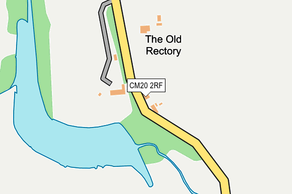
CM20 2RF lies on Gilston Lane in Gilston, Harlow. CM20 2RF is located in the Hunsdon electoral ward, within the local authority district of East Hertfordshire and the English Parliamentary constituency of Hertford and Stortford. The Sub Integrated Care Board (ICB) Location is NHS Hertfordshire and West Essex ICB - 06K and the police force is Hertfordshire. This postcode has been in use since January 1980.


GetTheData
Source: OS OpenMap – Local (Ordnance Survey)
Source: OS VectorMap District (Ordnance Survey)
Licence: Open Government Licence (requires attribution)
| Easting | 544549 |
| Northing | 212755 |
| Latitude | 51.794773 |
| Longitude | 0.094650 |
GetTheData
Source: Open Postcode Geo
Licence: Open Government Licence
| Street | Gilston Lane |
| Locality | Gilston |
| Town/City | Harlow |
| Country | England |
| Postcode District | CM20 |
➜ See where CM20 is on a map | |
GetTheData
Source: Land Registry Price Paid Data
Licence: Open Government Licence
Elevation or altitude of CM20 2RF as distance above sea level:
| Metres | Feet | |
|---|---|---|
| Elevation | 50m | 164ft |
Elevation is measured from the approximate centre of the postcode, to the nearest point on an OS contour line from OS Terrain 50, which has contour spacing of ten vertical metres.
➜ How high above sea level am I? Find the elevation of your current position using your device's GPS.
GetTheData
Source: Open Postcode Elevation
Licence: Open Government Licence
| Ward | Hunsdon |
| Constituency | Hertford And Stortford |
GetTheData
Source: ONS Postcode Database
Licence: Open Government Licence
| Plume Of Feathers Ph (Pye Corner) | Gilston | 618m |
| Plume Of Feathers Ph (Pye Corner) | Gilston | 625m |
| The Lion Ph (Eastwick Hall Lane) | Eastwick | 1,477m |
| Howard Way (Edinburgh Way) | Harlow | 1,633m |
| Queensgate Centre (Edinburgh Way) | Harlow | 1,657m |
| Harlow Town Station | 1.5km |
| Harlow Mill Station | 2.6km |
| Roydon Station | 4.6km |
GetTheData
Source: NaPTAN
Licence: Open Government Licence
| Percentage of properties with Next Generation Access | 100.0% |
| Percentage of properties with Superfast Broadband | 100.0% |
| Percentage of properties with Ultrafast Broadband | 100.0% |
| Percentage of properties with Full Fibre Broadband | 100.0% |
Superfast Broadband is between 30Mbps and 300Mbps
Ultrafast Broadband is > 300Mbps
| Percentage of properties unable to receive 2Mbps | 0.0% |
| Percentage of properties unable to receive 5Mbps | 0.0% |
| Percentage of properties unable to receive 10Mbps | 0.0% |
| Percentage of properties unable to receive 30Mbps | 0.0% |
GetTheData
Source: Ofcom
Licence: Ofcom Terms of Use (requires attribution)
GetTheData
Source: ONS Postcode Database
Licence: Open Government Licence

➜ Get more ratings from the Food Standards Agency
GetTheData
Source: Food Standards Agency
Licence: FSA terms & conditions
| Last Collection | |||
|---|---|---|---|
| Location | Mon-Fri | Sat | Distance |
| Harlow Town Station | 17:15 | 12:15 | 2,015m |
| River Mill | 17:15 | 12:00 | 2,054m |
| Pittmans Field | 17:45 | 12:00 | 2,240m |
GetTheData
Source: Dracos
Licence: Creative Commons Attribution-ShareAlike
The below table lists the International Territorial Level (ITL) codes (formerly Nomenclature of Territorial Units for Statistics (NUTS) codes) and Local Administrative Units (LAU) codes for CM20 2RF:
| ITL 1 Code | Name |
|---|---|
| TLH | East |
| ITL 2 Code | Name |
| TLH2 | Bedfordshire and Hertfordshire |
| ITL 3 Code | Name |
| TLH23 | Hertfordshire CC |
| LAU 1 Code | Name |
| E07000242 | East Hertfordshire |
GetTheData
Source: ONS Postcode Directory
Licence: Open Government Licence
The below table lists the Census Output Area (OA), Lower Layer Super Output Area (LSOA), and Middle Layer Super Output Area (MSOA) for CM20 2RF:
| Code | Name | |
|---|---|---|
| OA | E00119318 | |
| LSOA | E01023492 | East Hertfordshire 009B |
| MSOA | E02004886 | East Hertfordshire 009 |
GetTheData
Source: ONS Postcode Directory
Licence: Open Government Licence
| CM20 2GN | Gilston Park | 397m |
| CM20 2SF | 472m | |
| CM20 2RG | Gilston Park | 508m |
| CM20 2RL | 569m | |
| CM20 2RD | Pye Corner | 593m |
| CM20 2RE | Vine Grove | 593m |
| CM20 2RB | Pye Corner | 755m |
| CM20 2RN | 836m | |
| CM20 2FR | Hodgson Way | 973m |
| CM20 2RJ | Dairy Cottages | 981m |
GetTheData
Source: Open Postcode Geo; Land Registry Price Paid Data
Licence: Open Government Licence