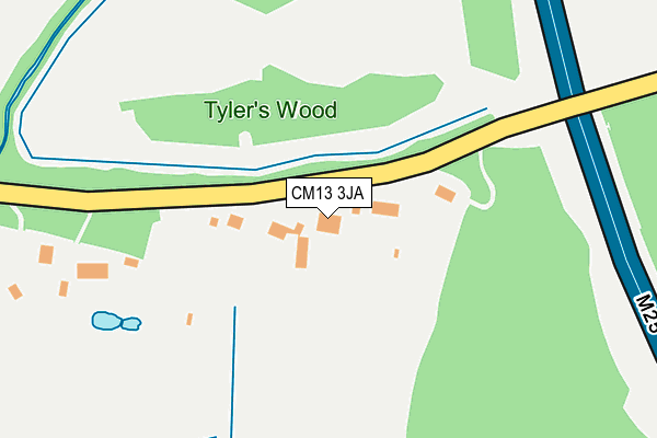
CM13 3JA lies on Warley Road in Great Warley, Brentwood. CM13 3JA is located in the Harold Wood electoral ward, within the London borough of Havering and the English Parliamentary constituency of Hornchurch and Upminster. The Sub Integrated Care Board (ICB) Location is NHS North East London ICB - A3A8R and the police force is Metropolitan Police. This postcode has been in use since January 1980.


GetTheData
Source: OS OpenMap – Local (Ordnance Survey)
Source: OS VectorMap District (Ordnance Survey)
Licence: Open Government Licence (requires attribution)
| Easting | 557140 |
| Northing | 190263 |
| Latitude | 51.589310 |
| Longitude | 0.266958 |
GetTheData
Source: Open Postcode Geo
Licence: Open Government Licence
| Street | Warley Road |
| Locality | Great Warley |
| Town/City | Brentwood |
| Country | England |
| Postcode District | CM13 |
➜ See where CM13 is on a map | |
GetTheData
Source: Land Registry Price Paid Data
Licence: Open Government Licence
Elevation or altitude of CM13 3JA as distance above sea level:
| Metres | Feet | |
|---|---|---|
| Elevation | 60m | 197ft |
Elevation is measured from the approximate centre of the postcode, to the nearest point on an OS contour line from OS Terrain 50, which has contour spacing of ten vertical metres.
➜ How high above sea level am I? Find the elevation of your current position using your device's GPS.
GetTheData
Source: Open Postcode Elevation
Licence: Open Government Licence
| Ward | Harold Wood |
| Constituency | Hornchurch And Upminster |
GetTheData
Source: ONS Postcode Database
Licence: Open Government Licence
| Pages Lane | Harold Wood | 1,244m |
| Pages Lane | Harold Wood | 1,261m |
| Thatchers Arms (Warley Street) | Great Warley | 1,289m |
| Blacksmiths Forge (Great Warley Street) | Great Warley | 1,333m |
| Thatchers Arms (Warley Street) | Great Warley | 1,336m |
| Harold Wood Station | 2.4km |
| Brentwood Station | 3.5km |
| Upminster Station | 3.5km |
GetTheData
Source: NaPTAN
Licence: Open Government Licence
| Percentage of properties with Next Generation Access | 100.0% |
| Percentage of properties with Superfast Broadband | 20.0% |
| Percentage of properties with Ultrafast Broadband | 0.0% |
| Percentage of properties with Full Fibre Broadband | 0.0% |
Superfast Broadband is between 30Mbps and 300Mbps
Ultrafast Broadband is > 300Mbps
| Percentage of properties unable to receive 2Mbps | 0.0% |
| Percentage of properties unable to receive 5Mbps | 0.0% |
| Percentage of properties unable to receive 10Mbps | 0.0% |
| Percentage of properties unable to receive 30Mbps | 80.0% |
GetTheData
Source: Ofcom
Licence: Ofcom Terms of Use (requires attribution)
GetTheData
Source: ONS Postcode Database
Licence: Open Government Licence


➜ Get more ratings from the Food Standards Agency
GetTheData
Source: Food Standards Agency
Licence: FSA terms & conditions
| Last Collection | |||
|---|---|---|---|
| Location | Mon-Fri | Sat | Distance |
| Old Great Warley P.o. | 17:00 | 10:30 | 1,278m |
| New World Hotel | 17:00 | 08:15 | 1,696m |
| Avon Road | 18:00 | 11:45 | 2,196m |
GetTheData
Source: Dracos
Licence: Creative Commons Attribution-ShareAlike
The below table lists the International Territorial Level (ITL) codes (formerly Nomenclature of Territorial Units for Statistics (NUTS) codes) and Local Administrative Units (LAU) codes for CM13 3JA:
| ITL 1 Code | Name |
|---|---|
| TLI | London |
| ITL 2 Code | Name |
| TLI5 | Outer London - East and North East |
| ITL 3 Code | Name |
| TLI52 | Barking & Dagenham and Havering |
| LAU 1 Code | Name |
| E09000016 | Havering |
GetTheData
Source: ONS Postcode Directory
Licence: Open Government Licence
The below table lists the Census Output Area (OA), Lower Layer Super Output Area (LSOA), and Middle Layer Super Output Area (MSOA) for CM13 3JA:
| Code | Name | |
|---|---|---|
| OA | E00011452 | |
| LSOA | E01002296 | Havering 007C |
| MSOA | E02000470 | Havering 007 |
GetTheData
Source: ONS Postcode Directory
Licence: Open Government Licence
| CM13 3JB | Beredens Lane | 642m |
| RM14 1TR | Warley Road | 691m |
| RM14 1TP | Tomkyns Lane | 697m |
| CM13 3HZ | Warley Road | 758m |
| RM14 1TT | Hall Lane | 976m |
| RM14 1TS | Nags Head Lane | 987m |
| CM13 3HX | Warley Road | 1120m |
| RM14 1TQ | Cornsland Close | 1122m |
| RM14 1TX | Hall Lane | 1218m |
| RM3 0NR | Shepherds Hill | 1221m |
GetTheData
Source: Open Postcode Geo; Land Registry Price Paid Data
Licence: Open Government Licence