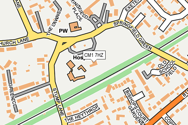
CM1 7HZ is located in the The Lawns electoral ward, within the local authority district of Chelmsford and the English Parliamentary constituency of Chelmsford. The Sub Integrated Care Board (ICB) Location is NHS Mid and South Essex ICB - 06Q and the police force is Essex. This postcode has been in use since June 2001.


GetTheData
Source: OS OpenMap – Local (Ordnance Survey)
Source: OS VectorMap District (Ordnance Survey)
Licence: Open Government Licence (requires attribution)
| Easting | 572013 |
| Northing | 207880 |
| Latitude | 51.743219 |
| Longitude | 0.490110 |
GetTheData
Source: Open Postcode Geo
Licence: Open Government Licence
| Country | England |
| Postcode District | CM1 |
➜ See where CM1 is on a map ➜ Where is Chelmsford? | |
GetTheData
Source: Land Registry Price Paid Data
Licence: Open Government Licence
Elevation or altitude of CM1 7HZ as distance above sea level:
| Metres | Feet | |
|---|---|---|
| Elevation | 40m | 131ft |
Elevation is measured from the approximate centre of the postcode, to the nearest point on an OS contour line from OS Terrain 50, which has contour spacing of ten vertical metres.
➜ How high above sea level am I? Find the elevation of your current position using your device's GPS.
GetTheData
Source: Open Postcode Elevation
Licence: Open Government Licence
| Ward | The Lawns |
| Constituency | Chelmsford |
GetTheData
Source: ONS Postcode Database
Licence: Open Government Licence
| Springfield Green | Springfield | 88m |
| Springfield Green | Springfield | 122m |
| Lawn Lane | Springfield | 265m |
| Lawn Lane | Springfield | 268m |
| Oaklea Avenue (Springfield Road) | Springfield | 287m |
| Chelmsford Station | 1.7km |
GetTheData
Source: NaPTAN
Licence: Open Government Licence
GetTheData
Source: ONS Postcode Database
Licence: Open Government Licence


➜ Get more ratings from the Food Standards Agency
GetTheData
Source: Food Standards Agency
Licence: FSA terms & conditions
| Last Collection | |||
|---|---|---|---|
| Location | Mon-Fri | Sat | Distance |
| Exeter Road | 17:30 | 11:30 | 201m |
| Stump Lane | 17:30 | 11:30 | 346m |
| Upper Springfield Road | 17:30 | 11:30 | 376m |
GetTheData
Source: Dracos
Licence: Creative Commons Attribution-ShareAlike
The below table lists the International Territorial Level (ITL) codes (formerly Nomenclature of Territorial Units for Statistics (NUTS) codes) and Local Administrative Units (LAU) codes for CM1 7HZ:
| ITL 1 Code | Name |
|---|---|
| TLH | East |
| ITL 2 Code | Name |
| TLH3 | Essex |
| ITL 3 Code | Name |
| TLH36 | Heart of Essex |
| LAU 1 Code | Name |
| E07000070 | Chelmsford |
GetTheData
Source: ONS Postcode Directory
Licence: Open Government Licence
The below table lists the Census Output Area (OA), Lower Layer Super Output Area (LSOA), and Middle Layer Super Output Area (MSOA) for CM1 7HZ:
| Code | Name | |
|---|---|---|
| OA | E00109836 | |
| LSOA | E01021622 | Chelmsford 007C |
| MSOA | E02004491 | Chelmsford 007 |
GetTheData
Source: ONS Postcode Directory
Licence: Open Government Licence
| CM2 6AZ | Bishops Court Gardens | 147m |
| CM2 6BX | The Heythrop | 149m |
| CM1 7SJ | Stump Lane | 162m |
| CM1 7HS | Springfield Green | 180m |
| CM1 7HU | Old School Field | 197m |
| CM1 7ZA | Springfield Place | 234m |
| CM1 7SQ | Church Lane | 248m |
| CM1 6JD | Camborne Close | 248m |
| CM2 6BG | Redgates Place | 255m |
| CM1 6HU | Exeter Road | 257m |
GetTheData
Source: Open Postcode Geo; Land Registry Price Paid Data
Licence: Open Government Licence