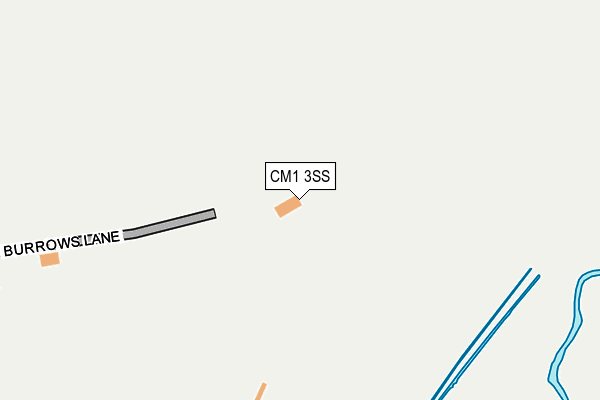
CM1 3SS is located in the Writtle electoral ward, within the local authority district of Chelmsford and the English Parliamentary constituency of Saffron Walden. The Sub Integrated Care Board (ICB) Location is NHS Mid and South Essex ICB - 06Q and the police force is Essex. This postcode has been in use since October 1984.


GetTheData
Source: OS OpenMap – Local (Ordnance Survey)
Source: OS VectorMap District (Ordnance Survey)
Licence: Open Government Licence (requires attribution)
| Easting | 568006 |
| Northing | 206867 |
| Latitude | 51.735340 |
| Longitude | 0.431666 |
GetTheData
Source: Open Postcode Geo
Licence: Open Government Licence
| Country | England |
| Postcode District | CM1 |
➜ See where CM1 is on a map | |
GetTheData
Source: Land Registry Price Paid Data
Licence: Open Government Licence
Elevation or altitude of CM1 3SS as distance above sea level:
| Metres | Feet | |
|---|---|---|
| Elevation | 30m | 98ft |
Elevation is measured from the approximate centre of the postcode, to the nearest point on an OS contour line from OS Terrain 50, which has contour spacing of ten vertical metres.
➜ How high above sea level am I? Find the elevation of your current position using your device's GPS.
GetTheData
Source: Open Postcode Elevation
Licence: Open Government Licence
| Ward | Writtle |
| Constituency | Saffron Walden |
GetTheData
Source: ONS Postcode Database
Licence: Open Government Licence
| Agricultural College (Lordship Road) | Writtle | 200m |
| Agricultural College (Lordship Road) | Writtle | 204m |
| Writtle Green (The Green) | Writtle | 584m |
| Writtle Green (The Green) | Writtle | 594m |
| St John's Road (Bridge Street) | Writtle | 601m |
| Chelmsford Station | 2.6km |
GetTheData
Source: NaPTAN
Licence: Open Government Licence
| Percentage of properties with Next Generation Access | 100.0% |
| Percentage of properties with Superfast Broadband | 100.0% |
| Percentage of properties with Ultrafast Broadband | 0.0% |
| Percentage of properties with Full Fibre Broadband | 0.0% |
Superfast Broadband is between 30Mbps and 300Mbps
Ultrafast Broadband is > 300Mbps
| Percentage of properties unable to receive 2Mbps | 0.0% |
| Percentage of properties unable to receive 5Mbps | 0.0% |
| Percentage of properties unable to receive 10Mbps | 0.0% |
| Percentage of properties unable to receive 30Mbps | 0.0% |
GetTheData
Source: Ofcom
Licence: Ofcom Terms of Use (requires attribution)
GetTheData
Source: ONS Postcode Database
Licence: Open Government Licence


➜ Get more ratings from the Food Standards Agency
GetTheData
Source: Food Standards Agency
Licence: FSA terms & conditions
| Last Collection | |||
|---|---|---|---|
| Location | Mon-Fri | Sat | Distance |
| Writtle P.o. | 17:30 | 12:00 | 632m |
| Lodge Road | 16:45 | 09:00 | 954m |
| Long Brandocks | 16:50 | 08:45 | 1,043m |
GetTheData
Source: Dracos
Licence: Creative Commons Attribution-ShareAlike
The below table lists the International Territorial Level (ITL) codes (formerly Nomenclature of Territorial Units for Statistics (NUTS) codes) and Local Administrative Units (LAU) codes for CM1 3SS:
| ITL 1 Code | Name |
|---|---|
| TLH | East |
| ITL 2 Code | Name |
| TLH3 | Essex |
| ITL 3 Code | Name |
| TLH36 | Heart of Essex |
| LAU 1 Code | Name |
| E07000070 | Chelmsford |
GetTheData
Source: ONS Postcode Directory
Licence: Open Government Licence
The below table lists the Census Output Area (OA), Lower Layer Super Output Area (LSOA), and Middle Layer Super Output Area (MSOA) for CM1 3SS:
| Code | Name | |
|---|---|---|
| OA | E00109887 | |
| LSOA | E01021633 | Chelmsford 011C |
| MSOA | E02004495 | Chelmsford 011 |
GetTheData
Source: ONS Postcode Directory
Licence: Open Government Licence
| CM1 3ED | Wykeham Road | 378m |
| CM1 3EE | Bruce Road | 407m |
| CM1 3GA | Guys Farm | 438m |
| CM1 3EF | Firs Drive | 442m |
| CM1 3EB | St Johns Road | 460m |
| CM1 3EH | Lordship Road | 474m |
| CM1 3EW | Melba Court | 479m |
| CM1 3EG | Orchard Close | 482m |
| CM1 3EA | Lawford Lane | 497m |
| CM1 3DZ | St Johns Green | 526m |
GetTheData
Source: Open Postcode Geo; Land Registry Price Paid Data
Licence: Open Government Licence