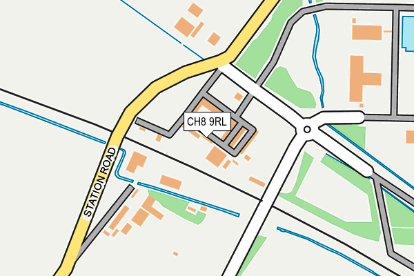
CH8 9RL is located in the Llanasa and Trelawnyd electoral ward, within the unitary authority of Flintshire and the Welsh Parliamentary constituency of Delyn. The Local Health Board is Betsi Cadwaladr University and the police force is North Wales. This postcode has been in use since January 1995.


GetTheData
Source: OS OpenMap – Local (Ordnance Survey)
Source: OS VectorMap District (Ordnance Survey)
Licence: Open Government Licence (requires attribution)
| Easting | 311847 |
| Northing | 383896 |
| Latitude | 53.344603 |
| Longitude | -3.325577 |
GetTheData
Source: Open Postcode Geo
Licence: Open Government Licence
| Country | Wales |
| Postcode District | CH8 |
➜ See where CH8 is on a map ➜ Where is Talacre? | |
GetTheData
Source: Land Registry Price Paid Data
Licence: Open Government Licence
Elevation or altitude of CH8 9RL as distance above sea level:
| Metres | Feet | |
|---|---|---|
| Elevation | 10m | 33ft |
Elevation is measured from the approximate centre of the postcode, to the nearest point on an OS contour line from OS Terrain 50, which has contour spacing of ten vertical metres.
➜ How high above sea level am I? Find the elevation of your current position using your device's GPS.
GetTheData
Source: Open Postcode Elevation
Licence: Open Government Licence
| Ward | Llanasa And Trelawnyd |
| Constituency | Delyn |
GetTheData
Source: ONS Postcode Database
Licence: Open Government Licence
| Talacre Beach (Station Road) | Talacre | 638m |
| Station Road Turn (A548) | Talacre | 717m |
| Station Road Turn (A548) | Talacre | 726m |
| White Gates (A548) | Tanlan Banks | 827m |
| White Gates (A548) | Tanlan Banks | 836m |
GetTheData
Source: NaPTAN
Licence: Open Government Licence
GetTheData
Source: ONS Postcode Database
Licence: Open Government Licence


➜ Get more ratings from the Food Standards Agency
GetTheData
Source: Food Standards Agency
Licence: FSA terms & conditions
| Last Collection | |||
|---|---|---|---|
| Location | Mon-Fri | Sat | Distance |
| Presthaven Sands | 16:30 | 07:00 | 1,711m |
| Shore Road | 16:15 | 09:00 | 2,773m |
| Marian | 17:00 | 09:45 | 4,973m |
GetTheData
Source: Dracos
Licence: Creative Commons Attribution-ShareAlike
The below table lists the International Territorial Level (ITL) codes (formerly Nomenclature of Territorial Units for Statistics (NUTS) codes) and Local Administrative Units (LAU) codes for CH8 9RL:
| ITL 1 Code | Name |
|---|---|
| TLL | Wales |
| ITL 2 Code | Name |
| TLL2 | East Wales |
| ITL 3 Code | Name |
| TLL23 | Flintshire and Wrexham |
| LAU 1 Code | Name |
| W06000005 | Flintshire |
GetTheData
Source: ONS Postcode Directory
Licence: Open Government Licence
The below table lists the Census Output Area (OA), Lower Layer Super Output Area (LSOA), and Middle Layer Super Output Area (MSOA) for CH8 9RL:
| Code | Name | |
|---|---|---|
| OA | W00001536 | |
| LSOA | W01000287 | Flintshire 001A |
| MSOA | W02000058 | Flintshire 001 |
GetTheData
Source: ONS Postcode Directory
Licence: Open Government Licence
| CH8 9RD | Station Road | 641m |
| CH8 9RE | Corbett Avenue | 656m |
| CH8 9RB | Beach Close | 701m |
| CH8 9RF | Beach Close | 723m |
| CH8 9RG | Third Avenue | 742m |
| CH8 9JH | 785m | |
| CH8 9RT | Gamfa Wen Road | 795m |
| CH8 9RQ | Fourth Avenue | 805m |
| CH8 9RH | Fifth Avenue | 852m |
| CH8 9JY | 873m |
GetTheData
Source: Open Postcode Geo; Land Registry Price Paid Data
Licence: Open Government Licence