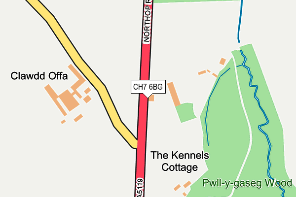
CH7 6BG lies on Mold Road in Northop, Mold. CH7 6BG is located in the Northop electoral ward, within the unitary authority of Flintshire and the Welsh Parliamentary constituency of Delyn. The Local Health Board is Betsi Cadwaladr University and the police force is North Wales. This postcode has been in use since January 1980.


GetTheData
Source: OS OpenMap – Local (Ordnance Survey)
Source: OS VectorMap District (Ordnance Survey)
Licence: Open Government Licence (requires attribution)
| Easting | 324318 |
| Northing | 367104 |
| Latitude | 53.195610 |
| Longitude | -3.134295 |
GetTheData
Source: Open Postcode Geo
Licence: Open Government Licence
| Street | Mold Road |
| Locality | Northop |
| Town/City | Mold |
| Country | Wales |
| Postcode District | CH7 |
➜ See where CH7 is on a map | |
GetTheData
Source: Land Registry Price Paid Data
Licence: Open Government Licence
Elevation or altitude of CH7 6BG as distance above sea level:
| Metres | Feet | |
|---|---|---|
| Elevation | 130m | 427ft |
Elevation is measured from the approximate centre of the postcode, to the nearest point on an OS contour line from OS Terrain 50, which has contour spacing of ten vertical metres.
➜ How high above sea level am I? Find the elevation of your current position using your device's GPS.
GetTheData
Source: Open Postcode Elevation
Licence: Open Government Licence
| Ward | Northop |
| Constituency | Delyn |
GetTheData
Source: ONS Postcode Database
Licence: Open Government Licence
| Banks Farm (A5119) | Soughton | 55m |
| Banks Farm (A5119) | Soughton | 57m |
| Cross Keys (Northop Road) | Soughton | 509m |
| Ffordd Eldon (Vownog) | Soughton | 624m |
| Llys-y-wern (New Brighton Road) | Soughton | 764m |
GetTheData
Source: NaPTAN
Licence: Open Government Licence
| Percentage of properties with Next Generation Access | 100.0% |
| Percentage of properties with Superfast Broadband | 100.0% |
| Percentage of properties with Ultrafast Broadband | 100.0% |
| Percentage of properties with Full Fibre Broadband | 100.0% |
Superfast Broadband is between 30Mbps and 300Mbps
Ultrafast Broadband is > 300Mbps
| Percentage of properties unable to receive 2Mbps | 0.0% |
| Percentage of properties unable to receive 5Mbps | 0.0% |
| Percentage of properties unable to receive 10Mbps | 0.0% |
| Percentage of properties unable to receive 30Mbps | 0.0% |
GetTheData
Source: Ofcom
Licence: Ofcom Terms of Use (requires attribution)
GetTheData
Source: ONS Postcode Database
Licence: Open Government Licence


➜ Get more ratings from the Food Standards Agency
GetTheData
Source: Food Standards Agency
Licence: FSA terms & conditions
| Last Collection | |||
|---|---|---|---|
| Location | Mon-Fri | Sat | Distance |
| Sychdyn Post Office | 17:02 | 10:45 | 791m |
| Watt's Dyke | 17:01 | 10:45 | 827m |
| Tai Cochion Soughton | 09:00 | 07:45 | 1,048m |
GetTheData
Source: Dracos
Licence: Creative Commons Attribution-ShareAlike
The below table lists the International Territorial Level (ITL) codes (formerly Nomenclature of Territorial Units for Statistics (NUTS) codes) and Local Administrative Units (LAU) codes for CH7 6BG:
| ITL 1 Code | Name |
|---|---|
| TLL | Wales |
| ITL 2 Code | Name |
| TLL2 | East Wales |
| ITL 3 Code | Name |
| TLL23 | Flintshire and Wrexham |
| LAU 1 Code | Name |
| W06000005 | Flintshire |
GetTheData
Source: ONS Postcode Directory
Licence: Open Government Licence
The below table lists the Census Output Area (OA), Lower Layer Super Output Area (LSOA), and Middle Layer Super Output Area (MSOA) for CH7 6BG:
| Code | Name | |
|---|---|---|
| OA | W00001737 | |
| LSOA | W01000323 | Flintshire 012C |
| MSOA | W02000069 | Flintshire 012 |
GetTheData
Source: ONS Postcode Directory
Licence: Open Government Licence
| CH7 6SS | Ffordd Celyn | 550m |
| CH7 6ED | Vownog Road | 576m |
| CH7 6BE | Mold Road | 588m |
| CH7 6ST | Ffordd Eldon | 602m |
| CH7 6EB | Chapel Walk | 628m |
| CH7 6EW | The Vownog | 636m |
| CH7 6ER | Vownog Newydd | 645m |
| CH7 6SR | Tan Yr Ysgol | 650m |
| CH7 6YT | Pant Isa | 692m |
| CH7 6SU | Tan Y Bryn | 718m |
GetTheData
Source: Open Postcode Geo; Land Registry Price Paid Data
Licence: Open Government Licence