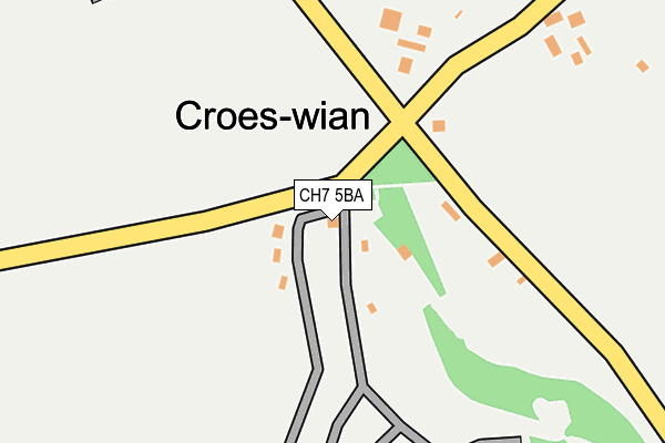
CH7 5BA is located in the Caerwys electoral ward, within the unitary authority of Flintshire and the Welsh Parliamentary constituency of Delyn. The Local Health Board is Betsi Cadwaladr University and the police force is North Wales. This postcode has been in use since January 1980.


GetTheData
Source: OS OpenMap – Local (Ordnance Survey)
Source: OS VectorMap District (Ordnance Survey)
Licence: Open Government Licence (requires attribution)
| Easting | 312180 |
| Northing | 373690 |
| Latitude | 53.252927 |
| Longitude | -3.317749 |
GetTheData
Source: Open Postcode Geo
Licence: Open Government Licence
| Country | Wales |
| Postcode District | CH7 |
➜ See where CH7 is on a map ➜ Where is Croes-wian? | |
GetTheData
Source: Land Registry Price Paid Data
Licence: Open Government Licence
Elevation or altitude of CH7 5BA as distance above sea level:
| Metres | Feet | |
|---|---|---|
| Elevation | 170m | 558ft |
Elevation is measured from the approximate centre of the postcode, to the nearest point on an OS contour line from OS Terrain 50, which has contour spacing of ten vertical metres.
➜ How high above sea level am I? Find the elevation of your current position using your device's GPS.
GetTheData
Source: Open Postcode Elevation
Licence: Open Government Licence
| Ward | Caerwys |
| Constituency | Delyn |
GetTheData
Source: ONS Postcode Database
Licence: Open Government Licence
| Caerwys Square (North Street) | Caerwys | 970m |
| Caerwys Square (North Street) | Caerwys | 1,012m |
| Llydiart Cerrig (B5122) | Croes-wian | 1,375m |
| Llydiart Cerrig (B5122) | Croes-wian | 1,376m |
GetTheData
Source: NaPTAN
Licence: Open Government Licence
GetTheData
Source: ONS Postcode Database
Licence: Open Government Licence

➜ Get more ratings from the Food Standards Agency
GetTheData
Source: Food Standards Agency
Licence: FSA terms & conditions
| Last Collection | |||
|---|---|---|---|
| Location | Mon-Fri | Sat | Distance |
| Caerwys Post Office | 16:00 | 11:00 | 1,045m |
| Afonwen | 09:00 | 11:00 | 2,192m |
| Pentre Ucha | 09:15 | 09:15 | 2,341m |
GetTheData
Source: Dracos
Licence: Creative Commons Attribution-ShareAlike
The below table lists the International Territorial Level (ITL) codes (formerly Nomenclature of Territorial Units for Statistics (NUTS) codes) and Local Administrative Units (LAU) codes for CH7 5BA:
| ITL 1 Code | Name |
|---|---|
| TLL | Wales |
| ITL 2 Code | Name |
| TLL2 | East Wales |
| ITL 3 Code | Name |
| TLL23 | Flintshire and Wrexham |
| LAU 1 Code | Name |
| W06000005 | Flintshire |
GetTheData
Source: ONS Postcode Directory
Licence: Open Government Licence
The below table lists the Census Output Area (OA), Lower Layer Super Output Area (LSOA), and Middle Layer Super Output Area (MSOA) for CH7 5BA:
| Code | Name | |
|---|---|---|
| OA | W00001452 | |
| LSOA | W01000271 | Flintshire 006C |
| MSOA | W02000063 | Flintshire 006 |
GetTheData
Source: ONS Postcode Directory
Licence: Open Government Licence
| CH7 5BG | Pen Y Cefn Road | 367m |
| CH7 5BH | Pen Y Cefn Road | 568m |
| CH7 5BE | Pen Y Cefn Road | 766m |
| CH7 5PX | Lon Syr Herbert | 876m |
| CH7 5BT | St Michaels Close | 880m |
| CH7 5XA | Parc Hafod | 900m |
| CH7 5PY | Ffordd Angharad | 919m |
| CH7 5AP | Lon Y Porthmyn | 923m |
| CH7 5BY | Cae Delyn | 926m |
| CH7 5BJ | Llys Pendre | 937m |
GetTheData
Source: Open Postcode Geo; Land Registry Price Paid Data
Licence: Open Government Licence