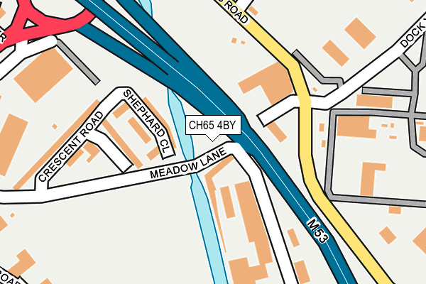
CH65 4BY is located in the Westminster electoral ward, within the unitary authority of Cheshire West and Chester and the English Parliamentary constituency of Ellesmere Port and Neston. The Sub Integrated Care Board (ICB) Location is NHS Cheshire and Merseyside ICB - 27D and the police force is Cheshire. This postcode has been in use since January 2015.


GetTheData
Source: OS OpenMap – Local (Ordnance Survey)
Source: OS VectorMap District (Ordnance Survey)
Licence: Open Government Licence (requires attribution)
| Easting | 340240 |
| Northing | 376532 |
| Latitude | 53.282393 |
| Longitude | -2.897776 |
GetTheData
Source: Open Postcode Geo
Licence: Open Government Licence
| Country | England |
| Postcode District | CH65 |
➜ See where CH65 is on a map ➜ Where is Ellesmere Port? | |
GetTheData
Source: Land Registry Price Paid Data
Licence: Open Government Licence
Elevation or altitude of CH65 4BY as distance above sea level:
| Metres | Feet | |
|---|---|---|
| Elevation | 10m | 33ft |
Elevation is measured from the approximate centre of the postcode, to the nearest point on an OS contour line from OS Terrain 50, which has contour spacing of ten vertical metres.
➜ How high above sea level am I? Find the elevation of your current position using your device's GPS.
GetTheData
Source: Open Postcode Elevation
Licence: Open Government Licence
| Ward | Westminster |
| Constituency | Ellesmere Port And Neston |
GetTheData
Source: ONS Postcode Database
Licence: Open Government Licence
| Woodfield Road North (Princes Road) | Ellesmere Port | 102m |
| Railway Station (Europa Way) | Ellesmere Port | 121m |
| Ashfield Road North (Princes Road) | Ellesmere Port | 122m |
| Charles Price Gardens (Percival Road) | Ellesmere Port | 128m |
| Charles Price Gardens (Percival Road) | Ellesmere Port | 148m |
| Ellesmere Port Station | 0.1km |
| Overpool Station | 1.8km |
| Little Sutton Station | 3.1km |
GetTheData
Source: NaPTAN
Licence: Open Government Licence
GetTheData
Source: ONS Postcode Database
Licence: Open Government Licence


➜ Get more ratings from the Food Standards Agency
GetTheData
Source: Food Standards Agency
Licence: FSA terms & conditions
| Last Collection | |||
|---|---|---|---|
| Location | Mon-Fri | Sat | Distance |
| Cromwell Road | 18:15 | 12:23 | 104m |
| Percival Road | 17:33 | 12:26 | 227m |
| Station Road Post Office | 18:15 | 12:00 | 250m |
GetTheData
Source: Dracos
Licence: Creative Commons Attribution-ShareAlike
The below table lists the International Territorial Level (ITL) codes (formerly Nomenclature of Territorial Units for Statistics (NUTS) codes) and Local Administrative Units (LAU) codes for CH65 4BY:
| ITL 1 Code | Name |
|---|---|
| TLD | North West (England) |
| ITL 2 Code | Name |
| TLD6 | Cheshire |
| ITL 3 Code | Name |
| TLD63 | Cheshire West and Chester |
| LAU 1 Code | Name |
| E06000050 | Cheshire West and Chester |
GetTheData
Source: ONS Postcode Directory
Licence: Open Government Licence
The below table lists the Census Output Area (OA), Lower Layer Super Output Area (LSOA), and Middle Layer Super Output Area (MSOA) for CH65 4BY:
| Code | Name | |
|---|---|---|
| OA | E00093672 | |
| LSOA | E01018563 | Cheshire West and Chester 007D |
| MSOA | E02003845 | Cheshire West and Chester 007 |
GetTheData
Source: ONS Postcode Directory
Licence: Open Government Licence
| CH65 8BA | Woodfield Road North | 73m |
| CH65 8BB | Ashfield Road North | 75m |
| CH65 4AR | Whitby Road | 88m |
| CH65 8AX | Princes Road | 102m |
| CH65 2DL | John Nicholas Crescent | 123m |
| CH65 8BD | Highfield Road North | 125m |
| CH65 8AS | Princes Road | 127m |
| CH65 4BW | Station Road | 163m |
| CH65 8AA | Whitby Road | 173m |
| CH65 4AT | Cook Street | 173m |
GetTheData
Source: Open Postcode Geo; Land Registry Price Paid Data
Licence: Open Government Licence