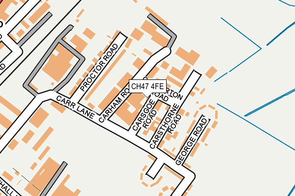
CH47 4FE is located in the Hoylake and Meols electoral ward, within the metropolitan district of Wirral and the English Parliamentary constituency of Wirral West. The Sub Integrated Care Board (ICB) Location is NHS Cheshire and Merseyside ICB - 12F and the police force is Merseyside. This postcode has been in use since June 1999.


GetTheData
Source: OS OpenMap – Local (Ordnance Survey)
Source: OS VectorMap District (Ordnance Survey)
Licence: Open Government Licence (requires attribution)
| Easting | 322135 |
| Northing | 388874 |
| Latitude | 53.390956 |
| Longitude | -3.172308 |
GetTheData
Source: Open Postcode Geo
Licence: Open Government Licence
| Country | England |
| Postcode District | CH47 |
➜ See where CH47 is on a map ➜ Where is Hoylake? | |
GetTheData
Source: Land Registry Price Paid Data
Licence: Open Government Licence
Elevation or altitude of CH47 4FE as distance above sea level:
| Metres | Feet | |
|---|---|---|
| Elevation | 10m | 33ft |
Elevation is measured from the approximate centre of the postcode, to the nearest point on an OS contour line from OS Terrain 50, which has contour spacing of ten vertical metres.
➜ How high above sea level am I? Find the elevation of your current position using your device's GPS.
GetTheData
Source: Open Postcode Elevation
Licence: Open Government Licence
| Ward | Hoylake And Meols |
| Constituency | Wirral West |
GetTheData
Source: ONS Postcode Database
Licence: Open Government Licence
| Carsgoe Road (Carr Lane) | Hoylake | 102m |
| Carr Lane | Hoylake | 360m |
| Alderley Road (Market Street) | Hoylake | 373m |
| Alderley Road (Market Street) | Hoylake | 374m |
| Carr Lane | Hoylake | 375m |
| Manor Road Station | 0.4km |
| Hoylake Station | 0.4km |
| Meols Station | 1.5km |
GetTheData
Source: NaPTAN
Licence: Open Government Licence
GetTheData
Source: ONS Postcode Database
Licence: Open Government Licence


➜ Get more ratings from the Food Standards Agency
GetTheData
Source: Food Standards Agency
Licence: FSA terms & conditions
| Last Collection | |||
|---|---|---|---|
| Location | Mon-Fri | Sat | Distance |
| Hoylake Post Office | 17:45 | 12:00 | 373m |
| 102 Market Street | 17:45 | 12:00 | 449m |
| Hoylake Delivery Office | 18:00 | 493m | |
GetTheData
Source: Dracos
Licence: Creative Commons Attribution-ShareAlike
The below table lists the International Territorial Level (ITL) codes (formerly Nomenclature of Territorial Units for Statistics (NUTS) codes) and Local Administrative Units (LAU) codes for CH47 4FE:
| ITL 1 Code | Name |
|---|---|
| TLD | North West (England) |
| ITL 2 Code | Name |
| TLD7 | Merseyside |
| ITL 3 Code | Name |
| TLD74 | Wirral |
| LAU 1 Code | Name |
| E08000015 | Wirral |
GetTheData
Source: ONS Postcode Directory
Licence: Open Government Licence
The below table lists the Census Output Area (OA), Lower Layer Super Output Area (LSOA), and Middle Layer Super Output Area (MSOA) for CH47 4FE:
| Code | Name | |
|---|---|---|
| OA | E00036451 | |
| LSOA | E01007202 | Wirral 014E |
| MSOA | E02001480 | Wirral 014 |
GetTheData
Source: ONS Postcode Directory
Licence: Open Government Licence
| CH47 4FF | Carham Road | 41m |
| CH47 4FB | Carsthorne Road | 91m |
| CH47 4BE | George Road | 105m |
| CH47 4BB | Proctor Road | 128m |
| CH47 4BG | Carr Lane | 177m |
| CH47 4BH | Edward Road | 177m |
| CH47 4AZ | Carr Lane | 185m |
| CH47 3EE | Elm Grove | 301m |
| CH47 3BS | Grosvenor Road | 315m |
| CH47 3BU | Melrose Avenue | 330m |
GetTheData
Source: Open Postcode Geo; Land Registry Price Paid Data
Licence: Open Government Licence