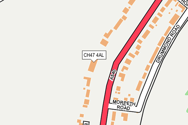
CH47 4AL is located in the Hoylake and Meols electoral ward, within the metropolitan district of Wirral and the English Parliamentary constituency of Wirral West. The Sub Integrated Care Board (ICB) Location is NHS Cheshire and Merseyside ICB - 12F and the police force is Merseyside. This postcode has been in use since June 1999.


GetTheData
Source: OS OpenMap – Local (Ordnance Survey)
Source: OS VectorMap District (Ordnance Survey)
Licence: Open Government Licence (requires attribution)
| Easting | 321292 |
| Northing | 388491 |
| Latitude | 53.387371 |
| Longitude | -3.184887 |
GetTheData
Source: Open Postcode Geo
Licence: Open Government Licence
| Country | England |
| Postcode District | CH47 |
➜ See where CH47 is on a map ➜ Where is Hoylake? | |
GetTheData
Source: Land Registry Price Paid Data
Licence: Open Government Licence
Elevation or altitude of CH47 4AL as distance above sea level:
| Metres | Feet | |
|---|---|---|
| Elevation | 10m | 33ft |
Elevation is measured from the approximate centre of the postcode, to the nearest point on an OS contour line from OS Terrain 50, which has contour spacing of ten vertical metres.
➜ How high above sea level am I? Find the elevation of your current position using your device's GPS.
GetTheData
Source: Open Postcode Elevation
Licence: Open Government Licence
| Ward | Hoylake And Meols |
| Constituency | Wirral West |
GetTheData
Source: ONS Postcode Database
Licence: Open Government Licence
| Morpeth Road (Meols Drive) | Hoylake | 109m |
| Morpeth Road (Meols Drive) | Hoylake | 131m |
| Winnington Road (Meols Drive) | West Kirby | 491m |
| Albert Road (Market Street) | Hoylake | 500m |
| Winnington Road (Meols Drive) | West Kirby | 527m |
| Hoylake Station | 0.5km |
| Manor Road Station | 1.2km |
| West Kirby Station | 1.6km |
GetTheData
Source: NaPTAN
Licence: Open Government Licence
GetTheData
Source: ONS Postcode Database
Licence: Open Government Licence


➜ Get more ratings from the Food Standards Agency
GetTheData
Source: Food Standards Agency
Licence: FSA terms & conditions
| Last Collection | |||
|---|---|---|---|
| Location | Mon-Fri | Sat | Distance |
| Hoylake Delivery Office | 18:00 | 463m | |
| Hoylake Post Office | 17:45 | 12:00 | 733m |
| Marmion Road | 16:45 | 12:00 | 1,062m |
GetTheData
Source: Dracos
Licence: Creative Commons Attribution-ShareAlike
The below table lists the International Territorial Level (ITL) codes (formerly Nomenclature of Territorial Units for Statistics (NUTS) codes) and Local Administrative Units (LAU) codes for CH47 4AL:
| ITL 1 Code | Name |
|---|---|
| TLD | North West (England) |
| ITL 2 Code | Name |
| TLD7 | Merseyside |
| ITL 3 Code | Name |
| TLD74 | Wirral |
| LAU 1 Code | Name |
| E08000015 | Wirral |
GetTheData
Source: ONS Postcode Directory
Licence: Open Government Licence
The below table lists the Census Output Area (OA), Lower Layer Super Output Area (LSOA), and Middle Layer Super Output Area (MSOA) for CH47 4AL:
| Code | Name | |
|---|---|---|
| OA | E00036439 | |
| LSOA | E01007193 | Wirral 014A |
| MSOA | E02001480 | Wirral 014 |
GetTheData
Source: ONS Postcode Directory
Licence: Open Government Licence
| CH47 4AE | Meols Drive | 108m |
| CH47 4AT | Morpeth Road | 171m |
| CH47 4AU | Drummond Road | 217m |
| CH47 4DF | Barn Hey | 233m |
| CH47 4AF | Meols Drive | 238m |
| CH47 4AD | Meols Drive | 280m |
| CH47 4AQ | Meols Drive | 303m |
| CH47 1HL | Stanley Road | 320m |
| CH47 1JA | Rosecroft Court | 362m |
| CH47 4AB | Airlie Road | 367m |
GetTheData
Source: Open Postcode Geo; Land Registry Price Paid Data
Licence: Open Government Licence