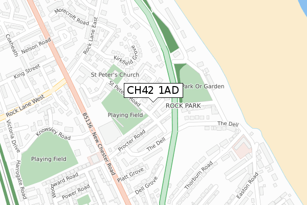
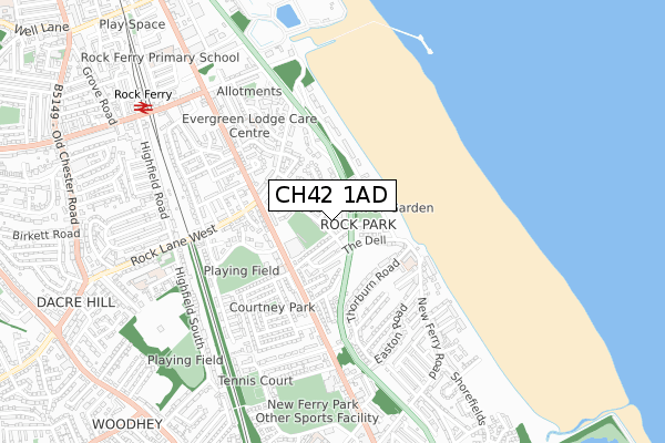
CH42 1AD is located in the Rock Ferry electoral ward, within the metropolitan district of Wirral and the English Parliamentary constituency of Birkenhead. The Sub Integrated Care Board (ICB) Location is NHS Cheshire and Merseyside ICB - 12F and the police force is Merseyside. This postcode has been in use since April 2020.


GetTheData
Source: OS Open Zoomstack (Ordnance Survey)
Licence: Open Government Licence (requires attribution)
Attribution: Contains OS data © Crown copyright and database right 2024
Source: Open Postcode Geo
Licence: Open Government Licence (requires attribution)
Attribution: Contains OS data © Crown copyright and database right 2024; Contains Royal Mail data © Royal Mail copyright and database right 2024; Source: Office for National Statistics licensed under the Open Government Licence v.3.0
| Easting | 333562 |
| Northing | 386214 |
| Latitude | 53.368613 |
| Longitude | -2.999954 |
GetTheData
Source: Open Postcode Geo
Licence: Open Government Licence
| Country | England |
| Postcode District | CH42 |
| ➜ CH42 open data dashboard ➜ See where CH42 is on a map ➜ Where is Birkenhead? | |
GetTheData
Source: Land Registry Price Paid Data
Licence: Open Government Licence
| Ward | Rock Ferry |
| Constituency | Birkenhead |
GetTheData
Source: ONS Postcode Database
Licence: Open Government Licence
| January 2024 | Criminal damage and arson | On or near Kirkfield Grove | 186m |
| November 2023 | Violence and sexual offences | On or near Kirkfield Grove | 186m |
| November 2023 | Violence and sexual offences | On or near Kirkfield Grove | 186m |
| ➜ Get more crime data in our Crime section | |||
GetTheData
Source: data.police.uk
Licence: Open Government Licence
| Procter Road | Rock Ferry | 101m |
| St Peters Road | Rock Ferry | 103m |
| Procter Road | Rock Ferry | 103m |
| St Peters Road | Rock Ferry | 123m |
| The Dell | Rock Park | 130m |
| Rock Ferry Station | 0.9km |
| Bebington Station | 1.2km |
| Green Lane Station | 2km |
GetTheData
Source: NaPTAN
Licence: Open Government Licence
GetTheData
Source: ONS Postcode Database
Licence: Open Government Licence

➜ Get more ratings from the Food Standards Agency
GetTheData
Source: Food Standards Agency
Licence: FSA terms & conditions
| Last Collection | |||
|---|---|---|---|
| Location | Mon-Fri | Sat | Distance |
| New Ferry Road | 17:30 | 12:00 | 620m |
| Overton View, | 17:15 | 12:00 | 996m |
| Bebington Post Office, | 17:15 | 12:00 | 1,415m |
GetTheData
Source: Dracos
Licence: Creative Commons Attribution-ShareAlike
| Facility | Distance |
|---|---|
| Cammell Laird 1907 Fc St Peters Road, Rock Ferry Grass Pitches | 101m |
| Conway Playing Fields Victoria Drive, Birkenhead Grass Pitches | 441m |
| New Ferry Park Sefton Road, Wirral Grass Pitches, Outdoor Tennis Courts | 653m |
GetTheData
Source: Active Places
Licence: Open Government Licence
| School | Phase of Education | Distance |
|---|---|---|
| St Anne's Catholic Primary School Highfield South, Rock Ferry, Birkenhead, CH42 4NE | Primary | 756m |
| Grove Street Primary School Grove Street Primary School, Grove Street, New Ferry, Wirral, CH62 5BA | Primary | 831m |
| Rock Ferry Primary School Ionic Street, Rock Ferry, Birkenhead, CH42 2BL | Primary | 909m |
GetTheData
Source: Edubase
Licence: Open Government Licence
The below table lists the International Territorial Level (ITL) codes (formerly Nomenclature of Territorial Units for Statistics (NUTS) codes) and Local Administrative Units (LAU) codes for CH42 1AD:
| ITL 1 Code | Name |
|---|---|
| TLD | North West (England) |
| ITL 2 Code | Name |
| TLD7 | Merseyside |
| ITL 3 Code | Name |
| TLD74 | Wirral |
| LAU 1 Code | Name |
| E08000015 | Wirral |
GetTheData
Source: ONS Postcode Directory
Licence: Open Government Licence
The below table lists the Census Output Area (OA), Lower Layer Super Output Area (LSOA), and Middle Layer Super Output Area (MSOA) for CH42 1AD:
| Code | Name | |
|---|---|---|
| OA | E00036972 | |
| LSOA | E01007290 | Wirral 027B |
| MSOA | E02001493 | Wirral 027 |
GetTheData
Source: ONS Postcode Directory
Licence: Open Government Licence
| CH42 1RT | St Peters Mews | 77m |
| CH42 1PY | St Peters Road | 98m |
| CH42 1PS | Procter Road | 123m |
| CH42 1PT | The Dell | 137m |
| CH42 1PR | Delta Road East | 140m |
| CH42 1PD | St Peters Road | 154m |
| CH42 1PU | The Dell | 156m |
| CH42 1PW | The Dell | 168m |
| CH42 1RS | Peterwood | 192m |
| CH42 1PP | Rock Park Road | 200m |
GetTheData
Source: Open Postcode Geo; Land Registry Price Paid Data
Licence: Open Government Licence