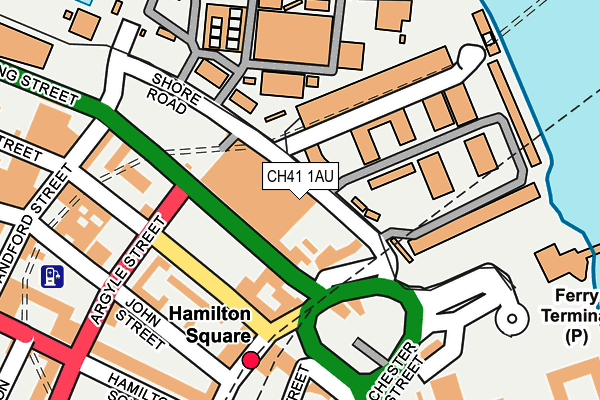
CH41 1AU is located in the Birkenhead and Tranmere electoral ward, within the metropolitan district of Wirral and the English Parliamentary constituency of Birkenhead. The Sub Integrated Care Board (ICB) Location is NHS Cheshire and Merseyside ICB - 12F and the police force is Merseyside. This postcode has been in use since September 2012.


GetTheData
Source: OS OpenMap – Local (Ordnance Survey)
Source: OS VectorMap District (Ordnance Survey)
Licence: Open Government Licence (requires attribution)
| Easting | 332726 |
| Northing | 389262 |
| Latitude | 53.395900 |
| Longitude | -3.013166 |
GetTheData
Source: Open Postcode Geo
Licence: Open Government Licence
| Country | England |
| Postcode District | CH41 |
➜ See where CH41 is on a map ➜ Where is Birkenhead? | |
GetTheData
Source: Land Registry Price Paid Data
Licence: Open Government Licence
Elevation or altitude of CH41 1AU as distance above sea level:
| Metres | Feet | |
|---|---|---|
| Elevation | 10m | 33ft |
Elevation is measured from the approximate centre of the postcode, to the nearest point on an OS contour line from OS Terrain 50, which has contour spacing of ten vertical metres.
➜ How high above sea level am I? Find the elevation of your current position using your device's GPS.
GetTheData
Source: Open Postcode Elevation
Licence: Open Government Licence
| Ward | Birkenhead And Tranmere |
| Constituency | Birkenhead |
GetTheData
Source: ONS Postcode Database
Licence: Open Government Licence
| Argyle Street (Canning Street) | Woodside | 70m |
| Argyle Street (Canning Street) | Woodside | 89m |
| Hamilton Street (Bridge Street) | Woodside | 119m |
| Chester Street (Bridge Street) | Woodside | 141m |
| Chester Street (Bridge Street) | Woodside | 153m |
| Birkenhead Hamilton Square Station | 0.1km |
| Conway Park Station | 0.7km |
| Birkenhead Central Station | 1km |
GetTheData
Source: NaPTAN
Licence: Open Government Licence
GetTheData
Source: ONS Postcode Database
Licence: Open Government Licence


➜ Get more ratings from the Food Standards Agency
GetTheData
Source: Food Standards Agency
Licence: FSA terms & conditions
| Last Collection | |||
|---|---|---|---|
| Location | Mon-Fri | Sat | Distance |
| 250 Cleveland Street | 17:30 | 12:00 | 458m |
| Conway Street | 17:15 | 12:00 | 682m |
| Woodchurch Lane | 18:05 | 756m | |
GetTheData
Source: Dracos
Licence: Creative Commons Attribution-ShareAlike
The below table lists the International Territorial Level (ITL) codes (formerly Nomenclature of Territorial Units for Statistics (NUTS) codes) and Local Administrative Units (LAU) codes for CH41 1AU:
| ITL 1 Code | Name |
|---|---|
| TLD | North West (England) |
| ITL 2 Code | Name |
| TLD7 | Merseyside |
| ITL 3 Code | Name |
| TLD74 | Wirral |
| LAU 1 Code | Name |
| E08000015 | Wirral |
GetTheData
Source: ONS Postcode Directory
Licence: Open Government Licence
The below table lists the Census Output Area (OA), Lower Layer Super Output Area (LSOA), and Middle Layer Super Output Area (MSOA) for CH41 1AU:
| Code | Name | |
|---|---|---|
| OA | E00036119 | |
| LSOA | E01007126 | Wirral 016A |
| MSOA | E02001482 | Wirral 016 |
GetTheData
Source: ONS Postcode Directory
Licence: Open Government Licence
| CH41 6DJ | Hamilton Street | 115m |
| CH41 1LX | Argyle Street | 162m |
| CH41 1AS | Bridge Street | 190m |
| CH41 6AU | Hamilton Square | 220m |
| CH41 5DQ | Chester Street | 229m |
| CH41 6AX | Hamilton Square | 244m |
| CH41 5AT | Hamilton Square | 253m |
| CH41 5EU | Mortimer Street | 283m |
| CH41 1BD | Bridge Street | 317m |
| CH41 6AY | Hamilton Square | 324m |
GetTheData
Source: Open Postcode Geo; Land Registry Price Paid Data
Licence: Open Government Licence