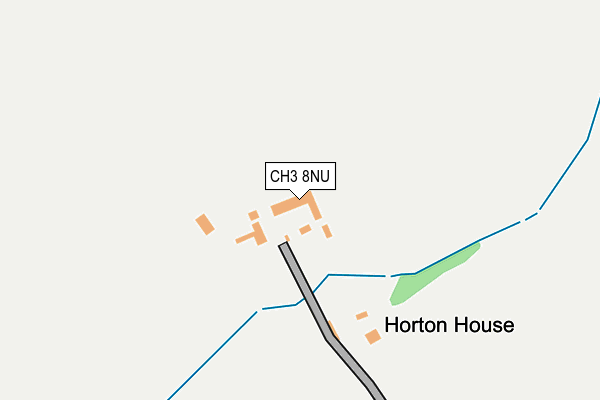
CH3 8NU lies on Horton Lane in Tarvin, Chester. CH3 8NU is located in the Sandstone electoral ward, within the unitary authority of Cheshire West and Chester and the English Parliamentary constituency of Eddisbury. The Sub Integrated Care Board (ICB) Location is NHS Cheshire and Merseyside ICB - 27D and the police force is Cheshire. This postcode has been in use since March 2013.


GetTheData
Source: OS OpenMap – Local (Ordnance Survey)
Source: OS VectorMap District (Ordnance Survey)
Licence: Open Government Licence (requires attribution)
| Easting | 349395 |
| Northing | 368833 |
| Latitude | 53.214133 |
| Longitude | -2.759252 |
GetTheData
Source: Open Postcode Geo
Licence: Open Government Licence
| Street | Horton Lane |
| Locality | Tarvin |
| Town/City | Chester |
| Country | England |
| Postcode District | CH3 |
➜ See where CH3 is on a map | |
GetTheData
Source: Land Registry Price Paid Data
Licence: Open Government Licence
Elevation or altitude of CH3 8NU as distance above sea level:
| Metres | Feet | |
|---|---|---|
| Elevation | 30m | 98ft |
Elevation is measured from the approximate centre of the postcode, to the nearest point on an OS contour line from OS Terrain 50, which has contour spacing of ten vertical metres.
➜ How high above sea level am I? Find the elevation of your current position using your device's GPS.
GetTheData
Source: Open Postcode Elevation
Licence: Open Government Licence
| Ward | Sandstone |
| Constituency | Eddisbury |
GetTheData
Source: ONS Postcode Database
Licence: Open Government Licence
| Nurseries (Barrow Lane) | Tarvin | 904m |
| Ashton Lane (Chester Road) | Tarvin | 1,128m |
| Shay Lane (Kelsall Road) | Tarvin Sands | 1,141m |
| Golden Lion Ph (Church Road) | Ashton Hayes | 1,165m |
| Irons Lane | Hollowmoor Heath | 1,169m |
| Mouldsworth Station | 2.7km |
GetTheData
Source: NaPTAN
Licence: Open Government Licence
GetTheData
Source: ONS Postcode Database
Licence: Open Government Licence


➜ Get more ratings from the Food Standards Agency
GetTheData
Source: Food Standards Agency
Licence: FSA terms & conditions
| Last Collection | |||
|---|---|---|---|
| Location | Mon-Fri | Sat | Distance |
| Guilden Sutton, | 16:00 | 08:15 | 4,508m |
| Dunham Hill So | 16:00 | 09:00 | 4,656m |
| Guilden Sutton Post Office. | 16:00 | 11:45 | 4,747m |
GetTheData
Source: Dracos
Licence: Creative Commons Attribution-ShareAlike
The below table lists the International Territorial Level (ITL) codes (formerly Nomenclature of Territorial Units for Statistics (NUTS) codes) and Local Administrative Units (LAU) codes for CH3 8NU:
| ITL 1 Code | Name |
|---|---|
| TLD | North West (England) |
| ITL 2 Code | Name |
| TLD6 | Cheshire |
| ITL 3 Code | Name |
| TLD63 | Cheshire West and Chester |
| LAU 1 Code | Name |
| E06000050 | Cheshire West and Chester |
GetTheData
Source: ONS Postcode Directory
Licence: Open Government Licence
The below table lists the Census Output Area (OA), Lower Layer Super Output Area (LSOA), and Middle Layer Super Output Area (MSOA) for CH3 8NU:
| Code | Name | |
|---|---|---|
| OA | E00092338 | |
| LSOA | E01018308 | Cheshire West and Chester 022A |
| MSOA | E02003794 | Cheshire West and Chester 022 |
GetTheData
Source: ONS Postcode Directory
Licence: Open Government Licence
| CH3 7LJ | Barrow Lane | 845m |
| CH3 8AZ | Peel Hall Park | 894m |
| CH3 8AA | Ashton Lane | 934m |
| CH3 8DF | Whitegate Lane | 979m |
| CH3 8DD | Booth Avenue | 984m |
| CH3 8DE | Peel Hall Lane | 993m |
| CH3 8NR | Kelsall Road | 1004m |
| CH3 8DA | Peel Crescent | 1041m |
| CH3 8DQ | Sunny Bank | 1079m |
| CH3 8DB | Peel Crescent | 1084m |
GetTheData
Source: Open Postcode Geo; Land Registry Price Paid Data
Licence: Open Government Licence