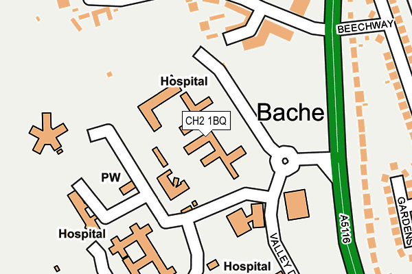
CH2 1BQ is located in the Upton electoral ward, within the unitary authority of Cheshire West and Chester and the English Parliamentary constituency of City of Chester. The Sub Integrated Care Board (ICB) Location is NHS Cheshire and Merseyside ICB - 27D and the police force is Cheshire. This postcode has been in use since June 2001.


GetTheData
Source: OS OpenMap – Local (Ordnance Survey)
Source: OS VectorMap District (Ordnance Survey)
Licence: Open Government Licence (requires attribution)
| Easting | 340071 |
| Northing | 368653 |
| Latitude | 53.211544 |
| Longitude | -2.898825 |
GetTheData
Source: Open Postcode Geo
Licence: Open Government Licence
| Country | England |
| Postcode District | CH2 |
➜ See where CH2 is on a map ➜ Where is Chester? | |
GetTheData
Source: Land Registry Price Paid Data
Licence: Open Government Licence
Elevation or altitude of CH2 1BQ as distance above sea level:
| Metres | Feet | |
|---|---|---|
| Elevation | 20m | 66ft |
Elevation is measured from the approximate centre of the postcode, to the nearest point on an OS contour line from OS Terrain 50, which has contour spacing of ten vertical metres.
➜ How high above sea level am I? Find the elevation of your current position using your device's GPS.
GetTheData
Source: Open Postcode Elevation
Licence: Open Government Licence
| Ward | Upton |
| Constituency | City Of Chester |
GetTheData
Source: ONS Postcode Database
Licence: Open Government Licence
| Countess Roundabout (Countess Health Park) | Bache | 148m |
| Beechway (Liverpool Road) | Bache | 170m |
| Beechway (Liverpool Road) | Bache | 218m |
| Main Entrance (Countess Health Park) | Bache | 314m |
| Countess Hospital (Liverpool Road) | Bache | 317m |
| Bache Station | 0.6km |
| Chester Station | 2.1km |
GetTheData
Source: NaPTAN
Licence: Open Government Licence
GetTheData
Source: ONS Postcode Database
Licence: Open Government Licence


➜ Get more ratings from the Food Standards Agency
GetTheData
Source: Food Standards Agency
Licence: FSA terms & conditions
| Last Collection | |||
|---|---|---|---|
| Location | Mon-Fri | Sat | Distance |
| The Bache Post Office. | 17:00 | 12:15 | 482m |
| Thornton Drive, Newton. | 17:30 | 12:45 | 884m |
| Eversley Park. | 17:45 | 11:45 | 901m |
GetTheData
Source: Dracos
Licence: Creative Commons Attribution-ShareAlike
The below table lists the International Territorial Level (ITL) codes (formerly Nomenclature of Territorial Units for Statistics (NUTS) codes) and Local Administrative Units (LAU) codes for CH2 1BQ:
| ITL 1 Code | Name |
|---|---|
| TLD | North West (England) |
| ITL 2 Code | Name |
| TLD6 | Cheshire |
| ITL 3 Code | Name |
| TLD63 | Cheshire West and Chester |
| LAU 1 Code | Name |
| E06000050 | Cheshire West and Chester |
GetTheData
Source: ONS Postcode Directory
Licence: Open Government Licence
The below table lists the Census Output Area (OA), Lower Layer Super Output Area (LSOA), and Middle Layer Super Output Area (MSOA) for CH2 1BQ:
| Code | Name | |
|---|---|---|
| OA | E00092714 | |
| LSOA | E01018377 | Cheshire West and Chester 028F |
| MSOA | E02003797 | Cheshire West and Chester 028 |
GetTheData
Source: ONS Postcode Directory
Licence: Open Government Licence
| CH2 1FD | Caldecott Close | 162m |
| CH2 1BF | Upton Grange | 233m |
| CH2 1AX | Liverpool Road | 233m |
| CH2 1BG | Upton Grange | 269m |
| CH2 1FA | Mottershead Court | 271m |
| CH2 1BY | Upton Drive | 293m |
| CH2 1BL | Upton Grange | 321m |
| CH2 1BX | Upton Drive | 322m |
| CH2 1DB | Pine Gardens | 323m |
| CH2 1DY | Ross Avenue | 334m |
GetTheData
Source: Open Postcode Geo; Land Registry Price Paid Data
Licence: Open Government Licence