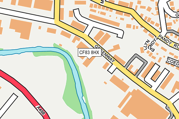
CF83 8HX is located in the Bedwas and Trethomas electoral ward, within the unitary authority of Caerphilly and the Welsh Parliamentary constituency of Caerphilly. The Local Health Board is Aneurin Bevan University and the police force is Gwent. This postcode has been in use since November 2007.


GetTheData
Source: OS OpenMap – Local (Ordnance Survey)
Source: OS VectorMap District (Ordnance Survey)
Licence: Open Government Licence (requires attribution)
| Easting | 316367 |
| Northing | 188815 |
| Latitude | 51.591955 |
| Longitude | -3.208687 |
GetTheData
Source: Open Postcode Geo
Licence: Open Government Licence
| Country | Wales |
| Postcode District | CF83 |
➜ See where CF83 is on a map ➜ Where is Bedwas? | |
GetTheData
Source: Land Registry Price Paid Data
Licence: Open Government Licence
Elevation or altitude of CF83 8HX as distance above sea level:
| Metres | Feet | |
|---|---|---|
| Elevation | 70m | 230ft |
Elevation is measured from the approximate centre of the postcode, to the nearest point on an OS contour line from OS Terrain 50, which has contour spacing of ten vertical metres.
➜ How high above sea level am I? Find the elevation of your current position using your device's GPS.
GetTheData
Source: Open Postcode Elevation
Licence: Open Government Licence
| Ward | Bedwas And Trethomas |
| Constituency | Caerphilly |
GetTheData
Source: ONS Postcode Database
Licence: Open Government Licence
| Meadow View (Pandy Road) | Bedwas | 203m |
| Meadow View (Pandy Road) | Bedwas | 205m |
| Greenway Workshops (Greenway) | Bedwas | 205m |
| Greenway Workshops (Greenway) | Bedwas | 220m |
| Maritime Court (Greenway) | Bedwas | 222m |
| Energlyn & Churchill Park Station | 1.7km |
| Llanbradach Station | 2.1km |
| Caerphilly Station | 2.4km |
GetTheData
Source: NaPTAN
Licence: Open Government Licence
GetTheData
Source: ONS Postcode Database
Licence: Open Government Licence


➜ Get more ratings from the Food Standards Agency
GetTheData
Source: Food Standards Agency
Licence: FSA terms & conditions
| Last Collection | |||
|---|---|---|---|
| Location | Mon-Fri | Sat | Distance |
| Bedwas Road | 17:00 | 12:00 | 944m |
| Blockbusters | 16:15 | 12:15 | 1,582m |
| Mill Road | 16:30 | 12:00 | 1,722m |
GetTheData
Source: Dracos
Licence: Creative Commons Attribution-ShareAlike
The below table lists the International Territorial Level (ITL) codes (formerly Nomenclature of Territorial Units for Statistics (NUTS) codes) and Local Administrative Units (LAU) codes for CF83 8HX:
| ITL 1 Code | Name |
|---|---|
| TLL | Wales |
| ITL 2 Code | Name |
| TLL1 | West Wales and The Valleys |
| ITL 3 Code | Name |
| TLL16 | Gwent Valleys |
| LAU 1 Code | Name |
| W06000018 | Caerphilly |
GetTheData
Source: ONS Postcode Directory
Licence: Open Government Licence
The below table lists the Census Output Area (OA), Lower Layer Super Output Area (LSOA), and Middle Layer Super Output Area (MSOA) for CF83 8HX:
| Code | Name | |
|---|---|---|
| OA | W00007024 | |
| LSOA | W01001344 | Caerphilly 020C |
| MSOA | W02000309 | Caerphilly 020 |
GetTheData
Source: ONS Postcode Directory
Licence: Open Government Licence
| CF83 8FW | Swanbridge Court | 141m |
| CF83 8DD | Clos Tyrywen | 185m |
| CF83 8EY | Llyn Pandy | 198m |
| CF83 8DW | Greenway | 199m |
| CF83 8EL | Pandy Road | 200m |
| CF83 8HA | Meadow View | 233m |
| CF83 8HB | Cherry Tree Close | 272m |
| CF83 8HJ | Cornfield Rise | 285m |
| CF83 8EN | Jerries Lane | 293m |
| CF83 8DS | Coed Y Pandy | 295m |
GetTheData
Source: Open Postcode Geo; Land Registry Price Paid Data
Licence: Open Government Licence