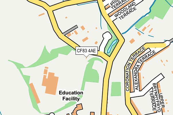
CF83 4AE is located in the Aber Valley electoral ward, within the unitary authority of Caerphilly and the Welsh Parliamentary constituency of Caerphilly. The Local Health Board is Aneurin Bevan University and the police force is Gwent. This postcode has been in use since August 2010.


GetTheData
Source: OS OpenMap – Local (Ordnance Survey)
Source: OS VectorMap District (Ordnance Survey)
Licence: Open Government Licence (requires attribution)
| Easting | 311392 |
| Northing | 191258 |
| Latitude | 51.613152 |
| Longitude | -3.281092 |
GetTheData
Source: Open Postcode Geo
Licence: Open Government Licence
| Country | Wales |
| Postcode District | CF83 |
➜ See where CF83 is on a map ➜ Where is Senghenydd? | |
GetTheData
Source: Land Registry Price Paid Data
Licence: Open Government Licence
Elevation or altitude of CF83 4AE as distance above sea level:
| Metres | Feet | |
|---|---|---|
| Elevation | 200m | 656ft |
Elevation is measured from the approximate centre of the postcode, to the nearest point on an OS contour line from OS Terrain 50, which has contour spacing of ten vertical metres.
➜ How high above sea level am I? Find the elevation of your current position using your device's GPS.
GetTheData
Source: Open Postcode Elevation
Licence: Open Government Licence
| Ward | Aber Valley |
| Constituency | Caerphilly |
GetTheData
Source: ONS Postcode Database
Licence: Open Government Licence
| Saw Mills (Senghenydd Road) | Senghenydd | 76m |
| Saw Mills (Senghenydd Road) | Senghenydd | 84m |
| Cenydd Terrace | Senghenydd | 203m |
| Alexandra Terrace | Senghenydd | 207m |
| Stanley Street Steps (High Street) | Senghenydd | 254m |
| Llanbradach Station | 3.5km |
| Trefforest Station | 3.9km |
| Ystrad Mynach Station | 4.1km |
GetTheData
Source: NaPTAN
Licence: Open Government Licence
GetTheData
Source: ONS Postcode Database
Licence: Open Government Licence


➜ Get more ratings from the Food Standards Agency
GetTheData
Source: Food Standards Agency
Licence: FSA terms & conditions
| Last Collection | |||
|---|---|---|---|
| Location | Mon-Fri | Sat | Distance |
| Glyntaff | 17:30 | 11:15 | 3,331m |
| The Common | 17:45 | 11:45 | 3,423m |
| Pentrebach | 17:30 | 11:15 | 3,533m |
GetTheData
Source: Dracos
Licence: Creative Commons Attribution-ShareAlike
The below table lists the International Territorial Level (ITL) codes (formerly Nomenclature of Territorial Units for Statistics (NUTS) codes) and Local Administrative Units (LAU) codes for CF83 4AE:
| ITL 1 Code | Name |
|---|---|
| TLL | Wales |
| ITL 2 Code | Name |
| TLL1 | West Wales and The Valleys |
| ITL 3 Code | Name |
| TLL16 | Gwent Valleys |
| LAU 1 Code | Name |
| W06000018 | Caerphilly |
GetTheData
Source: ONS Postcode Directory
Licence: Open Government Licence
The below table lists the Census Output Area (OA), Lower Layer Super Output Area (LSOA), and Middle Layer Super Output Area (MSOA) for CF83 4AE:
| Code | Name | |
|---|---|---|
| OA | W00006983 | |
| LSOA | W01001332 | Caerphilly 018C |
| MSOA | W02000307 | Caerphilly 018 |
GetTheData
Source: ONS Postcode Directory
Licence: Open Government Licence
| CF83 4HJ | 93m | |
| CF83 4HU | Coronation Terrace | 156m |
| CF83 4HX | Alexandra Terrace | 204m |
| CF83 4HQ | Woodland Terrace | 211m |
| CF83 4HP | Phillips Terrace | 228m |
| CF83 4HT | Stanley Street | 276m |
| CF83 4HN | Graig Terrace | 289m |
| CF83 4GL | Upper Brynhyfryd Terrace | 292m |
| CF83 4HL | Cenydd Terrace | 311m |
| CF83 4HG | Park Terrace | 314m |
GetTheData
Source: Open Postcode Geo; Land Registry Price Paid Data
Licence: Open Government Licence