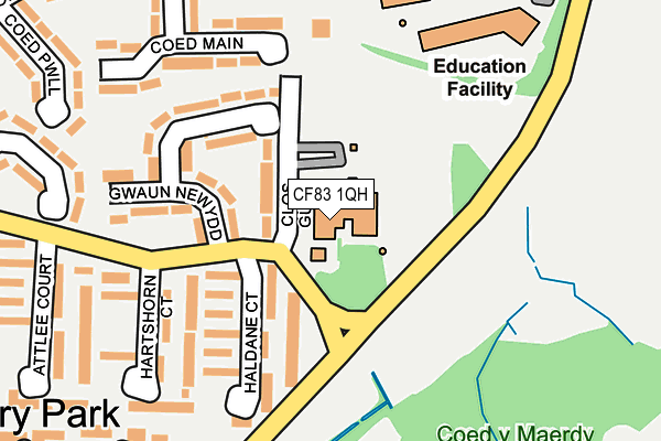
CF83 1QH is located in the Van electoral ward, within the unitary authority of Caerphilly and the Welsh Parliamentary constituency of Caerphilly. The Local Health Board is Aneurin Bevan University and the police force is Gwent. This postcode has been in use since July 1995.


GetTheData
Source: OS OpenMap – Local (Ordnance Survey)
Source: OS VectorMap District (Ordnance Survey)
Licence: Open Government Licence (requires attribution)
| Easting | 316729 |
| Northing | 187503 |
| Latitude | 51.580213 |
| Longitude | -3.203141 |
GetTheData
Source: Open Postcode Geo
Licence: Open Government Licence
| Country | Wales |
| Postcode District | CF83 |
➜ See where CF83 is on a map ➜ Where is Caerphilly? | |
GetTheData
Source: Land Registry Price Paid Data
Licence: Open Government Licence
Elevation or altitude of CF83 1QH as distance above sea level:
| Metres | Feet | |
|---|---|---|
| Elevation | 80m | 262ft |
Elevation is measured from the approximate centre of the postcode, to the nearest point on an OS contour line from OS Terrain 50, which has contour spacing of ten vertical metres.
➜ How high above sea level am I? Find the elevation of your current position using your device's GPS.
GetTheData
Source: Open Postcode Elevation
Licence: Open Government Licence
| Ward | Van |
| Constituency | Caerphilly |
GetTheData
Source: ONS Postcode Database
Licence: Open Government Licence
| Hartshorn Court (Orbital Road) | Lansbury Park | 136m |
| Haldane Court (Lansbury Park Orbital Road) | Lansbury Park | 205m |
| Lansbury Park Schools (Pen-y-cae) | Mornington Meadows | 293m |
| Cole Court (Pen-y-cae) | Mornington Meadows | 382m |
| Snowden Court (Orbital Road) | Lansbury Park | 385m |
| Caerphilly Station | 1.4km |
| Energlyn & Churchill Park Station | 1.8km |
| Aber Station | 1.9km |
GetTheData
Source: NaPTAN
Licence: Open Government Licence
GetTheData
Source: ONS Postcode Database
Licence: Open Government Licence


➜ Get more ratings from the Food Standards Agency
GetTheData
Source: Food Standards Agency
Licence: FSA terms & conditions
| Last Collection | |||
|---|---|---|---|
| Location | Mon-Fri | Sat | Distance |
| Bedwas Road | 17:00 | 12:00 | 528m |
| Blockbusters | 16:15 | 12:15 | 1,063m |
| Mill Road | 16:30 | 12:00 | 1,454m |
GetTheData
Source: Dracos
Licence: Creative Commons Attribution-ShareAlike
The below table lists the International Territorial Level (ITL) codes (formerly Nomenclature of Territorial Units for Statistics (NUTS) codes) and Local Administrative Units (LAU) codes for CF83 1QH:
| ITL 1 Code | Name |
|---|---|
| TLL | Wales |
| ITL 2 Code | Name |
| TLL1 | West Wales and The Valleys |
| ITL 3 Code | Name |
| TLL16 | Gwent Valleys |
| LAU 1 Code | Name |
| W06000018 | Caerphilly |
GetTheData
Source: ONS Postcode Directory
Licence: Open Government Licence
The below table lists the Census Output Area (OA), Lower Layer Super Output Area (LSOA), and Middle Layer Super Output Area (MSOA) for CF83 1QH:
| Code | Name | |
|---|---|---|
| OA | W00007433 | |
| LSOA | W01001419 | Caerphilly 021D |
| MSOA | W02000310 | Caerphilly 021 |
GetTheData
Source: ONS Postcode Directory
Licence: Open Government Licence
| CF83 1RX | Clos Guto | 69m |
| CF83 1RA | Haldane Court | 125m |
| CF83 1RW | Gwaun Newydd | 140m |
| CF83 1QZ | Haldane Court | 140m |
| CF83 1QY | Hartshorn Court | 167m |
| CF83 1RS | Coed Main | 190m |
| CF83 1QX | Hartshorn Court | 220m |
| CF83 1QW | Attlee Court | 230m |
| CF83 1QU | Attlee Court | 293m |
| CF83 1QT | Attlee Court | 297m |
GetTheData
Source: Open Postcode Geo; Land Registry Price Paid Data
Licence: Open Government Licence