CF71 7EN maps, stats, and open data
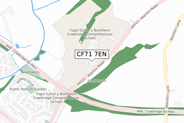
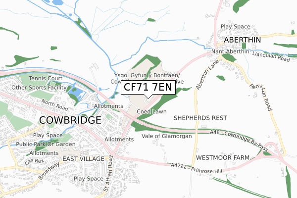
CF71 7EN lies on Aberthin Road in Cowbridge. CF71 7EN is located in the Cowbridge electoral ward, within the unitary authority of Vale of Glamorgan and the Welsh Parliamentary constituency of Vale of Glamorgan. The Local Health Board is Cardiff and Vale University and the police force is South Wales. This postcode has been in use since July 1995.
CF71 7EN maps


Licence: Open Government Licence (requires attribution)
Attribution: Contains OS data © Crown copyright and database right 2025
Source: Open Postcode Geo
Licence: Open Government Licence (requires attribution)
Attribution: Contains OS data © Crown copyright and database right 2025; Contains Royal Mail data © Royal Mail copyright and database right 2025; Source: Office for National Statistics licensed under the Open Government Licence v.3.0
CF71 7EN geodata
| Easting | 300230 |
| Northing | 174801 |
| Latitude | 51.463358 |
| Longitude | -3.437575 |
Where is CF71 7EN?
| Street | Aberthin Road |
| Town/City | Cowbridge |
| Country | Wales |
| Postcode District | CF71 |
CF71 7EN Elevation
Elevation or altitude of CF71 7EN as distance above sea level:
| Metres | Feet | |
|---|---|---|
| Elevation | 30m | 98ft |
Elevation is measured from the approximate centre of the postcode, to the nearest point on an OS contour line from OS Terrain 50, which has contour spacing of ten vertical metres.
➜ How high above sea level am I? Find the elevation of your current position using your device's GPS.
Politics
| Ward | Cowbridge |
|---|---|
| Constituency | Vale Of Glamorgan |
House Prices
Sales of detached houses in CF71 7EN
GLYNCOED, ABERTHIN ROAD, COWBRIDGE, CF71 7EN 1996 19 DEC £125,000 |
Licence: Contains HM Land Registry data © Crown copyright and database right 2025. This data is licensed under the Open Government Licence v3.0.
Transport
Nearest bus stops to CF71 7EN
| Comprehensive School (Aberthin Road) | Cowbridge | 245m |
| Geoffrey Ashe Court (Cardiff Road) | Cowbridge | 543m |
| Geoffrey Ashe Court (Cardiff Road) | Cowbridge | 549m |
| Town Hall (Town Hall Square) | Cowbridge | 646m |
| Aberthin Lane (Primrose Hill) | Primrose Hill | 667m |
Broadband
Broadband access in CF71 7EN (2020 data)
| Percentage of properties with Next Generation Access | 100.0% |
| Percentage of properties with Superfast Broadband | 100.0% |
| Percentage of properties with Ultrafast Broadband | 25.0% |
| Percentage of properties with Full Fibre Broadband | 25.0% |
Superfast Broadband is between 30Mbps and 300Mbps
Ultrafast Broadband is > 300Mbps
Broadband limitations in CF71 7EN (2020 data)
| Percentage of properties unable to receive 2Mbps | 0.0% |
| Percentage of properties unable to receive 5Mbps | 0.0% |
| Percentage of properties unable to receive 10Mbps | 0.0% |
| Percentage of properties unable to receive 30Mbps | 0.0% |
Deprivation
5.1% of Welsh postcodes are less deprived than CF71 7EN:Food Standards Agency
Three nearest food hygiene ratings to CF71 7EN (metres)


➜ Get more ratings from the Food Standards Agency
Nearest post box to CF71 7EN
| Last Collection | |||
|---|---|---|---|
| Location | Mon-Fri | Sat | Distance |
| Broadway | 16:45 | 11:15 | 1,050m |
| Bowmans Well | 16:30 | 11:15 | 1,599m |
| Llanblethain Hill | 16:15 | 11:15 | 2,354m |
CF71 7EN ITL and CF71 7EN LAU
The below table lists the International Territorial Level (ITL) codes (formerly Nomenclature of Territorial Units for Statistics (NUTS) codes) and Local Administrative Units (LAU) codes for CF71 7EN:
| ITL 1 Code | Name |
|---|---|
| TLL | Wales |
| ITL 2 Code | Name |
| TLL2 | East Wales |
| ITL 3 Code | Name |
| TLL22 | Cardiff and Vale of Glamorgan |
| LAU 1 Code | Name |
| W06000014 | Vale of Glamorgan |
CF71 7EN census areas
The below table lists the Census Output Area (OA), Lower Layer Super Output Area (LSOA), and Middle Layer Super Output Area (MSOA) for CF71 7EN:
| Code | Name | |
|---|---|---|
| OA | W00005719 | |
| LSOA | W01001084 | The Vale of Glamorgan 002C |
| MSOA | W02000238 | The Vale of Glamorgan 002 |
Nearest postcodes to CF71 7EN
| CF71 7ET | New Forest View | 331m |
| CF71 7BR | Millfield Drive | 344m |
| CF71 7BQ | Grays Walk | 364m |
| CF71 7BS | Slade Close | 373m |
| CF71 7EJ | The Paddock | 454m |
| CF71 7BP | Druids Green | 455m |
| CF71 7EF | Middlegate Court | 470m |
| CF71 7EU | Greenside | 504m |
| CF71 7EL | Eastgate | 521m |
| CF71 7DG | Eastgate | 545m |