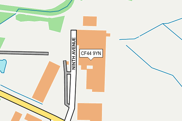
CF44 9YN is located in the Hirwaun, Penderyn and Rhigos electoral ward, within the unitary authority of Rhondda Cynon Taf and the Welsh Parliamentary constituency of Cynon Valley. The Local Health Board is Cwm Taf Morgannwg University and the police force is South Wales. This postcode has been in use since January 1993.


GetTheData
Source: OS OpenMap – Local (Ordnance Survey)
Source: OS VectorMap District (Ordnance Survey)
Licence: Open Government Licence (requires attribution)
| Easting | 294071 |
| Northing | 206805 |
| Latitude | 51.749892 |
| Longitude | -3.535880 |
GetTheData
Source: Open Postcode Geo
Licence: Open Government Licence
| Country | Wales |
| Postcode District | CF44 |
➜ See where CF44 is on a map ➜ Where is Twyn Bryn-hîr? | |
GetTheData
Source: Land Registry Price Paid Data
Licence: Open Government Licence
Elevation or altitude of CF44 9YN as distance above sea level:
| Metres | Feet | |
|---|---|---|
| Elevation | 210m | 689ft |
Elevation is measured from the approximate centre of the postcode, to the nearest point on an OS contour line from OS Terrain 50, which has contour spacing of ten vertical metres.
➜ How high above sea level am I? Find the elevation of your current position using your device's GPS.
GetTheData
Source: Open Postcode Elevation
Licence: Open Government Licence
| Ward | Hirwaun, Penderyn And Rhigos |
| Constituency | Cynon Valley |
GetTheData
Source: ONS Postcode Database
Licence: Open Government Licence
| Maesglas Farm (Rhigos Road) | Hirwaun | 862m |
| Maesglas Farm (Rhigos Road) | Hirwaun | 876m |
| Pont Yr Ochain (Rhigos Road) | Rhigos | 884m |
| Pont Yr Ochain (Rhigos Road) | Rhigos | 894m |
| Tower Colliery (Rhigos Road) | Hirwaun | 973m |
GetTheData
Source: NaPTAN
Licence: Open Government Licence
GetTheData
Source: ONS Postcode Database
Licence: Open Government Licence


➜ Get more ratings from the Food Standards Agency
GetTheData
Source: Food Standards Agency
Licence: FSA terms & conditions
| Last Collection | |||
|---|---|---|---|
| Location | Mon-Fri | Sat | Distance |
| Lamb Inn Pendery | 16:00 | 09:45 | 2,221m |
| Pencomen | 16:30 | 11:00 | 3,992m |
| Ty Mawr Penderyn | 16:00 | 10:00 | 4,652m |
GetTheData
Source: Dracos
Licence: Creative Commons Attribution-ShareAlike
The below table lists the International Territorial Level (ITL) codes (formerly Nomenclature of Territorial Units for Statistics (NUTS) codes) and Local Administrative Units (LAU) codes for CF44 9YN:
| ITL 1 Code | Name |
|---|---|
| TLL | Wales |
| ITL 2 Code | Name |
| TLL1 | West Wales and The Valleys |
| ITL 3 Code | Name |
| TLL15 | Central Valleys |
| LAU 1 Code | Name |
| W06000016 | Rhondda Cynon Taf |
GetTheData
Source: ONS Postcode Directory
Licence: Open Government Licence
The below table lists the Census Output Area (OA), Lower Layer Super Output Area (LSOA), and Middle Layer Super Output Area (MSOA) for CF44 9YN:
| Code | Name | |
|---|---|---|
| OA | W00006478 | |
| LSOA | W01001233 | Rhondda Cynon Taf 001F |
| MSOA | W02000252 | Rhondda Cynon Taf 001 |
GetTheData
Source: ONS Postcode Directory
Licence: Open Government Licence
| CF44 9TJ | 684m | |
| CF44 9UW | Halt Road | 896m |
| CF44 0NJ | 920m | |
| CF44 9UD | Rhigos Road | 932m |
| CF44 9UP | Hirwaun Industrial Estate | 957m |
| CF44 0RX | 1129m | |
| CF44 9UJ | Trebanog Terrace | 1139m |
| CF44 9TX | Woodland Park | 1184m |
| CF44 9UX | 1263m | |
| CF44 9YJ | Llwyn Onn | 1278m |
GetTheData
Source: Open Postcode Geo; Land Registry Price Paid Data
Licence: Open Government Licence