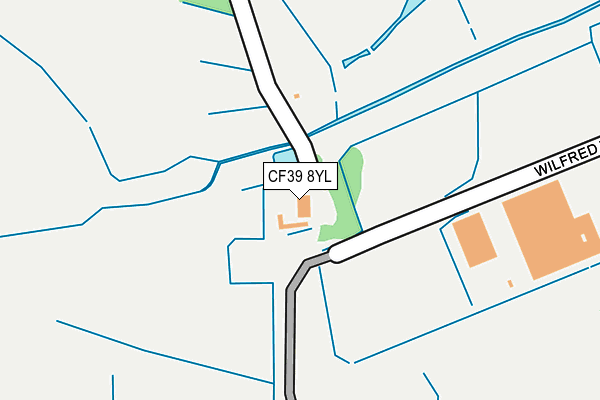
CF39 8YL is located in the Gilfach-goch electoral ward, within the unitary authority of Rhondda Cynon Taf and the Welsh Parliamentary constituency of Ogmore. The Local Health Board is Cwm Taf Morgannwg University and the police force is South Wales. This postcode has been in use since January 1980.


GetTheData
Source: OS OpenMap – Local (Ordnance Survey)
Source: OS VectorMap District (Ordnance Survey)
Licence: Open Government Licence (requires attribution)
| Easting | 298545 |
| Northing | 188087 |
| Latitude | 51.582483 |
| Longitude | -3.465665 |
GetTheData
Source: Open Postcode Geo
Licence: Open Government Licence
| Country | Wales |
| Postcode District | CF39 |
➜ See where CF39 is on a map ➜ Where is Hendreforgan? | |
GetTheData
Source: Land Registry Price Paid Data
Licence: Open Government Licence
Elevation or altitude of CF39 8YL as distance above sea level:
| Metres | Feet | |
|---|---|---|
| Elevation | 160m | 525ft |
Elevation is measured from the approximate centre of the postcode, to the nearest point on an OS contour line from OS Terrain 50, which has contour spacing of ten vertical metres.
➜ How high above sea level am I? Find the elevation of your current position using your device's GPS.
GetTheData
Source: Open Postcode Elevation
Licence: Open Government Licence
| Ward | Gilfach-goch |
| Constituency | Ogmore |
GetTheData
Source: ONS Postcode Database
Licence: Open Government Licence
| Primary School (Gilfach Road) | Hendreforgan | 67m |
| Ffordd Llanbad (Gilfach Road) | Hendreforgan | 67m |
| Ffordd Llanbad (Gilfach Road) | Hendreforgan | 85m |
| Primary School (Gilfach Road) | Hendreforgan | 90m |
| Boxing Club (Cambrian Avenue) | Gilfach Goch | 375m |
| Tonypandy Station | 4.3km |
| Dinas (Rhondda) Station | 4.4km |
| Porth Station | 5.3km |
GetTheData
Source: NaPTAN
Licence: Open Government Licence
| Percentage of properties with Next Generation Access | 100.0% |
| Percentage of properties with Superfast Broadband | 100.0% |
| Percentage of properties with Ultrafast Broadband | 0.0% |
| Percentage of properties with Full Fibre Broadband | 0.0% |
Superfast Broadband is between 30Mbps and 300Mbps
Ultrafast Broadband is > 300Mbps
| Percentage of properties unable to receive 2Mbps | 0.0% |
| Percentage of properties unable to receive 5Mbps | 0.0% |
| Percentage of properties unable to receive 10Mbps | 0.0% |
| Percentage of properties unable to receive 30Mbps | 0.0% |
GetTheData
Source: Ofcom
Licence: Ofcom Terms of Use (requires attribution)
GetTheData
Source: ONS Postcode Database
Licence: Open Government Licence


➜ Get more ratings from the Food Standards Agency
GetTheData
Source: Food Standards Agency
Licence: FSA terms & conditions
| Last Collection | |||
|---|---|---|---|
| Location | Mon-Fri | Sat | Distance |
| Penrhiwfer Road | 17:00 | 11:00 | 2,896m |
| Tynybryn Road | 16:45 | 11:00 | 3,216m |
| Lower Trealaw | 17:15 | 11:00 | 4,338m |
GetTheData
Source: Dracos
Licence: Creative Commons Attribution-ShareAlike
The below table lists the International Territorial Level (ITL) codes (formerly Nomenclature of Territorial Units for Statistics (NUTS) codes) and Local Administrative Units (LAU) codes for CF39 8YL:
| ITL 1 Code | Name |
|---|---|
| TLL | Wales |
| ITL 2 Code | Name |
| TLL1 | West Wales and The Valleys |
| ITL 3 Code | Name |
| TLL15 | Central Valleys |
| LAU 1 Code | Name |
| W06000016 | Rhondda Cynon Taf |
GetTheData
Source: ONS Postcode Directory
Licence: Open Government Licence
The below table lists the Census Output Area (OA), Lower Layer Super Output Area (LSOA), and Middle Layer Super Output Area (MSOA) for CF39 8YL:
| Code | Name | |
|---|---|---|
| OA | W00006211 | |
| LSOA | W01001179 | Rhondda Cynon Taf 023B |
| MSOA | W02000274 | Rhondda Cynon Taf 023 |
GetTheData
Source: ONS Postcode Directory
Licence: Open Government Licence
| CF39 8FL | Ffordd Llanbad | 121m |
| CF39 8UN | Brynhyfryd | 158m |
| CF39 8UW | Heol Y Mynydd | 192m |
| CF39 8YB | 195m | |
| CF39 8UH | 212m | |
| CF39 8UL | Hendreforgan Crescent | 267m |
| CF39 8TL | Alfred Street | 318m |
| CF39 8YA | Heol Y Bryn | 348m |
| CF39 8UY | Heol Y Grug | 361m |
| CF39 8UU | Heol Glyn Goch | 369m |
GetTheData
Source: Open Postcode Geo; Land Registry Price Paid Data
Licence: Open Government Licence