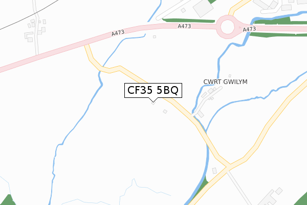
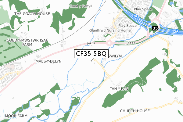
CF35 5BQ is located in the Brackla East and Coychurch Lower electoral ward, within the unitary authority of Bridgend and the Welsh Parliamentary constituency of Bridgend. The Local Health Board is Cwm Taf Morgannwg University and the police force is South Wales. This postcode has been in use since February 2008.


GetTheData
Source: OS Open Zoomstack (Ordnance Survey)
Licence: Open Government Licence (requires attribution)
Attribution: Contains OS data © Crown copyright and database right 2025
Source: Open Postcode Geo
Licence: Open Government Licence (requires attribution)
Attribution: Contains OS data © Crown copyright and database right 2025; Contains Royal Mail data © Royal Mail copyright and database right 2025; Source: Office for National Statistics licensed under the Open Government Licence v.3.0
| Easting | 295249 |
| Northing | 179997 |
| Latitude | 51.509160 |
| Longitude | -3.510793 |
GetTheData
Source: Open Postcode Geo
Licence: Open Government Licence
| Country | Wales |
| Postcode District | CF35 |
➜ See where CF35 is on a map | |
GetTheData
Source: Land Registry Price Paid Data
Licence: Open Government Licence
Elevation or altitude of CF35 5BQ as distance above sea level:
| Metres | Feet | |
|---|---|---|
| Elevation | 20m | 66ft |
Elevation is measured from the approximate centre of the postcode, to the nearest point on an OS contour line from OS Terrain 50, which has contour spacing of ten vertical metres.
➜ How high above sea level am I? Find the elevation of your current position using your device's GPS.
GetTheData
Source: Open Postcode Elevation
Licence: Open Government Licence
| Ward | Brackla East And Coychurch Lower |
| Constituency | Bridgend |
GetTheData
Source: ONS Postcode Database
Licence: Open Government Licence
| Bocam Park (Coychurch Road) | Pencoed | 458m |
| Bocam Park (Coychurch Road) | Pencoed | 601m |
| Maerdy Park (Coychurch Road) | Pencoed | 963m |
| Maerdy Park (Coychurch Road) | Pencoed | 969m |
| Petrol Station (Service Road) | Pencoed | 1,168m |
| Pencoed Station | 1.9km |
| Bridgend Station | 4.5km |
| Wildmill Station | 5km |
GetTheData
Source: NaPTAN
Licence: Open Government Licence
GetTheData
Source: ONS Postcode Database
Licence: Open Government Licence


➜ Get more ratings from the Food Standards Agency
GetTheData
Source: Food Standards Agency
Licence: FSA terms & conditions
| Last Collection | |||
|---|---|---|---|
| Location | Mon-Fri | Sat | Distance |
| Bridgend Industrial Estate | 18:30 | 12:00 | 2,052m |
| Coity | 17:00 | 12:00 | 3,389m |
| Brackla | 17:30 | 12:00 | 3,548m |
GetTheData
Source: Dracos
Licence: Creative Commons Attribution-ShareAlike
The below table lists the International Territorial Level (ITL) codes (formerly Nomenclature of Territorial Units for Statistics (NUTS) codes) and Local Administrative Units (LAU) codes for CF35 5BQ:
| ITL 1 Code | Name |
|---|---|
| TLL | Wales |
| ITL 2 Code | Name |
| TLL1 | West Wales and The Valleys |
| ITL 3 Code | Name |
| TLL17 | Bridgend and Neath Port Talbot |
| LAU 1 Code | Name |
| W06000013 | Bridgend |
GetTheData
Source: ONS Postcode Directory
Licence: Open Government Licence
The below table lists the Census Output Area (OA), Lower Layer Super Output Area (LSOA), and Middle Layer Super Output Area (MSOA) for CF35 5BQ:
| Code | Name | |
|---|---|---|
| OA | W00005315 | |
| LSOA | W01001003 | Bridgend 015D |
| MSOA | W02000232 | Bridgend 015 |
GetTheData
Source: ONS Postcode Directory
Licence: Open Government Licence
| CF35 5BY | 298m | |
| CF35 5BU | 437m | |
| CF35 5LX | Heol Yr Eithin | 516m |
| CF35 5LJ | Old Field Road | 567m |
| CF35 5LL | St Mary Close | 599m |
| CF35 5LP | Coychurch Road | 643m |
| CF35 5LQ | Heol Y Dolau | 657m |
| CF35 5LN | Plouzane Road | 659m |
| CF35 5HW | 734m | |
| CF35 5LW | Waldsassen Road | 740m |
GetTheData
Source: Open Postcode Geo; Land Registry Price Paid Data
Licence: Open Government Licence