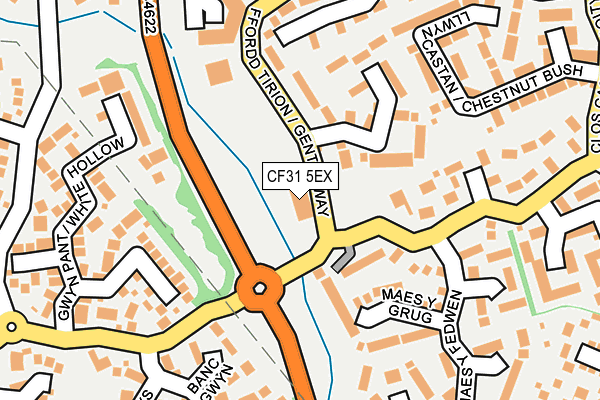
CF31 5EX is located in the Bryntirion, Laleston and Merthyr Mawr electoral ward, within the unitary authority of Bridgend and the Welsh Parliamentary constituency of Bridgend. The Local Health Board is Cwm Taf Morgannwg University and the police force is South Wales. This postcode has been in use since July 2004.


GetTheData
Source: OS OpenMap – Local (Ordnance Survey)
Source: OS VectorMap District (Ordnance Survey)
Licence: Open Government Licence (requires attribution)
| Easting | 289006 |
| Northing | 179137 |
| Latitude | 51.500238 |
| Longitude | -3.600444 |
GetTheData
Source: Open Postcode Geo
Licence: Open Government Licence
| Country | Wales |
| Postcode District | CF31 |
➜ See where CF31 is on a map ➜ Where is Bridgend? | |
GetTheData
Source: Land Registry Price Paid Data
Licence: Open Government Licence
Elevation or altitude of CF31 5EX as distance above sea level:
| Metres | Feet | |
|---|---|---|
| Elevation | 30m | 98ft |
Elevation is measured from the approximate centre of the postcode, to the nearest point on an OS contour line from OS Terrain 50, which has contour spacing of ten vertical metres.
➜ How high above sea level am I? Find the elevation of your current position using your device's GPS.
GetTheData
Source: Open Postcode Elevation
Licence: Open Government Licence
| Ward | Bryntirion, Laleston And Merthyr Mawr |
| Constituency | Bridgend |
GetTheData
Source: ONS Postcode Database
Licence: Open Government Licence
| Nursery (Gentle Way) | Bryntirion | 21m |
| Faircourt Meadow (Gentle Way) | Bryntirion | 260m |
| Heol Blandy | Bryntirion | 296m |
| Llwyn Glas (Greystone) | Bryntirion | 484m |
| Rhiw Blandy | Bryntirion | 556m |
| Bridgend Station | 1.9km |
| Wildmill Station | 2.7km |
| Sarn Station | 4.3km |
GetTheData
Source: NaPTAN
Licence: Open Government Licence
GetTheData
Source: ONS Postcode Database
Licence: Open Government Licence


➜ Get more ratings from the Food Standards Agency
GetTheData
Source: Food Standards Agency
Licence: FSA terms & conditions
| Last Collection | |||
|---|---|---|---|
| Location | Mon-Fri | Sat | Distance |
| Shopping Centre Broadlands | 17:15 | 11:45 | 268m |
| Broadlands North | 17:00 | 11:30 | 542m |
| Bryntirion Hill | 17:00 | 12:00 | 792m |
GetTheData
Source: Dracos
Licence: Creative Commons Attribution-ShareAlike
The below table lists the International Territorial Level (ITL) codes (formerly Nomenclature of Territorial Units for Statistics (NUTS) codes) and Local Administrative Units (LAU) codes for CF31 5EX:
| ITL 1 Code | Name |
|---|---|
| TLL | Wales |
| ITL 2 Code | Name |
| TLL1 | West Wales and The Valleys |
| ITL 3 Code | Name |
| TLL17 | Bridgend and Neath Port Talbot |
| LAU 1 Code | Name |
| W06000013 | Bridgend |
GetTheData
Source: ONS Postcode Directory
Licence: Open Government Licence
The below table lists the Census Output Area (OA), Lower Layer Super Output Area (LSOA), and Middle Layer Super Output Area (MSOA) for CF31 5EX:
| Code | Name | |
|---|---|---|
| OA | W00009963 | |
| LSOA | W01001920 | Bridgend 017G |
| MSOA | W02000234 | Bridgend 017 |
GetTheData
Source: ONS Postcode Directory
Licence: Open Government Licence
| CF31 5HA | Coed Derw | 86m |
| CF31 5AP | Trem Y Dyffryn | 122m |
| CF31 5DQ | Cwrt Bont Newydd | 126m |
| CF31 5DJ | Banc Gwyn | 164m |
| CF31 5DD | Maes Y Grug | 167m |
| CF31 5BD | Pant Poeth | 179m |
| CF31 5DX | New Candlestone | 184m |
| CF31 5DA | Maes Y Fedwen | 211m |
| CF31 5DB | Nant Y Wennol | 224m |
| CF31 5DG | Maes Yr Eirlys | 227m |
GetTheData
Source: Open Postcode Geo; Land Registry Price Paid Data
Licence: Open Government Licence