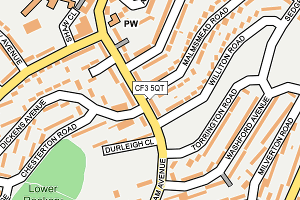
CF3 5QT lies on Burnham Avenue in Llanrumney, Cardiff. CF3 5QT is located in the Llanrumney electoral ward, within the unitary authority of Cardiff and the Welsh Parliamentary constituency of Cardiff South and Penarth. The Local Health Board is Cardiff and Vale University and the police force is South Wales. This postcode has been in use since June 1999.


GetTheData
Source: OS OpenMap – Local (Ordnance Survey)
Source: OS VectorMap District (Ordnance Survey)
Licence: Open Government Licence (requires attribution)
| Easting | 322153 |
| Northing | 181252 |
| Latitude | 51.524795 |
| Longitude | -3.123494 |
GetTheData
Source: Open Postcode Geo
Licence: Open Government Licence
| Street | Burnham Avenue |
| Locality | Llanrumney |
| Town/City | Cardiff |
| Country | Wales |
| Postcode District | CF3 |
➜ See where CF3 is on a map ➜ Where is Cardiff? | |
GetTheData
Source: Land Registry Price Paid Data
Licence: Open Government Licence
Elevation or altitude of CF3 5QT as distance above sea level:
| Metres | Feet | |
|---|---|---|
| Elevation | 30m | 98ft |
Elevation is measured from the approximate centre of the postcode, to the nearest point on an OS contour line from OS Terrain 50, which has contour spacing of ten vertical metres.
➜ How high above sea level am I? Find the elevation of your current position using your device's GPS.
GetTheData
Source: Open Postcode Elevation
Licence: Open Government Licence
| Ward | Llanrumney |
| Constituency | Cardiff South And Penarth |
GetTheData
Source: ONS Postcode Database
Licence: Open Government Licence
| Torrington Road (Burnham Avenue) | Llanrumney | 84m |
| Burnham Avenue | Llanrumney | 109m |
| Somerset Court (Burnham Avenue) | Llanrumney | 157m |
| Shaw Close (Ball Road) | Llanrumney | 188m |
| Siloam Baptist (Burnham Avenue) | Llanrumney | 193m |
| Heath High Level Station | 4.1km |
| Llanishen Station | 4.2km |
| Heath Low Level Station | 4.2km |
GetTheData
Source: NaPTAN
Licence: Open Government Licence
| Percentage of properties with Next Generation Access | 100.0% |
| Percentage of properties with Superfast Broadband | 100.0% |
| Percentage of properties with Ultrafast Broadband | 100.0% |
| Percentage of properties with Full Fibre Broadband | 0.0% |
Superfast Broadband is between 30Mbps and 300Mbps
Ultrafast Broadband is > 300Mbps
| Median download speed | 82.2Mbps |
| Average download speed | 104.2Mbps |
| Maximum download speed | 200.00Mbps |
| Median upload speed | 7.8Mbps |
| Average upload speed | 9.1Mbps |
| Maximum upload speed | 19.90Mbps |
| Percentage of properties unable to receive 2Mbps | 0.0% |
| Percentage of properties unable to receive 5Mbps | 0.0% |
| Percentage of properties unable to receive 10Mbps | 0.0% |
| Percentage of properties unable to receive 30Mbps | 0.0% |
GetTheData
Source: Ofcom
Licence: Ofcom Terms of Use (requires attribution)
Estimated total energy consumption in CF3 5QT by fuel type, 2015.
| Consumption (kWh) | 128,608 |
|---|---|
| Meter count | 12 |
| Mean (kWh/meter) | 10,717 |
| Median (kWh/meter) | 11,302 |
| Consumption (kWh) | 46,288 |
|---|---|
| Meter count | 10 |
| Mean (kWh/meter) | 4,629 |
| Median (kWh/meter) | 3,153 |
GetTheData
Source: Postcode level gas estimates: 2015 (experimental)
Source: Postcode level electricity estimates: 2015 (experimental)
Licence: Open Government Licence
GetTheData
Source: ONS Postcode Database
Licence: Open Government Licence


➜ Get more ratings from the Food Standards Agency
GetTheData
Source: Food Standards Agency
Licence: FSA terms & conditions
| Last Collection | |||
|---|---|---|---|
| Location | Mon-Fri | Sat | Distance |
| Ball Road | 17:15 | 11:00 | 495m |
| Coed Y Gores | 17:30 | 11:45 | 973m |
| Bryn Celyn | 17:30 | 11:30 | 1,534m |
GetTheData
Source: Dracos
Licence: Creative Commons Attribution-ShareAlike
The below table lists the International Territorial Level (ITL) codes (formerly Nomenclature of Territorial Units for Statistics (NUTS) codes) and Local Administrative Units (LAU) codes for CF3 5QT:
| ITL 1 Code | Name |
|---|---|
| TLL | Wales |
| ITL 2 Code | Name |
| TLL2 | East Wales |
| ITL 3 Code | Name |
| TLL22 | Cardiff and Vale of Glamorgan |
| LAU 1 Code | Name |
| W06000015 | Cardiff |
GetTheData
Source: ONS Postcode Directory
Licence: Open Government Licence
The below table lists the Census Output Area (OA), Lower Layer Super Output Area (LSOA), and Middle Layer Super Output Area (MSOA) for CF3 5QT:
| Code | Name | |
|---|---|---|
| OA | W00009326 | |
| LSOA | W01001808 | Cardiff 007C |
| MSOA | W02000373 | Cardiff 007 |
GetTheData
Source: ONS Postcode Directory
Licence: Open Government Licence
| CF3 5LN | Burnham Avenue | 77m |
| CF3 5QG | Malmsmead Road | 95m |
| CF3 5LW | Durleigh Close | 103m |
| CF3 5NN | Burnham Avenue | 123m |
| CF3 5LZ | Dickens Avenue | 147m |
| CF3 5QJ | Honiton Road | 147m |
| CF3 5QD | Torrington Road | 148m |
| CF3 5PD | Burnham Avenue | 158m |
| CF3 5QE | Williton Road | 158m |
| CF3 5LL | Burnham Avenue | 165m |
GetTheData
Source: Open Postcode Geo; Land Registry Price Paid Data
Licence: Open Government Licence