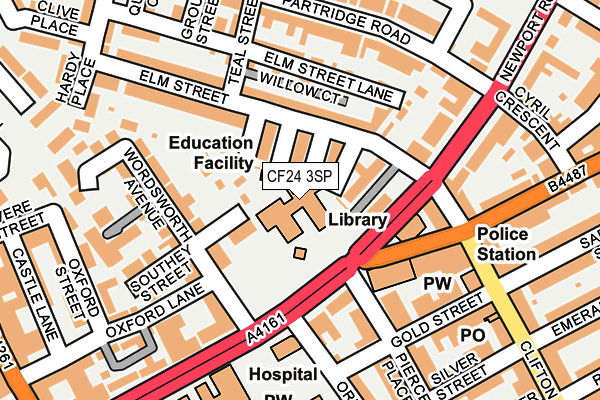
CF24 3SP is located in the Plasnewydd electoral ward, within the unitary authority of Cardiff and the Welsh Parliamentary constituency of Cardiff Central. The Local Health Board is Cardiff and Vale University and the police force is South Wales. This postcode has been in use since June 1999.


GetTheData
Source: OS OpenMap – Local (Ordnance Survey)
Source: OS VectorMap District (Ordnance Survey)
Licence: Open Government Licence (requires attribution)
| Easting | 319448 |
| Northing | 177108 |
| Latitude | 51.487162 |
| Longitude | -3.161528 |
GetTheData
Source: Open Postcode Geo
Licence: Open Government Licence
| Country | Wales |
| Postcode District | CF24 |
➜ See where CF24 is on a map ➜ Where is Cardiff? | |
GetTheData
Source: Land Registry Price Paid Data
Licence: Open Government Licence
Elevation or altitude of CF24 3SP as distance above sea level:
| Metres | Feet | |
|---|---|---|
| Elevation | 10m | 33ft |
Elevation is measured from the approximate centre of the postcode, to the nearest point on an OS contour line from OS Terrain 50, which has contour spacing of ten vertical metres.
➜ How high above sea level am I? Find the elevation of your current position using your device's GPS.
GetTheData
Source: Open Postcode Elevation
Licence: Open Government Licence
| Ward | Plasnewydd |
| Constituency | Cardiff Central |
GetTheData
Source: ONS Postcode Database
Licence: Open Government Licence
| Piercefield Place (Newport Road) | Roath | 95m |
| Elm Street (Newport Road) | Roath | 102m |
| Four Elms Road | Roath | 117m |
| Clifton Street (Broadway) | Roath | 204m |
| Infirmary (Newport Road) | Roath | 277m |
| Cardiff Queen Street Station | 0.8km |
| Cathays Station | 1.2km |
| Cardiff Central Station | 1.7km |
GetTheData
Source: NaPTAN
Licence: Open Government Licence
GetTheData
Source: ONS Postcode Database
Licence: Open Government Licence


➜ Get more ratings from the Food Standards Agency
GetTheData
Source: Food Standards Agency
Licence: FSA terms & conditions
| Last Collection | |||
|---|---|---|---|
| Location | Mon-Fri | Sat | Distance |
| Orbit Street | 17:30 | 13:15 | 129m |
| Clifton Street Post Office | 17:30 | 12:00 | 243m |
| Newport Road Roath | 17:30 | 12:15 | 262m |
GetTheData
Source: Dracos
Licence: Creative Commons Attribution-ShareAlike
The below table lists the International Territorial Level (ITL) codes (formerly Nomenclature of Territorial Units for Statistics (NUTS) codes) and Local Administrative Units (LAU) codes for CF24 3SP:
| ITL 1 Code | Name |
|---|---|
| TLL | Wales |
| ITL 2 Code | Name |
| TLL2 | East Wales |
| ITL 3 Code | Name |
| TLL22 | Cardiff and Vale of Glamorgan |
| LAU 1 Code | Name |
| W06000015 | Cardiff |
GetTheData
Source: ONS Postcode Directory
Licence: Open Government Licence
The below table lists the Census Output Area (OA), Lower Layer Super Output Area (LSOA), and Middle Layer Super Output Area (MSOA) for CF24 3SP:
| Code | Name | |
|---|---|---|
| OA | W00009447 | |
| LSOA | W01001835 | Cardiff 033F |
| MSOA | W02000399 | Cardiff 033 |
GetTheData
Source: ONS Postcode Directory
Licence: Open Government Licence
| CF24 3RJ | Elm Street | 41m |
| CF24 3RH | Elm Street | 42m |
| CF24 3RG | Elm Street | 65m |
| CF24 3RL | Elm Street | 74m |
| CF24 3QR | Elm Street | 96m |
| CF24 3QT | Elm Street | 108m |
| CF24 3FQ | Wordsworth Avenue | 126m |
| CF24 3FX | Wordsworth Avenue | 131m |
| CF24 3FR | Wordsworth Avenue | 153m |
| CF24 3DU | Oxford Lane | 153m |
GetTheData
Source: Open Postcode Geo; Land Registry Price Paid Data
Licence: Open Government Licence