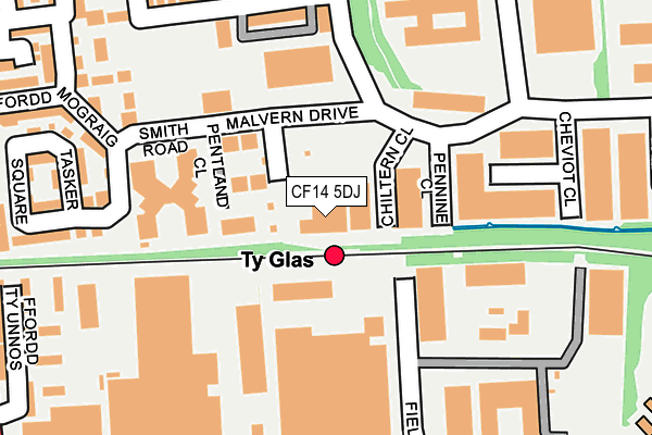
CF14 5DJ is located in the Llanishen electoral ward, within the unitary authority of Cardiff and the Welsh Parliamentary constituency of Cardiff North. The Local Health Board is Cardiff and Vale University and the police force is South Wales. This postcode has been in use since June 1999.


GetTheData
Source: OS OpenMap – Local (Ordnance Survey)
Source: OS VectorMap District (Ordnance Survey)
Licence: Open Government Licence (requires attribution)
| Easting | 317046 |
| Northing | 181023 |
| Latitude | 51.522008 |
| Longitude | -3.197036 |
GetTheData
Source: Open Postcode Geo
Licence: Open Government Licence
| Country | Wales |
| Postcode District | CF14 |
➜ See where CF14 is on a map ➜ Where is Cardiff? | |
GetTheData
Source: Land Registry Price Paid Data
Licence: Open Government Licence
Elevation or altitude of CF14 5DJ as distance above sea level:
| Metres | Feet | |
|---|---|---|
| Elevation | 40m | 131ft |
Elevation is measured from the approximate centre of the postcode, to the nearest point on an OS contour line from OS Terrain 50, which has contour spacing of ten vertical metres.
➜ How high above sea level am I? Find the elevation of your current position using your device's GPS.
GetTheData
Source: Open Postcode Elevation
Licence: Open Government Licence
| Ward | Llanishen |
| Constituency | Cardiff North |
GetTheData
Source: ONS Postcode Database
Licence: Open Government Licence
| Llys Enfys (Smith Road) | Llanishen | 159m |
| Llys Enfys (Smith Road) | Llanishen | 167m |
| Tatham Road (Ashbourn Way) | Llanishen | 238m |
| Tatham Road (Ashbourn Way) | Llanishen | 238m |
| Ton-yr-ywen Avenue (Maes-y-coed Road) | Birchgrove | 271m |
| Ty Glas Station | 0.1km |
| Birchgrove Station | 0.3km |
| Rhiwbina Station | 1.2km |
GetTheData
Source: NaPTAN
Licence: Open Government Licence
GetTheData
Source: ONS Postcode Database
Licence: Open Government Licence


➜ Get more ratings from the Food Standards Agency
GetTheData
Source: Food Standards Agency
Licence: FSA terms & conditions
| Last Collection | |||
|---|---|---|---|
| Location | Mon-Fri | Sat | Distance |
| Parc Ty Glas | 18:30 | 12:00 | 287m |
| St Isan Road Post Office | 17:30 | 12:00 | 706m |
| St Cadoc Road | 17:30 | 12:00 | 808m |
GetTheData
Source: Dracos
Licence: Creative Commons Attribution-ShareAlike
The below table lists the International Territorial Level (ITL) codes (formerly Nomenclature of Territorial Units for Statistics (NUTS) codes) and Local Administrative Units (LAU) codes for CF14 5DJ:
| ITL 1 Code | Name |
|---|---|
| TLL | Wales |
| ITL 2 Code | Name |
| TLL2 | East Wales |
| ITL 3 Code | Name |
| TLL22 | Cardiff and Vale of Glamorgan |
| LAU 1 Code | Name |
| W06000015 | Cardiff |
GetTheData
Source: ONS Postcode Directory
Licence: Open Government Licence
The below table lists the Census Output Area (OA), Lower Layer Super Output Area (LSOA), and Middle Layer Super Output Area (MSOA) for CF14 5DJ:
| Code | Name | |
|---|---|---|
| OA | W00010177 | |
| LSOA | W01001949 | Cardiff 005F |
| MSOA | W02000371 | Cardiff 005 |
GetTheData
Source: ONS Postcode Directory
Licence: Open Government Licence
| CF14 5BB | Pentland Close | 86m |
| CF14 4HY | Field Way | 186m |
| CF14 5FD | Tatham Road | 192m |
| CF14 5EU | Smith Road | 203m |
| CF14 5EW | Ffordd Mograig | 239m |
| CF14 5ET | Tasker Square | 258m |
| CF14 5FE | Mostyn Square | 258m |
| CF14 5EQ | Watkins Square | 282m |
| CF14 4NJ | Ffordd Ty Unnos | 294m |
| CF14 4NG | Ffordd Mograig | 310m |
GetTheData
Source: Open Postcode Geo; Land Registry Price Paid Data
Licence: Open Government Licence