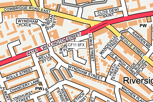
CF11 6FX lies on South Morgan Place in Cardiff. CF11 6FX is located in the Riverside electoral ward, within the unitary authority of Cardiff and the Welsh Parliamentary constituency of Cardiff West. The Local Health Board is Cardiff and Vale University and the police force is South Wales. This postcode has been in use since June 1999.


GetTheData
Source: OS OpenMap – Local (Ordnance Survey)
Source: OS VectorMap District (Ordnance Survey)
Licence: Open Government Licence (requires attribution)
| Easting | 317162 |
| Northing | 176353 |
| Latitude | 51.480044 |
| Longitude | -3.194267 |
GetTheData
Source: Open Postcode Geo
Licence: Open Government Licence
| Street | South Morgan Place |
| Town/City | Cardiff |
| Country | Wales |
| Postcode District | CF11 |
➜ See where CF11 is on a map ➜ Where is Cardiff? | |
GetTheData
Source: Land Registry Price Paid Data
Licence: Open Government Licence
Elevation or altitude of CF11 6FX as distance above sea level:
| Metres | Feet | |
|---|---|---|
| Elevation | 10m | 33ft |
Elevation is measured from the approximate centre of the postcode, to the nearest point on an OS contour line from OS Terrain 50, which has contour spacing of ten vertical metres.
➜ How high above sea level am I? Find the elevation of your current position using your device's GPS.
GetTheData
Source: Open Postcode Elevation
Licence: Open Government Licence
| Ward | Riverside |
| Constituency | Cardiff West |
GetTheData
Source: ONS Postcode Database
Licence: Open Government Licence
| Neville Street | Riverside | 161m |
| Neville Street | Riverside | 196m |
| Wellington Street | Riverside | 211m |
| St Davids Hospital (Cowbridge Road East) | Pontcanna | 222m |
| Wyndham Crescent (Cowbridge Road East) | Canton | 246m |
| Ninian Park Station | 0.6km |
| Cardiff Central Station | 1.1km |
| Grangetown (Cardiff) Station | 1.4km |
GetTheData
Source: NaPTAN
Licence: Open Government Licence
| Percentage of properties with Next Generation Access | 100.0% |
| Percentage of properties with Superfast Broadband | 100.0% |
| Percentage of properties with Ultrafast Broadband | 100.0% |
| Percentage of properties with Full Fibre Broadband | 0.0% |
Superfast Broadband is between 30Mbps and 300Mbps
Ultrafast Broadband is > 300Mbps
| Median download speed | 52.0Mbps |
| Average download speed | 61.1Mbps |
| Maximum download speed | 200.00Mbps |
| Median upload speed | 10.0Mbps |
| Average upload speed | 10.3Mbps |
| Maximum upload speed | 20.00Mbps |
| Percentage of properties unable to receive 2Mbps | 0.0% |
| Percentage of properties unable to receive 5Mbps | 0.0% |
| Percentage of properties unable to receive 10Mbps | 0.0% |
| Percentage of properties unable to receive 30Mbps | 0.0% |
GetTheData
Source: Ofcom
Licence: Ofcom Terms of Use (requires attribution)
Estimated total energy consumption in CF11 6FX by fuel type, 2015.
| Consumption (kWh) | 191,896 |
|---|---|
| Meter count | 42 |
| Mean (kWh/meter) | 4,569 |
| Median (kWh/meter) | 3,483 |
| Consumption (kWh) | 94,046 |
|---|---|
| Meter count | 48 |
| Mean (kWh/meter) | 1,959 |
| Median (kWh/meter) | 1,677 |
GetTheData
Source: Postcode level gas estimates: 2015 (experimental)
Source: Postcode level electricity estimates: 2015 (experimental)
Licence: Open Government Licence
GetTheData
Source: ONS Postcode Database
Licence: Open Government Licence


➜ Get more ratings from the Food Standards Agency
GetTheData
Source: Food Standards Agency
Licence: FSA terms & conditions
| Last Collection | |||
|---|---|---|---|
| Location | Mon-Fri | Sat | Distance |
| Wells Street | 17:30 | 13:00 | 169m |
| Cowbridge Road Post Office | 17:30 | 12:00 | 175m |
| Lower Cathedral Road | 17:30 | 12:45 | 398m |
GetTheData
Source: Dracos
Licence: Creative Commons Attribution-ShareAlike
The below table lists the International Territorial Level (ITL) codes (formerly Nomenclature of Territorial Units for Statistics (NUTS) codes) and Local Administrative Units (LAU) codes for CF11 6FX:
| ITL 1 Code | Name |
|---|---|
| TLL | Wales |
| ITL 2 Code | Name |
| TLL2 | East Wales |
| ITL 3 Code | Name |
| TLL22 | Cardiff and Vale of Glamorgan |
| LAU 1 Code | Name |
| W06000015 | Cardiff |
GetTheData
Source: ONS Postcode Directory
Licence: Open Government Licence
The below table lists the Census Output Area (OA), Lower Layer Super Output Area (LSOA), and Middle Layer Super Output Area (MSOA) for CF11 6FX:
| Code | Name | |
|---|---|---|
| OA | W00009562 | |
| LSOA | W01001857 | Cardiff 042C |
| MSOA | W02000408 | Cardiff 042 |
GetTheData
Source: ONS Postcode Directory
Licence: Open Government Licence
| CF11 6JZ | Lewis Street | 55m |
| CF11 6FY | South Morgan Place | 62m |
| CF11 6DS | Wyndham Place | 71m |
| CF11 6LA | Mandeville Place | 78m |
| CF11 9BL | Wellington Street | 80m |
| CF11 6DR | Wyndham Street | 96m |
| CF11 6ED | Wyndham Place | 97m |
| CF11 6JY | Lewis Street | 101m |
| CF11 6JX | Mandeville Street | 117m |
| CF11 6EY | Craddock Street | 128m |
GetTheData
Source: Open Postcode Geo; Land Registry Price Paid Data
Licence: Open Government Licence