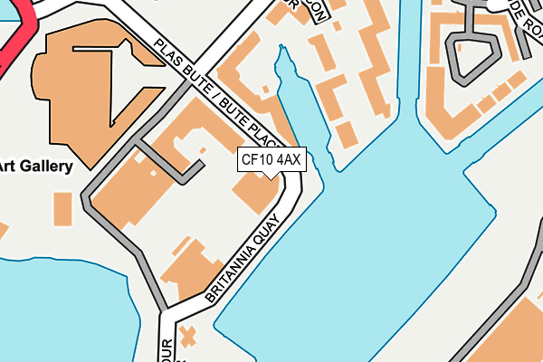
CF10 4AX is located in the Butetown electoral ward, within the unitary authority of Cardiff and the Welsh Parliamentary constituency of Cardiff South and Penarth. The Local Health Board is Cardiff and Vale University and the police force is South Wales. This postcode has been in use since August 2010.


GetTheData
Source: OS OpenMap – Local (Ordnance Survey)
Source: OS VectorMap District (Ordnance Survey)
Licence: Open Government Licence (requires attribution)
| Easting | 319494 |
| Northing | 174503 |
| Latitude | 51.463751 |
| Longitude | -3.160280 |
GetTheData
Source: Open Postcode Geo
Licence: Open Government Licence
| Country | Wales |
| Postcode District | CF10 |
➜ See where CF10 is on a map ➜ Where is Cardiff? | |
GetTheData
Source: Land Registry Price Paid Data
Licence: Open Government Licence
Elevation or altitude of CF10 4AX as distance above sea level:
| Metres | Feet | |
|---|---|---|
| Elevation | 10m | 33ft |
Elevation is measured from the approximate centre of the postcode, to the nearest point on an OS contour line from OS Terrain 50, which has contour spacing of ten vertical metres.
➜ How high above sea level am I? Find the elevation of your current position using your device's GPS.
GetTheData
Source: Open Postcode Elevation
Licence: Open Government Licence
| Ward | Butetown |
| Constituency | Cardiff South And Penarth |
GetTheData
Source: ONS Postcode Database
Licence: Open Government Licence
| Harbour Drive (Britannia Quay) | Cardiff Bay | 105m |
| Harbour Drive (Britannia Quay) | Cardiff Bay | 108m |
| Britannia Quay (Piehead Street) | Cardiff Bay | 155m |
| East Bute Street (Bute Place) | Cardiff Bay | 190m |
| East Bute Street (Bute Place) | Cardiff Bay | 190m |
| Cardiff Bay Station | 0.6km |
| Cardiff Central Station | 1.9km |
| Grangetown (Cardiff) Station | 2.1km |
GetTheData
Source: NaPTAN
Licence: Open Government Licence
GetTheData
Source: ONS Postcode Database
Licence: Open Government Licence


➜ Get more ratings from the Food Standards Agency
GetTheData
Source: Food Standards Agency
Licence: FSA terms & conditions
| Last Collection | |||
|---|---|---|---|
| Location | Mon-Fri | Sat | Distance |
| Britannia Quay | 18:30 | 11:30 | 59m |
| Bute Street Post Office | 18:30 | 12:00 | 431m |
| Mount Stuart Square | 18:30 | 11:30 | 501m |
GetTheData
Source: Dracos
Licence: Creative Commons Attribution-ShareAlike
The below table lists the International Territorial Level (ITL) codes (formerly Nomenclature of Territorial Units for Statistics (NUTS) codes) and Local Administrative Units (LAU) codes for CF10 4AX:
| ITL 1 Code | Name |
|---|---|
| TLL | Wales |
| ITL 2 Code | Name |
| TLL2 | East Wales |
| ITL 3 Code | Name |
| TLL22 | Cardiff and Vale of Glamorgan |
| LAU 1 Code | Name |
| W06000015 | Cardiff |
GetTheData
Source: ONS Postcode Directory
Licence: Open Government Licence
The below table lists the Census Output Area (OA), Lower Layer Super Output Area (LSOA), and Middle Layer Super Output Area (MSOA) for CF10 4AX:
| Code | Name | |
|---|---|---|
| OA | W00010127 | |
| LSOA | W01001943 | Cardiff 048B |
| MSOA | W02000422 | Cardiff 048 |
GetTheData
Source: ONS Postcode Directory
Licence: Open Government Licence
| CF10 4RG | Falcon Drive | 115m |
| CF10 4RH | Falcon Drive | 127m |
| CF10 4RF | Falcon Drive | 167m |
| CF10 4RE | Falcon Drive | 199m |
| CF10 4NQ | Adventurers Quay | 212m |
| CF10 4RD | Falcon Drive | 238m |
| CF10 4NP | Adventurers Quay | 241m |
| CF10 4PD | Falcon Drive | 267m |
| CF10 4PE | Falcon Drive | 267m |
| CF10 4RB | Falcon Drive | 278m |
GetTheData
Source: Open Postcode Geo; Land Registry Price Paid Data
Licence: Open Government Licence