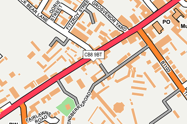
CB8 9BT is located in the Newmarket West electoral ward, within the local authority district of West Suffolk and the English Parliamentary constituency of West Suffolk. The Sub Integrated Care Board (ICB) Location is NHS Suffolk and North East Essex ICB - 07K and the police force is Suffolk. This postcode has been in use since January 1980.


GetTheData
Source: OS OpenMap – Local (Ordnance Survey)
Source: OS VectorMap District (Ordnance Survey)
Licence: Open Government Licence (requires attribution)
| Easting | 564043 |
| Northing | 263126 |
| Latitude | 52.241875 |
| Longitude | 0.401192 |
GetTheData
Source: Open Postcode Geo
Licence: Open Government Licence
| Country | England |
| Postcode District | CB8 |
➜ See where CB8 is on a map ➜ Where is Newmarket? | |
GetTheData
Source: Land Registry Price Paid Data
Licence: Open Government Licence
Elevation or altitude of CB8 9BT as distance above sea level:
| Metres | Feet | |
|---|---|---|
| Elevation | 40m | 131ft |
Elevation is measured from the approximate centre of the postcode, to the nearest point on an OS contour line from OS Terrain 50, which has contour spacing of ten vertical metres.
➜ How high above sea level am I? Find the elevation of your current position using your device's GPS.
GetTheData
Source: Open Postcode Elevation
Licence: Open Government Licence
| Ward | Newmarket West |
| Constituency | West Suffolk |
GetTheData
Source: ONS Postcode Database
Licence: Open Government Licence
| White Lion (High Street) | Newmarket | 147m |
| Bus Shelter (The Avenue) | Newmarket | 190m |
| Bus Shelter (The Avenue) | Newmarket | 211m |
| White Lion (High Street) | Newmarket | 230m |
| Horse Racing Museum (High Street) | Newmarket | 315m |
| Newmarket Station | 0.6km |
| Dullingham Station | 5.1km |
GetTheData
Source: NaPTAN
Licence: Open Government Licence
GetTheData
Source: ONS Postcode Database
Licence: Open Government Licence


➜ Get more ratings from the Food Standards Agency
GetTheData
Source: Food Standards Agency
Licence: FSA terms & conditions
| Last Collection | |||
|---|---|---|---|
| Location | Mon-Fri | Sat | Distance |
| Fitzroy Street | 17:30 | 11:30 | 154m |
| Newmarket Post Office | 18:30 | 12:15 | 220m |
| White Lion | 17:30 | 11:30 | 233m |
GetTheData
Source: Dracos
Licence: Creative Commons Attribution-ShareAlike
The below table lists the International Territorial Level (ITL) codes (formerly Nomenclature of Territorial Units for Statistics (NUTS) codes) and Local Administrative Units (LAU) codes for CB8 9BT:
| ITL 1 Code | Name |
|---|---|
| TLH | East |
| ITL 2 Code | Name |
| TLH1 | East Anglia |
| ITL 3 Code | Name |
| TLH14 | Suffolk CC |
| LAU 1 Code | Name |
| E07000245 | West Suffolk |
GetTheData
Source: ONS Postcode Directory
Licence: Open Government Licence
The below table lists the Census Output Area (OA), Lower Layer Super Output Area (LSOA), and Middle Layer Super Output Area (MSOA) for CB8 9BT:
| Code | Name | |
|---|---|---|
| OA | E00152501 | |
| LSOA | E01029925 | Forest Heath 008A |
| MSOA | E02006826 | Forest Heath 008 |
GetTheData
Source: ONS Postcode Directory
Licence: Open Government Licence
| CB8 9AE | Queensberry Mews | 20m |
| CB8 9AF | High Street | 48m |
| CB8 9AU | Queensberry Road | 53m |
| CB8 9AP | High Street | 70m |
| CB8 9AH | High Street | 82m |
| CB8 0JT | Black Bear Lane | 94m |
| CB8 9AG | High Street | 95m |
| CB8 9AQ | High Street | 106m |
| CB8 0FH | Abernant Drive | 128m |
| CB8 9AT | Bridlemere Court | 146m |
GetTheData
Source: Open Postcode Geo; Land Registry Price Paid Data
Licence: Open Government Licence