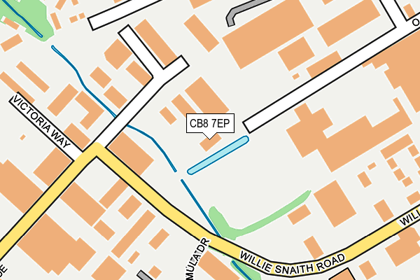
CB8 7EP is located in the Newmarket North electoral ward, within the local authority district of West Suffolk and the English Parliamentary constituency of West Suffolk. The Sub Integrated Care Board (ICB) Location is NHS Suffolk and North East Essex ICB - 07K and the police force is Suffolk. This postcode has been in use since July 2006.


GetTheData
Source: OS OpenMap – Local (Ordnance Survey)
Source: OS VectorMap District (Ordnance Survey)
Licence: Open Government Licence (requires attribution)
| Easting | 563332 |
| Northing | 265136 |
| Latitude | 52.260141 |
| Longitude | 0.391759 |
GetTheData
Source: Open Postcode Geo
Licence: Open Government Licence
| Country | England |
| Postcode District | CB8 |
➜ See where CB8 is on a map ➜ Where is Newmarket? | |
GetTheData
Source: Land Registry Price Paid Data
Licence: Open Government Licence
Elevation or altitude of CB8 7EP as distance above sea level:
| Metres | Feet | |
|---|---|---|
| Elevation | 20m | 66ft |
Elevation is measured from the approximate centre of the postcode, to the nearest point on an OS contour line from OS Terrain 50, which has contour spacing of ten vertical metres.
➜ How high above sea level am I? Find the elevation of your current position using your device's GPS.
GetTheData
Source: Open Postcode Elevation
Licence: Open Government Licence
| Ward | Newmarket North |
| Constituency | West Suffolk |
GetTheData
Source: ONS Postcode Database
Licence: Open Government Licence
| Victoria Way (Studlands Park Avenue) | Newmarket | 228m |
| Victoria Way (Studlands Park Avenue) | Newmarket | 232m |
| Kings Court (Willie Snaith Road) | Newmarket | 366m |
| Kings Court (Willie Snaith Road) | Newmarket | 387m |
| Vincent Close (Hyperion Way) | Newmarket | 389m |
| Newmarket Station | 2.7km |
GetTheData
Source: NaPTAN
Licence: Open Government Licence
GetTheData
Source: ONS Postcode Database
Licence: Open Government Licence


➜ Get more ratings from the Food Standards Agency
GetTheData
Source: Food Standards Agency
Licence: FSA terms & conditions
| Last Collection | |||
|---|---|---|---|
| Location | Mon-Fri | Sat | Distance |
| Studlands Park | 17:30 | 11:30 | 310m |
| Willie Snaith Road | 18:30 | 384m | |
| Tesco Stores, Fordham Road | 18:15 | 11:30 | 386m |
GetTheData
Source: Dracos
Licence: Creative Commons Attribution-ShareAlike
The below table lists the International Territorial Level (ITL) codes (formerly Nomenclature of Territorial Units for Statistics (NUTS) codes) and Local Administrative Units (LAU) codes for CB8 7EP:
| ITL 1 Code | Name |
|---|---|
| TLH | East |
| ITL 2 Code | Name |
| TLH1 | East Anglia |
| ITL 3 Code | Name |
| TLH14 | Suffolk CC |
| LAU 1 Code | Name |
| E07000245 | West Suffolk |
GetTheData
Source: ONS Postcode Directory
Licence: Open Government Licence
The below table lists the Census Output Area (OA), Lower Layer Super Output Area (LSOA), and Middle Layer Super Output Area (MSOA) for CB8 7EP:
| Code | Name | |
|---|---|---|
| OA | E00152666 | |
| LSOA | E01029953 | Forest Heath 006B |
| MSOA | E02006243 | Forest Heath 006 |
GetTheData
Source: ONS Postcode Directory
Licence: Open Government Licence
| CB8 7SQ | Goodwin Business Park | 160m |
| CB8 7XA | Albion Court | 161m |
| CB8 7YY | Oaks Drive | 205m |
| CB8 7FA | Willie Snaith Road | 211m |
| CB8 7SY | Acorn Business Centre | 229m |
| CB8 7AN | Vincent Close | 264m |
| CB8 7SU | Willie Snaith Road | 270m |
| CB8 7SG | Kings Court | 272m |
| CB8 7AW | Vincent Close | 298m |
| CB8 7AP | Parkers Walk | 321m |
GetTheData
Source: Open Postcode Geo; Land Registry Price Paid Data
Licence: Open Government Licence