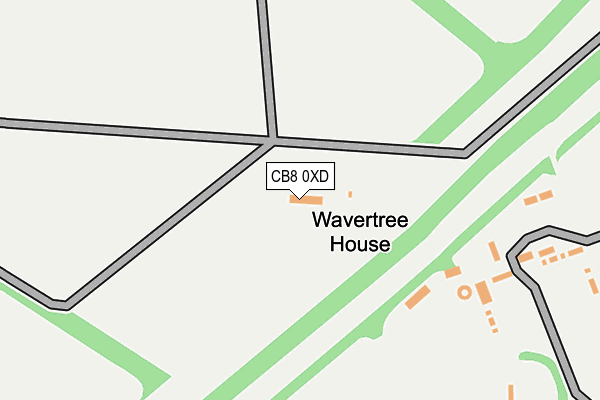
CB8 0XD is located in the Bottisham electoral ward, within the local authority district of East Cambridgeshire and the English Parliamentary constituency of South East Cambridgeshire. The Sub Integrated Care Board (ICB) Location is NHS Cambridgeshire and Peterborough ICB - 06H and the police force is Cambridgeshire. This postcode has been in use since January 1980.


GetTheData
Source: OS OpenMap – Local (Ordnance Survey)
Source: OS VectorMap District (Ordnance Survey)
Licence: Open Government Licence (requires attribution)
| Easting | 560295 |
| Northing | 261502 |
| Latitude | 52.228391 |
| Longitude | 0.345579 |
GetTheData
Source: Open Postcode Geo
Licence: Open Government Licence
| Country | England |
| Postcode District | CB8 |
➜ See where CB8 is on a map | |
GetTheData
Source: Land Registry Price Paid Data
Licence: Open Government Licence
Elevation or altitude of CB8 0XD as distance above sea level:
| Metres | Feet | |
|---|---|---|
| Elevation | 30m | 98ft |
Elevation is measured from the approximate centre of the postcode, to the nearest point on an OS contour line from OS Terrain 50, which has contour spacing of ten vertical metres.
➜ How high above sea level am I? Find the elevation of your current position using your device's GPS.
GetTheData
Source: Open Postcode Elevation
Licence: Open Government Licence
| Ward | Bottisham |
| Constituency | South East Cambridgeshire |
GetTheData
Source: ONS Postcode Database
Licence: Open Government Licence
| Dullingham Station | 3.3km |
| Newmarket Station | 4.3km |
GetTheData
Source: NaPTAN
Licence: Open Government Licence
| Median download speed | 40.0Mbps |
| Average download speed | 38.9Mbps |
| Maximum download speed | 55.00Mbps |
| Median upload speed | 7.9Mbps |
| Average upload speed | 7.6Mbps |
| Maximum upload speed | 11.97Mbps |
GetTheData
Source: Ofcom
Licence: Ofcom Terms of Use (requires attribution)
Estimated total energy consumption in CB8 0XD by fuel type, 2015.
| Consumption (kWh) | 67,691 |
|---|---|
| Meter count | 18 |
| Mean (kWh/meter) | 3,761 |
| Median (kWh/meter) | 3,100 |
GetTheData
Source: Postcode level gas estimates: 2015 (experimental)
Source: Postcode level electricity estimates: 2015 (experimental)
Licence: Open Government Licence
GetTheData
Source: ONS Postcode Database
Licence: Open Government Licence

➜ Get more ratings from the Food Standards Agency
GetTheData
Source: Food Standards Agency
Licence: FSA terms & conditions
| Last Collection | |||
|---|---|---|---|
| Location | Mon-Fri | Sat | Distance |
| Stetchworth Toll | 16:00 | 07:30 | 1,557m |
| Golf Links | 16:00 | 07:30 | 2,548m |
| Crockfords | 16:45 | 10:00 | 3,185m |
GetTheData
Source: Dracos
Licence: Creative Commons Attribution-ShareAlike
The below table lists the International Territorial Level (ITL) codes (formerly Nomenclature of Territorial Units for Statistics (NUTS) codes) and Local Administrative Units (LAU) codes for CB8 0XD:
| ITL 1 Code | Name |
|---|---|
| TLH | East |
| ITL 2 Code | Name |
| TLH1 | East Anglia |
| ITL 3 Code | Name |
| TLH12 | Cambridgeshire CC |
| LAU 1 Code | Name |
| E07000009 | East Cambridgeshire |
GetTheData
Source: ONS Postcode Directory
Licence: Open Government Licence
The below table lists the Census Output Area (OA), Lower Layer Super Output Area (LSOA), and Middle Layer Super Output Area (MSOA) for CB8 0XD:
| Code | Name | |
|---|---|---|
| OA | E00091096 | |
| LSOA | E01018057 | East Cambridgeshire 009C |
| MSOA | E02003740 | East Cambridgeshire 009 |
GetTheData
Source: ONS Postcode Directory
Licence: Open Government Licence
| CB8 0TW | London Road | 1505m |
| CB8 0TR | London Road | 1898m |
| CB25 0LA | Heath Road | 2482m |
| CB8 0TS | Lower Hare Park | 2493m |
| CB25 0AP | Heath Road | 2592m |
| CB8 0UZ | Hare Park | 2898m |
| CB8 0UY | Hare Park | 2992m |
| CB8 9UT | Station Road | 3166m |
| CB8 0UU | Hare Park | 3248m |
| CB8 9JT | Dullingham Road | 3290m |
GetTheData
Source: Open Postcode Geo; Land Registry Price Paid Data
Licence: Open Government Licence