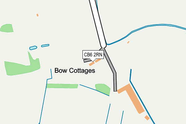
CB6 2RN lies on Bow Cottages in Sutton, Ely. CB6 2RN is located in the Sutton electoral ward, within the local authority district of East Cambridgeshire and the English Parliamentary constituency of North East Cambridgeshire. The Sub Integrated Care Board (ICB) Location is NHS Cambridgeshire and Peterborough ICB - 06H and the police force is Cambridgeshire. This postcode has been in use since January 1980.


GetTheData
Source: OS OpenMap – Local (Ordnance Survey)
Source: OS VectorMap District (Ordnance Survey)
Licence: Open Government Licence (requires attribution)
| Easting | 545229 |
| Northing | 278650 |
| Latitude | 52.386624 |
| Longitude | 0.132552 |
GetTheData
Source: Open Postcode Geo
Licence: Open Government Licence
| Street | Bow Cottages |
| Locality | Sutton |
| Town/City | Ely |
| Country | England |
| Postcode District | CB6 |
➜ See where CB6 is on a map | |
GetTheData
Source: Land Registry Price Paid Data
Licence: Open Government Licence
Elevation or altitude of CB6 2RN as distance above sea level:
| Metres | Feet | |
|---|---|---|
| Elevation | 10m | 33ft |
Elevation is measured from the approximate centre of the postcode, to the nearest point on an OS contour line from OS Terrain 50, which has contour spacing of ten vertical metres.
➜ How high above sea level am I? Find the elevation of your current position using your device's GPS.
GetTheData
Source: Open Postcode Elevation
Licence: Open Government Licence
| Ward | Sutton |
| Constituency | North East Cambridgeshire |
GetTheData
Source: ONS Postcode Database
Licence: Open Government Licence
| Windmill Lane (High Street) | Sutton | 616m |
| Park Road (Ely Road) | Sutton | 624m |
| Park Road (Ely Road) | Sutton | 633m |
| The Chestnuts (Ely Road) | Sutton | 693m |
| The Chestnuts (Ely Road) | Sutton | 712m |
GetTheData
Source: NaPTAN
Licence: Open Government Licence
| Percentage of properties with Next Generation Access | 100.0% |
| Percentage of properties with Superfast Broadband | 85.7% |
| Percentage of properties with Ultrafast Broadband | 0.0% |
| Percentage of properties with Full Fibre Broadband | 0.0% |
Superfast Broadband is between 30Mbps and 300Mbps
Ultrafast Broadband is > 300Mbps
| Median download speed | 28.7Mbps |
| Average download speed | 25.7Mbps |
| Maximum download speed | 36.81Mbps |
| Median upload speed | 6.3Mbps |
| Average upload speed | 5.5Mbps |
| Maximum upload speed | 6.89Mbps |
| Percentage of properties unable to receive 2Mbps | 0.0% |
| Percentage of properties unable to receive 5Mbps | 0.0% |
| Percentage of properties unable to receive 10Mbps | 0.0% |
| Percentage of properties unable to receive 30Mbps | 14.3% |
GetTheData
Source: Ofcom
Licence: Ofcom Terms of Use (requires attribution)
GetTheData
Source: ONS Postcode Database
Licence: Open Government Licence


➜ Get more ratings from the Food Standards Agency
GetTheData
Source: Food Standards Agency
Licence: FSA terms & conditions
| Last Collection | |||
|---|---|---|---|
| Location | Mon-Fri | Sat | Distance |
| Sutton Post Office | 17:00 | 10:45 | 630m |
| Churchill Close | 17:00 | 10:00 | 708m |
| The Toll | 16:30 | 10:15 | 1,045m |
GetTheData
Source: Dracos
Licence: Creative Commons Attribution-ShareAlike
The below table lists the International Territorial Level (ITL) codes (formerly Nomenclature of Territorial Units for Statistics (NUTS) codes) and Local Administrative Units (LAU) codes for CB6 2RN:
| ITL 1 Code | Name |
|---|---|
| TLH | East |
| ITL 2 Code | Name |
| TLH1 | East Anglia |
| ITL 3 Code | Name |
| TLH12 | Cambridgeshire CC |
| LAU 1 Code | Name |
| E07000009 | East Cambridgeshire |
GetTheData
Source: ONS Postcode Directory
Licence: Open Government Licence
The below table lists the Census Output Area (OA), Lower Layer Super Output Area (LSOA), and Middle Layer Super Output Area (MSOA) for CB6 2RN:
| Code | Name | |
|---|---|---|
| OA | E00091084 | |
| LSOA | E01018056 | East Cambridgeshire 002E |
| MSOA | E02003733 | East Cambridgeshire 002 |
GetTheData
Source: ONS Postcode Directory
Licence: Open Government Licence
| CB6 2RF | Garden Close | 360m |
| CB6 2RL | Station Road | 383m |
| CB6 2RX | Pippin Close | 430m |
| CB6 2RE | Lawn Lane | 447m |
| CB6 2RP | Sutton Park | 452m |
| CB6 2RG | Oates Lane | 462m |
| CB6 2NJ | Link Lane | 473m |
| CB6 2RH | Eastwood Close | 495m |
| CB6 2NH | Windmill Walk | 538m |
| CB6 2RQ | Church Lane | 582m |
GetTheData
Source: Open Postcode Geo; Land Registry Price Paid Data
Licence: Open Government Licence