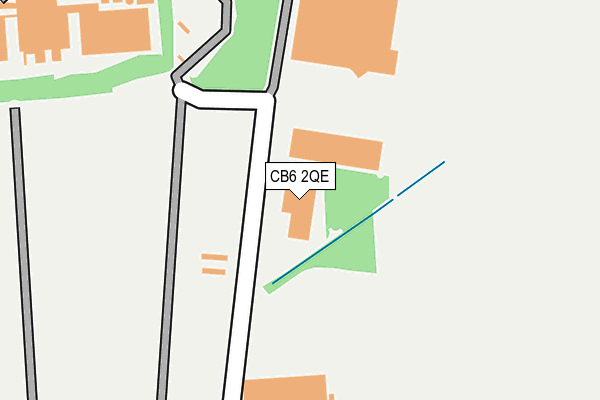
CB6 2QE is located in the Sutton electoral ward, within the local authority district of East Cambridgeshire and the English Parliamentary constituency of North East Cambridgeshire. The Sub Integrated Care Board (ICB) Location is NHS Cambridgeshire and Peterborough ICB - 06H and the police force is Cambridgeshire. This postcode has been in use since September 1991.


GetTheData
Source: OS OpenMap – Local (Ordnance Survey)
Source: OS VectorMap District (Ordnance Survey)
Licence: Open Government Licence (requires attribution)
| Easting | 545375 |
| Northing | 279789 |
| Latitude | 52.396818 |
| Longitude | 0.135189 |
GetTheData
Source: Open Postcode Geo
Licence: Open Government Licence
| Country | England |
| Postcode District | CB6 |
➜ See where CB6 is on a map | |
GetTheData
Source: Land Registry Price Paid Data
Licence: Open Government Licence
Elevation or altitude of CB6 2QE as distance above sea level:
| Metres | Feet | |
|---|---|---|
| Elevation | 20m | 66ft |
Elevation is measured from the approximate centre of the postcode, to the nearest point on an OS contour line from OS Terrain 50, which has contour spacing of ten vertical metres.
➜ How high above sea level am I? Find the elevation of your current position using your device's GPS.
GetTheData
Source: Open Postcode Elevation
Licence: Open Government Licence
| Ward | Sutton |
| Constituency | North East Cambridgeshire |
GetTheData
Source: ONS Postcode Database
Licence: Open Government Licence
| The Chestnuts (Ely Road) | Sutton | 694m |
| The Chestnuts (Ely Road) | Sutton | 710m |
| Park Road (Ely Road) | Sutton | 716m |
| Park Road (Ely Road) | Sutton | 724m |
| Manor Farm (Martins Lane) | Witcham | 976m |
GetTheData
Source: NaPTAN
Licence: Open Government Licence
GetTheData
Source: ONS Postcode Database
Licence: Open Government Licence


➜ Get more ratings from the Food Standards Agency
GetTheData
Source: Food Standards Agency
Licence: FSA terms & conditions
| Last Collection | |||
|---|---|---|---|
| Location | Mon-Fri | Sat | Distance |
| Churchill Close | 17:00 | 10:00 | 810m |
| High Street | 16:15 | 10:00 | 997m |
| The Toll | 16:30 | 10:15 | 1,098m |
GetTheData
Source: Dracos
Licence: Creative Commons Attribution-ShareAlike
The below table lists the International Territorial Level (ITL) codes (formerly Nomenclature of Territorial Units for Statistics (NUTS) codes) and Local Administrative Units (LAU) codes for CB6 2QE:
| ITL 1 Code | Name |
|---|---|
| TLH | East |
| ITL 2 Code | Name |
| TLH1 | East Anglia |
| ITL 3 Code | Name |
| TLH12 | Cambridgeshire CC |
| LAU 1 Code | Name |
| E07000009 | East Cambridgeshire |
GetTheData
Source: ONS Postcode Directory
Licence: Open Government Licence
The below table lists the Census Output Area (OA), Lower Layer Super Output Area (LSOA), and Middle Layer Super Output Area (MSOA) for CB6 2QE:
| Code | Name | |
|---|---|---|
| OA | E00091084 | |
| LSOA | E01018056 | East Cambridgeshire 002E |
| MSOA | E02003733 | East Cambridgeshire 002 |
GetTheData
Source: ONS Postcode Directory
Licence: Open Government Licence
| CB6 2QP | Tramar Drive | 586m |
| CB6 2QN | Redwood Gardens | 624m |
| CB6 2LG | Westway Place | 651m |
| CB6 2AF | Witcham Road | 685m |
| CB6 2QG | Park Road | 693m |
| CB6 2AB | Ely Road | 704m |
| CB6 2QB | Mill Field | 728m |
| CB6 2LR | The Orchards | 730m |
| CB6 2QD | Ely Road | 736m |
| CB6 2AE | Mepal Road | 766m |
GetTheData
Source: Open Postcode Geo; Land Registry Price Paid Data
Licence: Open Government Licence