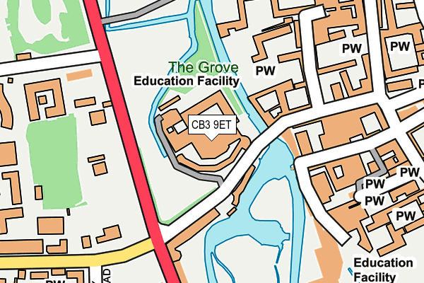
CB3 9ET is located in the Newnham electoral ward, within the local authority district of Cambridge and the English Parliamentary constituency of Cambridge. The Sub Integrated Care Board (ICB) Location is NHS Cambridgeshire and Peterborough ICB - 06H and the police force is Cambridgeshire. This postcode has been in use since January 1980.


GetTheData
Source: OS OpenMap – Local (Ordnance Survey)
Source: OS VectorMap District (Ordnance Survey)
Licence: Open Government Licence (requires attribution)
| Easting | 544719 |
| Northing | 258127 |
| Latitude | 52.202392 |
| Longitude | 0.116283 |
GetTheData
Source: Open Postcode Geo
Licence: Open Government Licence
| Country | England |
| Postcode District | CB3 |
➜ See where CB3 is on a map ➜ Where is Cambridge? | |
GetTheData
Source: Land Registry Price Paid Data
Licence: Open Government Licence
Elevation or altitude of CB3 9ET as distance above sea level:
| Metres | Feet | |
|---|---|---|
| Elevation | 10m | 33ft |
Elevation is measured from the approximate centre of the postcode, to the nearest point on an OS contour line from OS Terrain 50, which has contour spacing of ten vertical metres.
➜ How high above sea level am I? Find the elevation of your current position using your device's GPS.
GetTheData
Source: Open Postcode Elevation
Licence: Open Government Licence
| Ward | Newnham |
| Constituency | Cambridge |
GetTheData
Source: ONS Postcode Database
Licence: Open Government Licence
| Corpus Christi Col (Trumpington Street) | Cambridge | 108m |
| Queens' College (Silver Street) | Cambridge | 131m |
| Queens' College (Silver Street) | Cambridge | 154m |
| Pembroke Street (Trumpington Street) | Cambridge | 170m |
| Pembroke Street (Trumpington Street) | Cambridge | 187m |
| Cambridge Station | 1.7km |
GetTheData
Source: NaPTAN
Licence: Open Government Licence
GetTheData
Source: ONS Postcode Database
Licence: Open Government Licence


➜ Get more ratings from the Food Standards Agency
GetTheData
Source: Food Standards Agency
Licence: FSA terms & conditions
| Last Collection | |||
|---|---|---|---|
| Location | Mon-Fri | Sat | Distance |
| Queens College | 18:30 | 12:00 | 12m |
| Corpus Christi College | 18:30 | 12:15 | 122m |
| Pembrooke College | 18:30 | 12:30 | 145m |
GetTheData
Source: Dracos
Licence: Creative Commons Attribution-ShareAlike
The below table lists the International Territorial Level (ITL) codes (formerly Nomenclature of Territorial Units for Statistics (NUTS) codes) and Local Administrative Units (LAU) codes for CB3 9ET:
| ITL 1 Code | Name |
|---|---|
| TLH | East |
| ITL 2 Code | Name |
| TLH1 | East Anglia |
| ITL 3 Code | Name |
| TLH12 | Cambridgeshire CC |
| LAU 1 Code | Name |
| E07000008 | Cambridge |
GetTheData
Source: ONS Postcode Directory
Licence: Open Government Licence
The below table lists the Census Output Area (OA), Lower Layer Super Output Area (LSOA), and Middle Layer Super Output Area (MSOA) for CB3 9ET:
| Code | Name | |
|---|---|---|
| OA | E00090723 | |
| LSOA | E01017986 | Cambridge 007F |
| MSOA | E02003725 | Cambridge 007 |
GetTheData
Source: ONS Postcode Directory
Licence: Open Government Licence
| CB2 1RR | Little St Marys Lane | 155m |
| CB2 3PJ | St Edwards Passage | 270m |
| CB2 3PP | Peas Hill | 277m |
| CB3 9EX | Newnham Terrace | 316m |
| CB2 3QF | Corn Exchange Street | 359m |
| CB2 1QH | Fitzwilliam Street | 386m |
| CB3 9HF | Malting Lane | 410m |
| CB3 9EY | Newnham Road | 417m |
| CB2 3NB | Petty Cury | 424m |
| CB2 3LP | Rose Crescent | 441m |
GetTheData
Source: Open Postcode Geo; Land Registry Price Paid Data
Licence: Open Government Licence