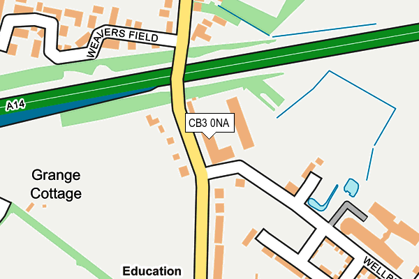
CB3 0NA is located in the Girton electoral ward, within the local authority district of South Cambridgeshire and the English Parliamentary constituency of South Cambridgeshire. The Sub Integrated Care Board (ICB) Location is NHS Cambridgeshire and Peterborough ICB - 06H and the police force is Cambridgeshire. This postcode has been in use since January 1992.


GetTheData
Source: OS OpenMap – Local (Ordnance Survey)
Source: OS VectorMap District (Ordnance Survey)
Licence: Open Government Licence (requires attribution)
| Easting | 542604 |
| Northing | 261317 |
| Latitude | 52.231603 |
| Longitude | 0.086699 |
GetTheData
Source: Open Postcode Geo
Licence: Open Government Licence
| Country | England |
| Postcode District | CB3 |
➜ See where CB3 is on a map ➜ Where is Girton? | |
GetTheData
Source: Land Registry Price Paid Data
Licence: Open Government Licence
Elevation or altitude of CB3 0NA as distance above sea level:
| Metres | Feet | |
|---|---|---|
| Elevation | 20m | 66ft |
Elevation is measured from the approximate centre of the postcode, to the nearest point on an OS contour line from OS Terrain 50, which has contour spacing of ten vertical metres.
➜ How high above sea level am I? Find the elevation of your current position using your device's GPS.
GetTheData
Source: Open Postcode Elevation
Licence: Open Government Licence
| Ward | Girton |
| Constituency | South Cambridgeshire |
GetTheData
Source: ONS Postcode Database
Licence: Open Government Licence
| Wellbrook Way (Girton Road) | Girton | 84m |
| Wellbrook Way (Girton Road) | Girton | 126m |
| Pepys Way (Girton Road) | Girton | 237m |
| Pepys Way (Girton Road) | Girton | 335m |
| Hicks Lane (Cambridge Road) | Girton | 541m |
| Cambridge Station | 5.4km |
GetTheData
Source: NaPTAN
Licence: Open Government Licence
Estimated total energy consumption in CB3 0NA by fuel type, 2015.
| Consumption (kWh) | 248,641 |
|---|---|
| Meter count | 6 |
| Mean (kWh/meter) | 41,440 |
| Median (kWh/meter) | 39,275 |
GetTheData
Source: Postcode level gas estimates: 2015 (experimental)
Source: Postcode level electricity estimates: 2015 (experimental)
Licence: Open Government Licence
GetTheData
Source: ONS Postcode Database
Licence: Open Government Licence


➜ Get more ratings from the Food Standards Agency
GetTheData
Source: Food Standards Agency
Licence: FSA terms & conditions
| Last Collection | |||
|---|---|---|---|
| Location | Mon-Fri | Sat | Distance |
| Girton Road | 18:45 | 12:30 | 233m |
| Pepys Way | 19:00 | 12:30 | 288m |
| St Vincents Close | 18:45 | 12:00 | 470m |
GetTheData
Source: Dracos
Licence: Creative Commons Attribution-ShareAlike
The below table lists the International Territorial Level (ITL) codes (formerly Nomenclature of Territorial Units for Statistics (NUTS) codes) and Local Administrative Units (LAU) codes for CB3 0NA:
| ITL 1 Code | Name |
|---|---|
| TLH | East |
| ITL 2 Code | Name |
| TLH1 | East Anglia |
| ITL 3 Code | Name |
| TLH12 | Cambridgeshire CC |
| LAU 1 Code | Name |
| E07000012 | South Cambridgeshire |
GetTheData
Source: ONS Postcode Directory
Licence: Open Government Licence
The below table lists the Census Output Area (OA), Lower Layer Super Output Area (LSOA), and Middle Layer Super Output Area (MSOA) for CB3 0NA:
| Code | Name | |
|---|---|---|
| OA | E00092055 | |
| LSOA | E01018248 | South Cambridgeshire 009C |
| MSOA | E02003783 | South Cambridgeshire 009 |
GetTheData
Source: ONS Postcode Directory
Licence: Open Government Licence
| CB3 0FW | Wellbrook Way | 105m |
| CB3 0LN | Girton Road | 116m |
| CB3 0LW | Girton Road | 181m |
| CB3 0LS | Girton Road | 198m |
| CB3 0GP | Wellbrook Way | 225m |
| CB3 0GQ | Wellbrook Way | 272m |
| CB3 0NP | Thornton Road | 280m |
| CB3 0XB | Weavers Field | 290m |
| CB3 0NW | Thornton Road | 304m |
| CB3 0LL | Girton Road | 331m |
GetTheData
Source: Open Postcode Geo; Land Registry Price Paid Data
Licence: Open Government Licence