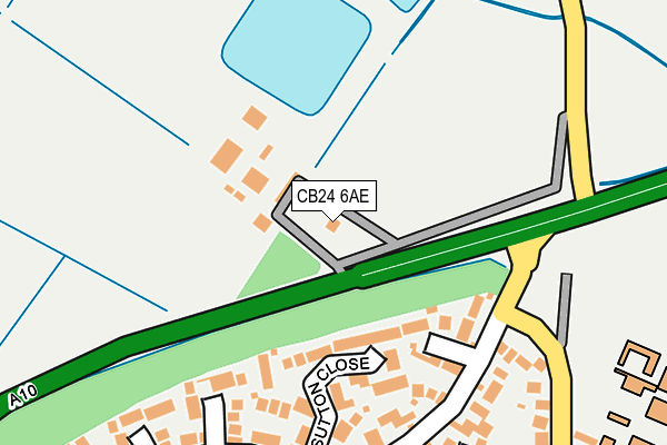
CB24 6AE is located in the Milton & Waterbeach electoral ward, within the local authority district of South Cambridgeshire and the English Parliamentary constituency of South East Cambridgeshire. The Sub Integrated Care Board (ICB) Location is NHS Cambridgeshire and Peterborough ICB - 06H and the police force is Cambridgeshire. This postcode has been in use since June 2014.


GetTheData
Source: OS OpenMap – Local (Ordnance Survey)
Source: OS VectorMap District (Ordnance Survey)
Licence: Open Government Licence (requires attribution)
| Easting | 547570 |
| Northing | 263389 |
| Latitude | 52.248911 |
| Longitude | 0.160265 |
GetTheData
Source: Open Postcode Geo
Licence: Open Government Licence
| Country | England |
| Postcode District | CB24 |
➜ See where CB24 is on a map | |
GetTheData
Source: Land Registry Price Paid Data
Licence: Open Government Licence
Elevation or altitude of CB24 6AE as distance above sea level:
| Metres | Feet | |
|---|---|---|
| Elevation | 10m | 33ft |
Elevation is measured from the approximate centre of the postcode, to the nearest point on an OS contour line from OS Terrain 50, which has contour spacing of ten vertical metres.
➜ How high above sea level am I? Find the elevation of your current position using your device's GPS.
GetTheData
Source: Open Postcode Elevation
Licence: Open Government Licence
| Ward | Milton & Waterbeach |
| Constituency | South East Cambridgeshire |
GetTheData
Source: ONS Postcode Database
Licence: Open Government Licence
| College Of West Anglia (Landbeach Road) | Milton | 253m |
| College Of West Anglia (Landbeach Road) | Milton | 253m |
| Ely Road (High Street) | Milton | 516m |
| Ely Road (High Street) | Milton | 532m |
| Edmund Close (High Street) | Milton | 695m |
| Waterbeach Station | 2.9km |
GetTheData
Source: NaPTAN
Licence: Open Government Licence
GetTheData
Source: ONS Postcode Database
Licence: Open Government Licence


➜ Get more ratings from the Food Standards Agency
GetTheData
Source: Food Standards Agency
Licence: FSA terms & conditions
| Last Collection | |||
|---|---|---|---|
| Location | Mon-Fri | Sat | Distance |
| Humphries Way | 17:00 | 11:15 | 248m |
| Milton Post Office | 17:15 | 11:30 | 626m |
| The Rowans | 17:00 | 11:30 | 730m |
GetTheData
Source: Dracos
Licence: Creative Commons Attribution-ShareAlike
The below table lists the International Territorial Level (ITL) codes (formerly Nomenclature of Territorial Units for Statistics (NUTS) codes) and Local Administrative Units (LAU) codes for CB24 6AE:
| ITL 1 Code | Name |
|---|---|
| TLH | East |
| ITL 2 Code | Name |
| TLH1 | East Anglia |
| ITL 3 Code | Name |
| TLH12 | Cambridgeshire CC |
| LAU 1 Code | Name |
| E07000012 | South Cambridgeshire |
GetTheData
Source: ONS Postcode Directory
Licence: Open Government Licence
The below table lists the Census Output Area (OA), Lower Layer Super Output Area (LSOA), and Middle Layer Super Output Area (MSOA) for CB24 6AE:
| Code | Name | |
|---|---|---|
| OA | E00092163 | |
| LSOA | E01018272 | South Cambridgeshire 007A |
| MSOA | E02003781 | South Cambridgeshire 007 |
GetTheData
Source: ONS Postcode Directory
Licence: Open Government Licence
| CB24 6DU | Sutton Close | 163m |
| CB24 6DX | Burling Walk | 180m |
| CB24 6DN | Townsend Close | 202m |
| CB24 6DY | Garner Close | 225m |
| CB24 6DW | Ballard Close | 264m |
| CB24 6DL | Humphries Way | 283m |
| CB24 6DZ | Conder Close | 292m |
| CB24 6DP | David Bull Way | 297m |
| CB24 6DA | Landbeach Road | 313m |
| CB24 6DT | Froment Way | 326m |
GetTheData
Source: Open Postcode Geo; Land Registry Price Paid Data
Licence: Open Government Licence